Index of /public/incident_specific_data/calif_s/!CALFIRE/2014_Incidents/BEUTEST/Batt.2 Preplan CD
Name
Last modified
Size
Description
Parent Directory
-
Agape Residential Care 25527 Flanders Dr..jpg
2011-10-01 14:09
95K
Agape Residential Care 25661 Morse Dr..jpg
2011-10-01 14:09
101K
Arroyo Carmel.jpg
2011-10-01 14:09
95K
Carmel Area Wastewater District Office.jpg
2011-10-01 14:10
86K
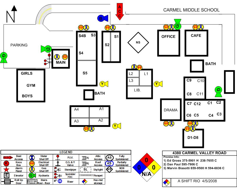
Carmel Middle School.jpg
2011-10-01 14:11
113K
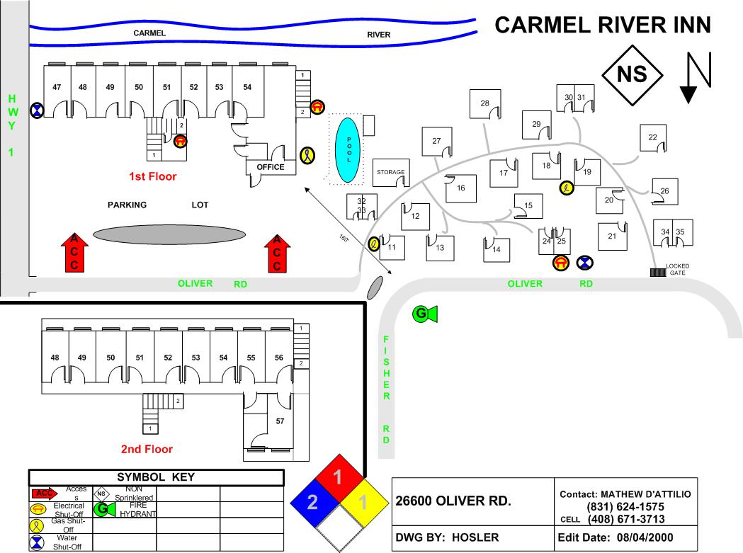
Carmel River Inn.jpg
2011-10-01 14:16
105K
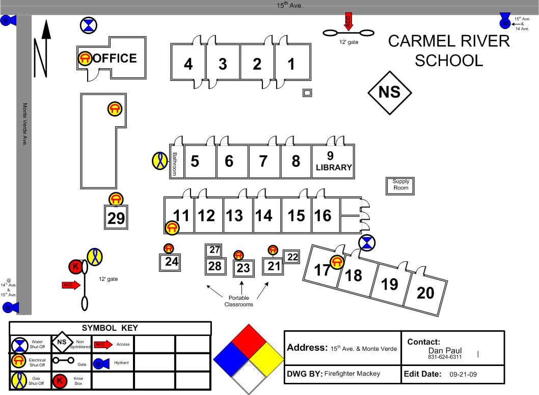
Carmel River School.jpg
2011-10-01 14:16
98K
Carmel Wastewater Treatment Facility.jpg
2011-10-01 14:16
130K
Chevron Station - Rio.jpg
2011-10-01 14:17
116K
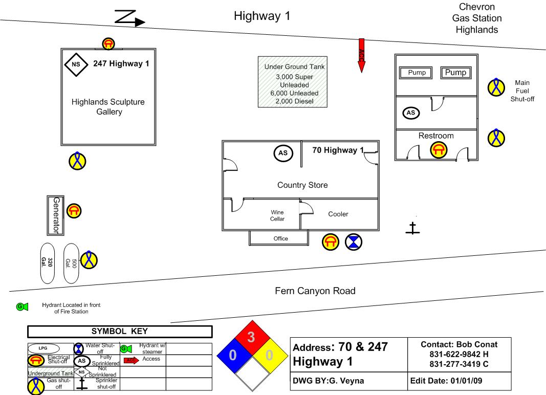
Chevron Station and Store - Hwy 1.jpg
2011-10-01 14:17
92K
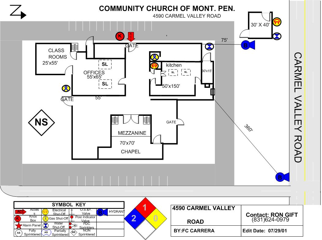
Community Church Of Monterey Peninsula.jpg
2011-10-01 14:17
103K
Community Hospital Of Monterey Peninsula.jpg
2011-10-01 14:17
106K
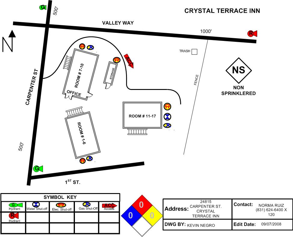
Crystal Terrace Inn.jpg
2011-10-01 14:19
81K
Defense Area Map.pdf
2011-10-01 14:19
430K
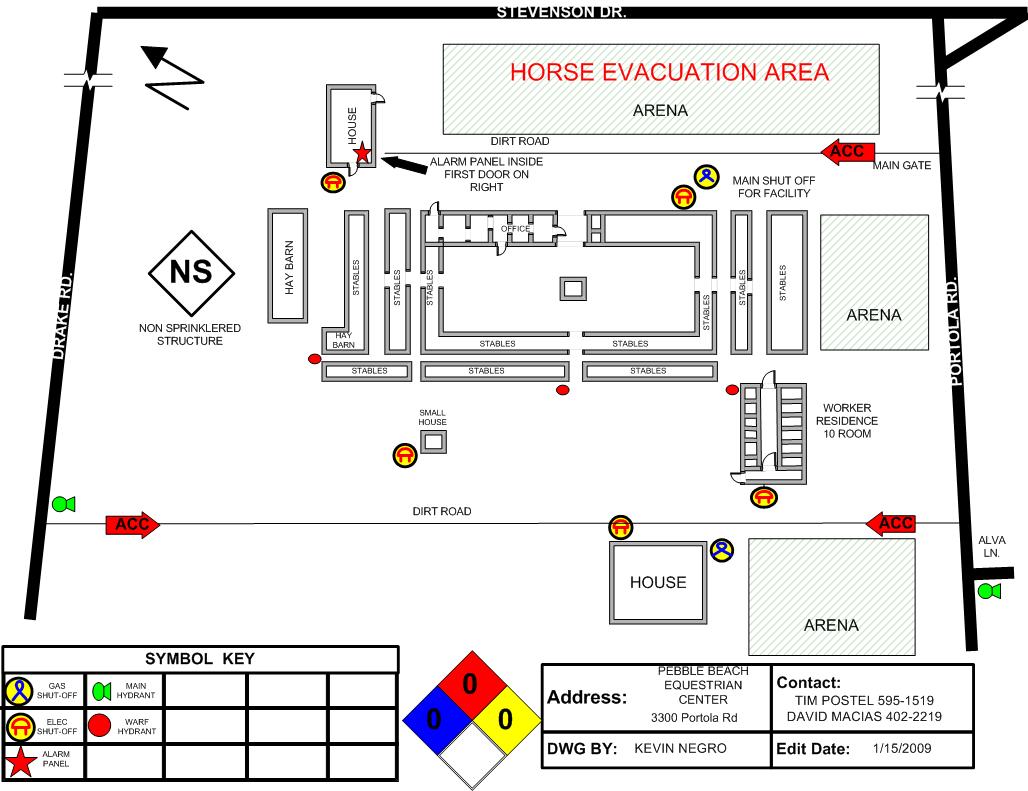
Equestrian Center.jpg
2011-10-01 14:20
116K
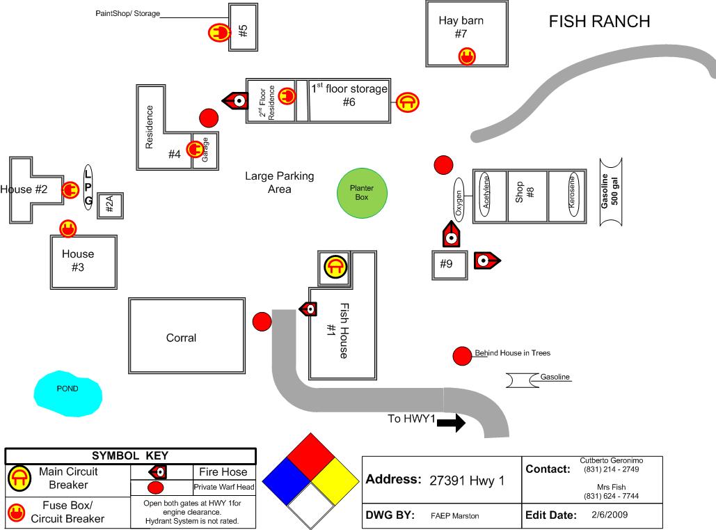
FishRanch.jpg
2011-10-01 14:20
81K
GentryHill.jpg
2011-10-01 14:20
74K
High Meadows Drive Townhouses.jpg
2011-10-01 14:20
103K
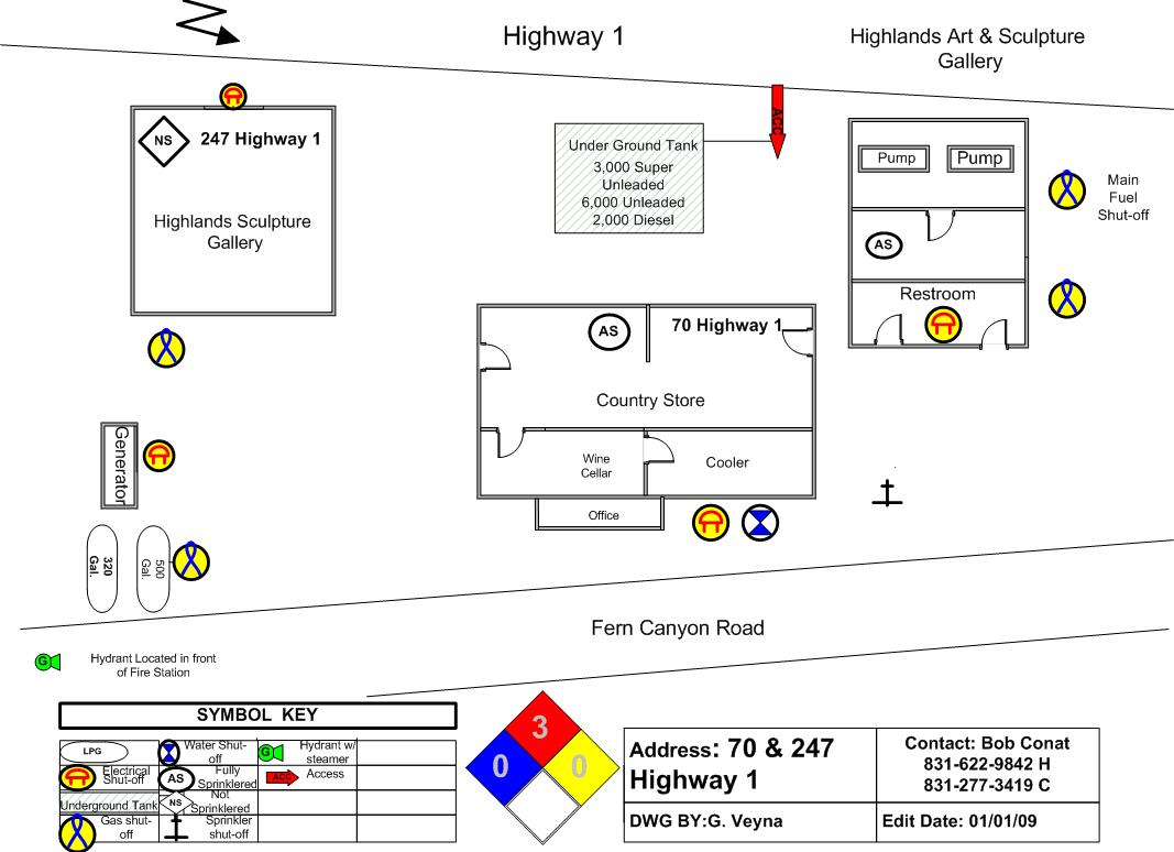
Highlands Art And Sculpture Shop.jpg
2011-10-01 14:20
92K
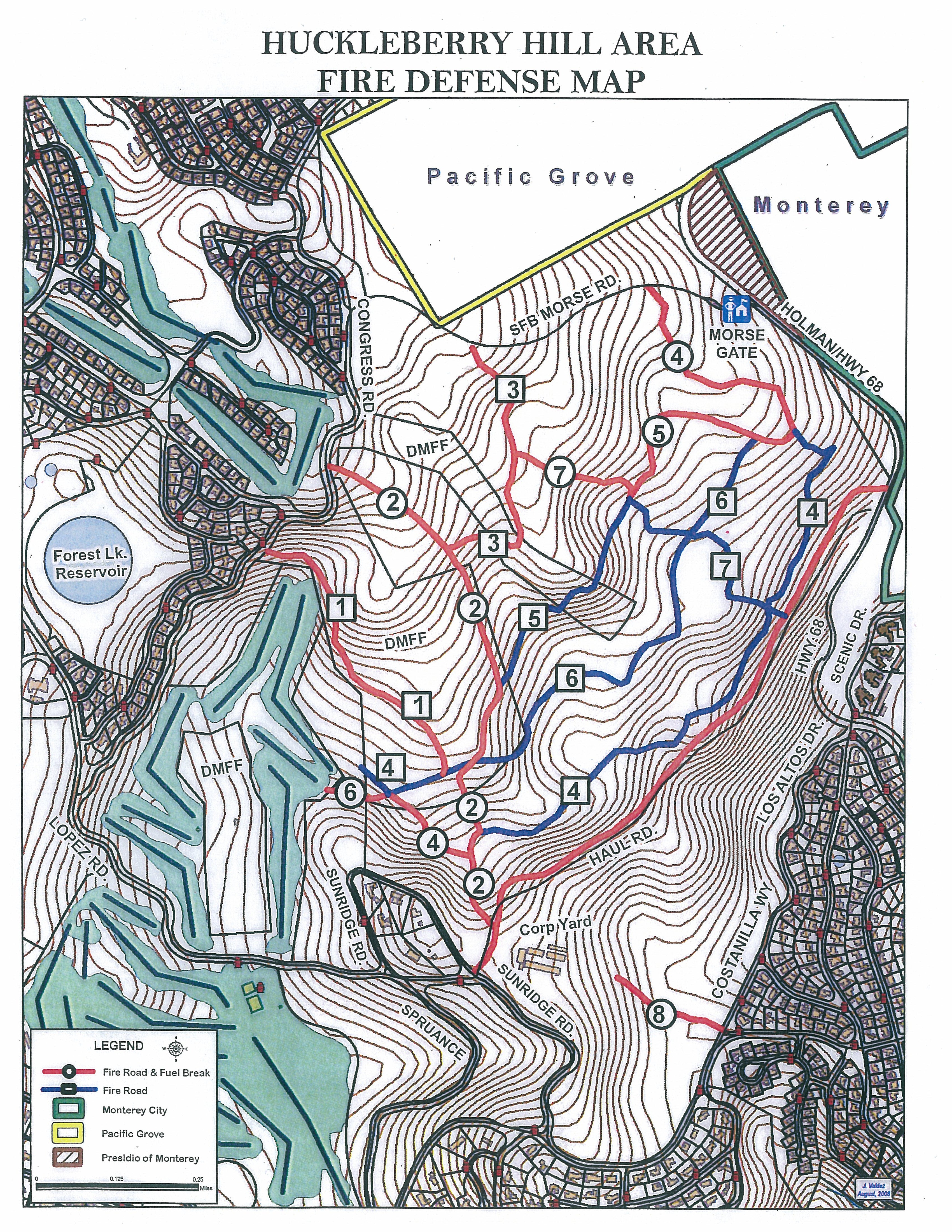
Huckleberry Hill Area Map.jpg
2011-10-01 14:22
4.4M
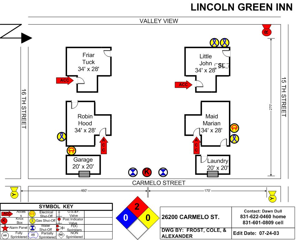
Lincoln Green Inn.jpg
2011-10-01 14:24
93K
Mission Linen Supply.jpg
2011-10-01 14:26
104K
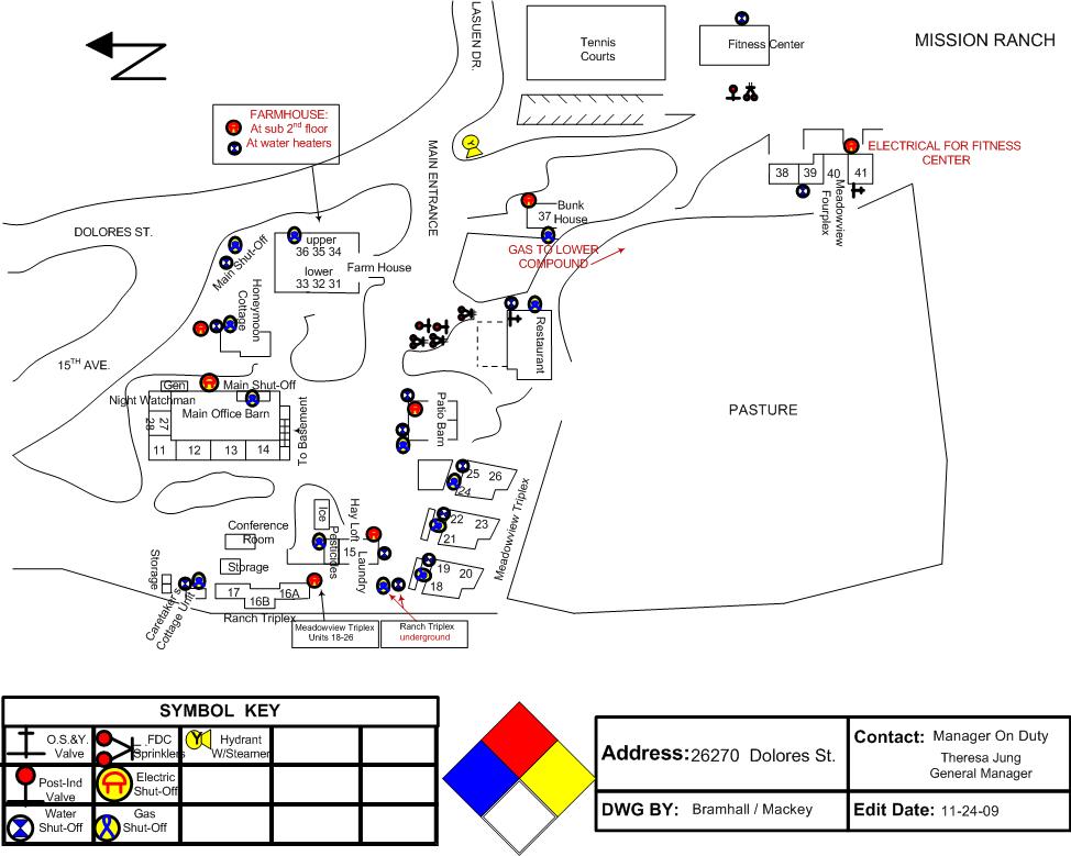
Mission Ranch Inn.jpg
2011-10-01 14:26
101K
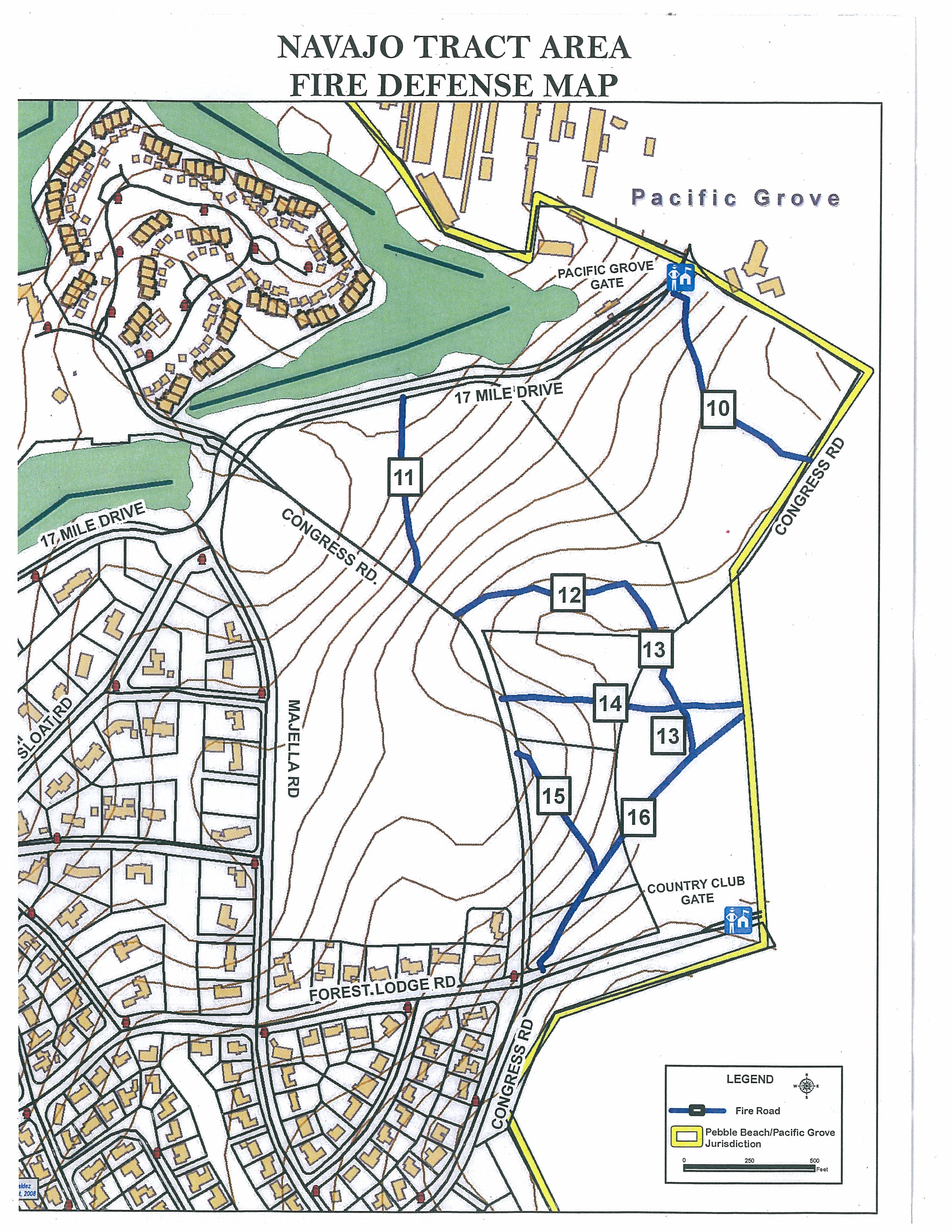
Navajo Tract Area Map.jpg
2011-10-01 14:29
2.9M
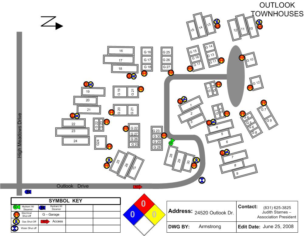
Outlook Townhouses.jpg
2011-10-01 14:30
108K
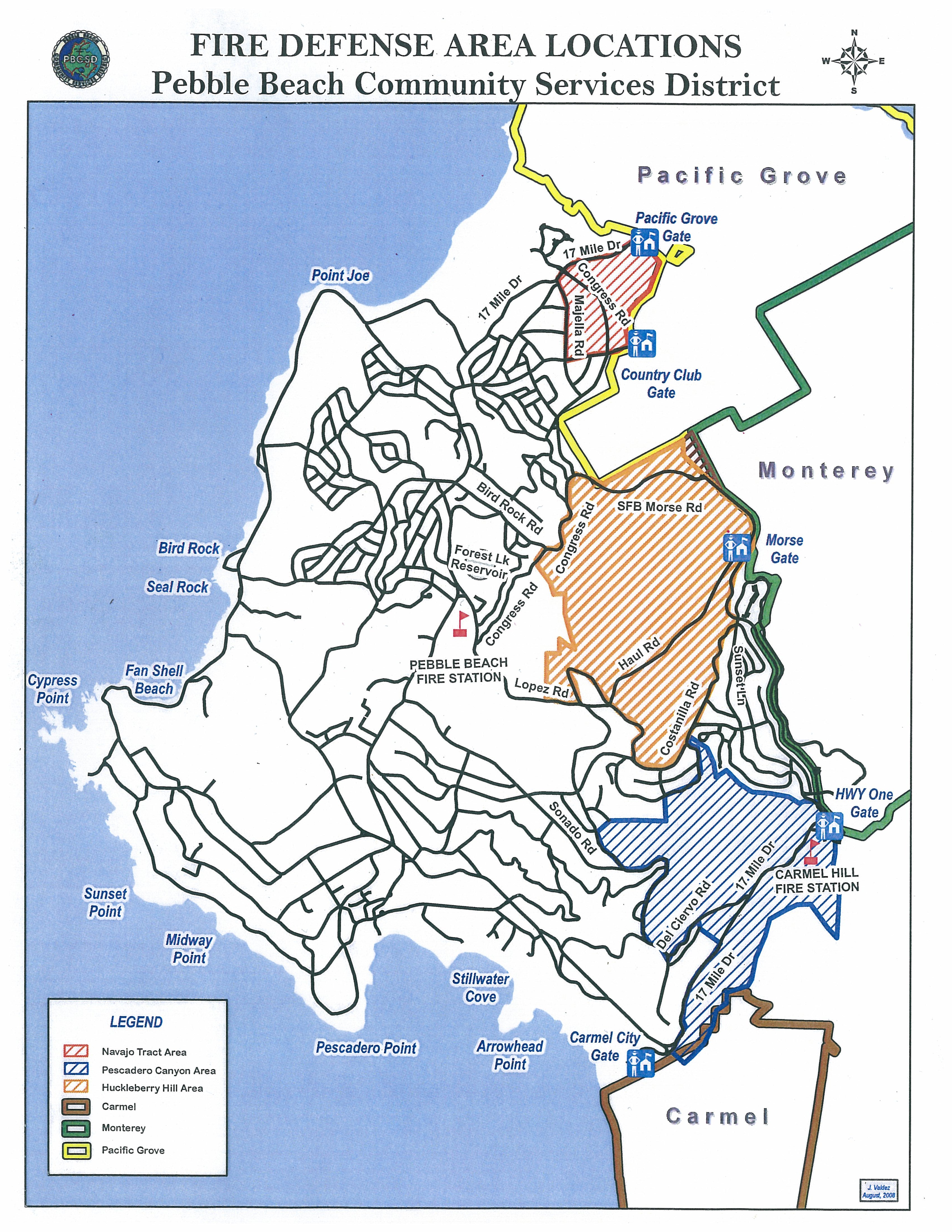
Pebble Beach Comm. Serv. Distr. Area Map.jpg
2011-10-01 14:33
2.5M
Pebble Beach Company Corporate Office.jpg
2011-10-01 14:33
121K
Pebble Beach Company Human Resources and Corporation Yard.jpg
2011-10-01 14:33
77K
Pebble Beach Equestrian Center.jpg
2011-10-01 14:33
116K
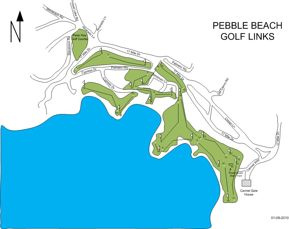
Pebble Beach Golf Links.jpg
2011-10-01 14:34
80K
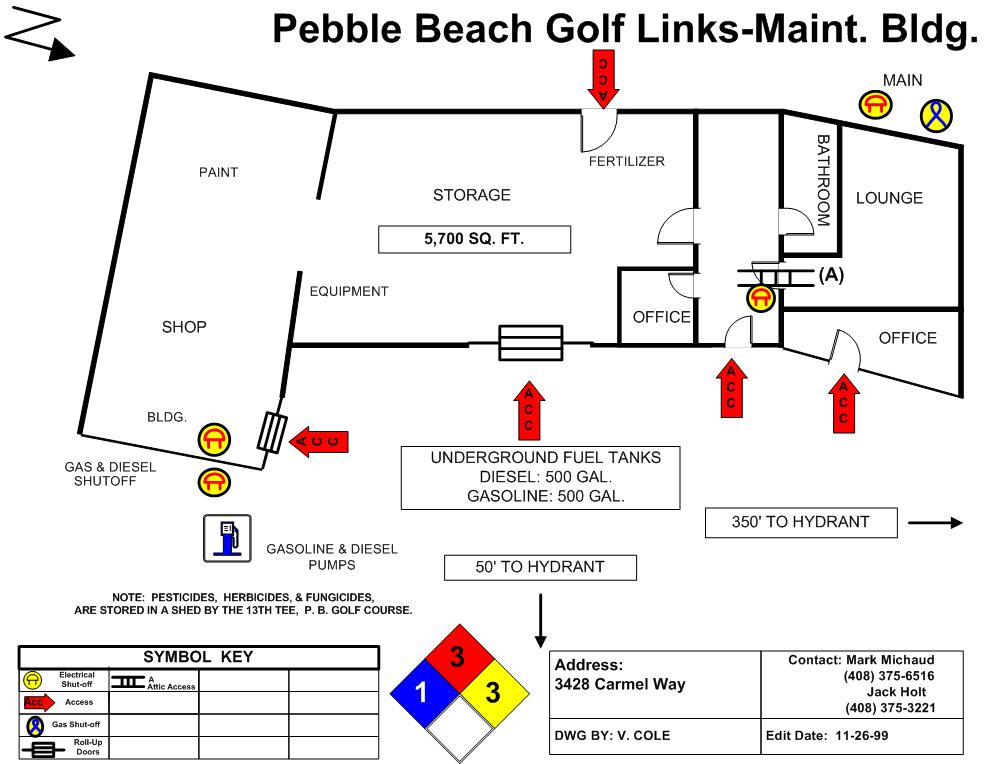
Pebble Beach Golf Links and Maintenace Shop.jpg
2011-10-01 14:34
93K
Pebble Beach Townhouses.jpg
2011-10-01 14:34
106K
Pescadero Cyn Area Map.vsd
2011-10-01 14:34
522K
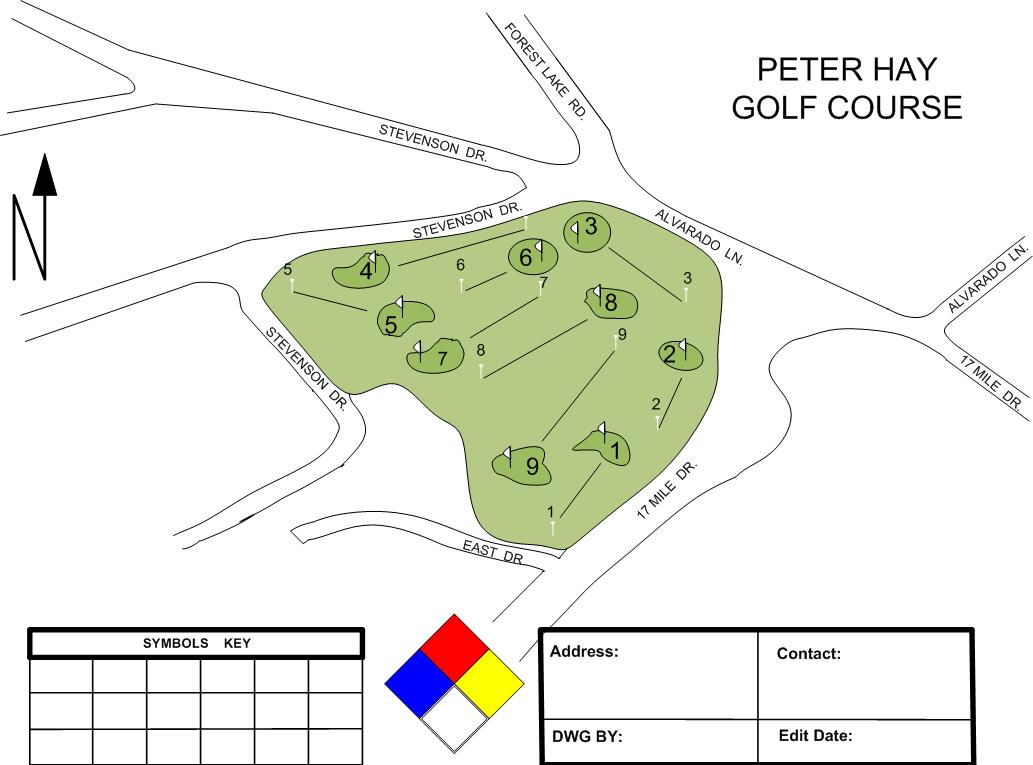
Peter Hay Golf Course.jpg
2011-10-01 14:34
77K
Point Lobos Trail Map.jpg
2013-01-20 17:06
153K
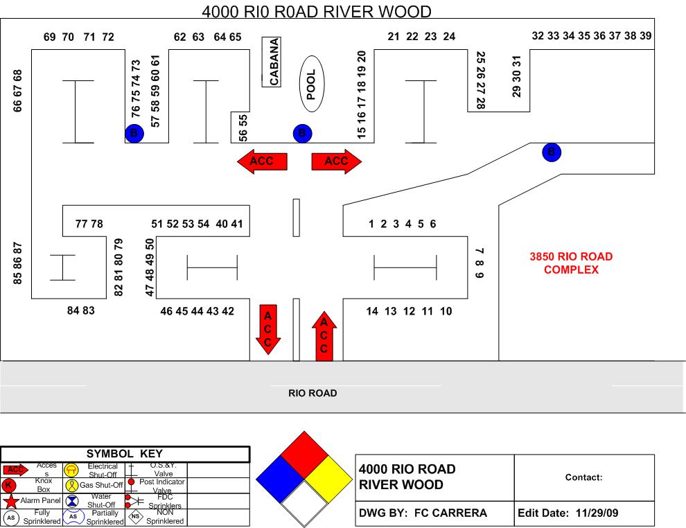
Riverwood.jpg
2011-10-01 14:36
89K
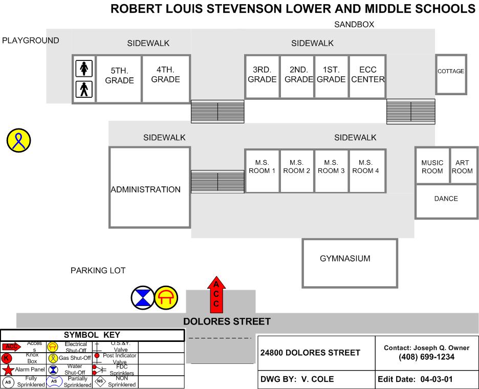
Robert Lewis Stevenson Lower and Middle School.jpg
2011-10-01 14:36
87K
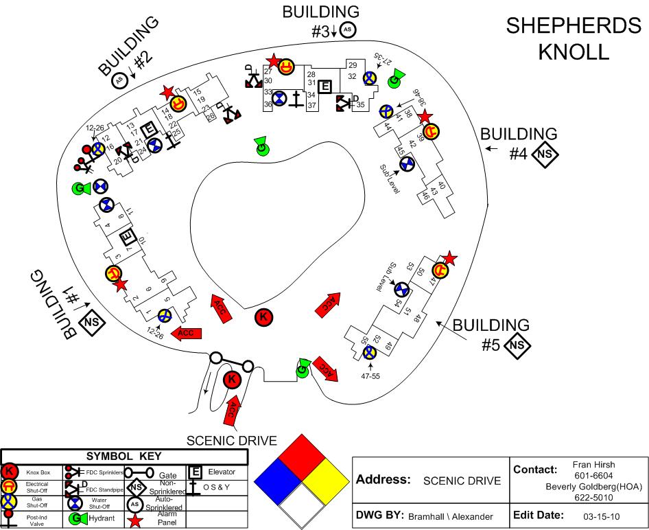
Shepherds Knoll Condominums.jpg
2011-10-01 14:37
103K
Spanish Bay Golf - Maintenance.jpg
2011-10-01 14:38
76K
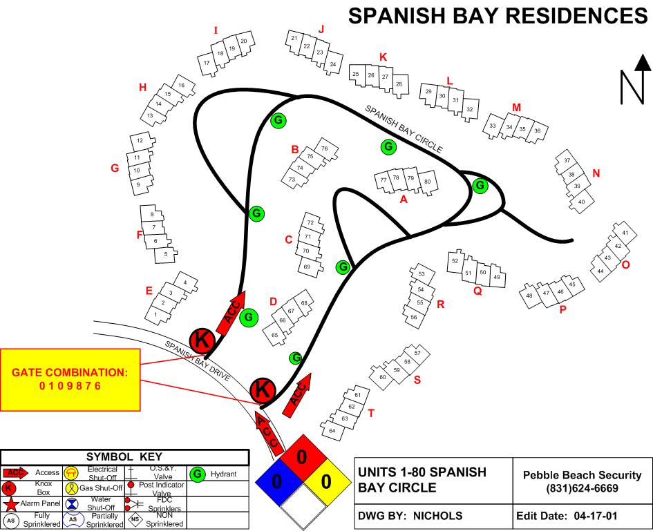
Spanish Bay Residences.jpg
2011-10-01 14:38
108K
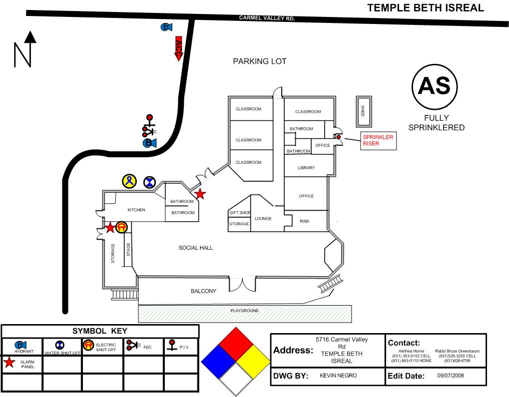
Temple Beth Isreal.jpg
2011-10-01 14:38
87K
The Ridge at High Meadows.jpg
2011-10-01 14:38
105K
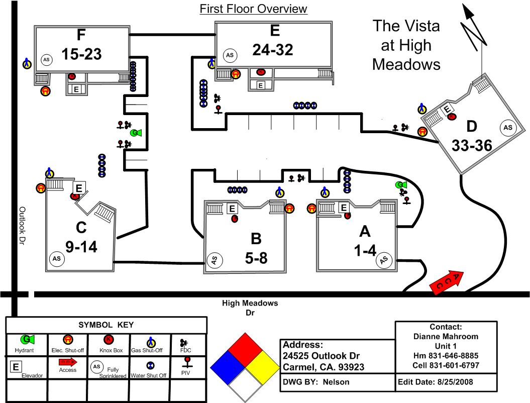
The Vistas at High Meadows.jpg
2011-10-01 14:38
116K
Thumbs.db
2011-10-01 14:38
188K
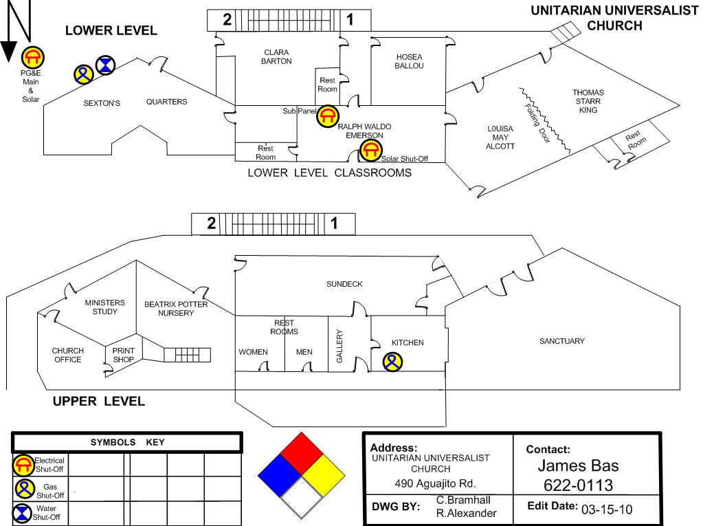
Unitarian Universalist Church.jpg
2011-10-01 14:39
99K
Unitarian Universalist Church Overview.jpg
2011-10-01 14:39
35K
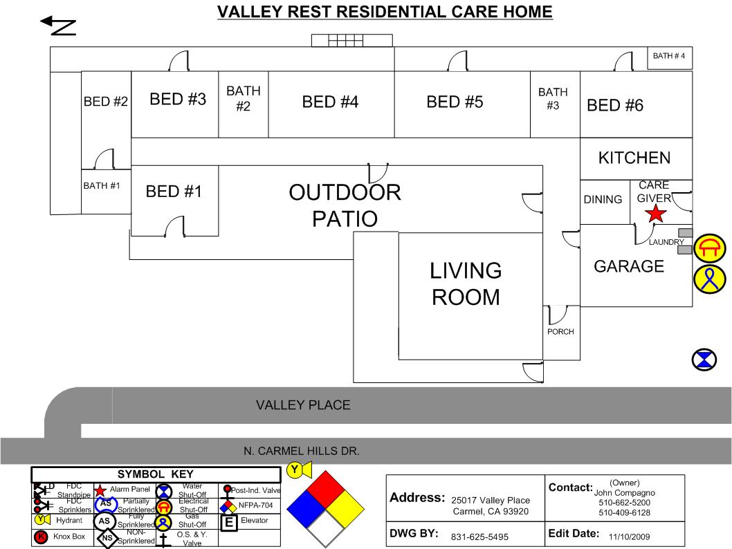
Valley Rest Residential Care Home.jpg
2011-10-01 14:39
96K
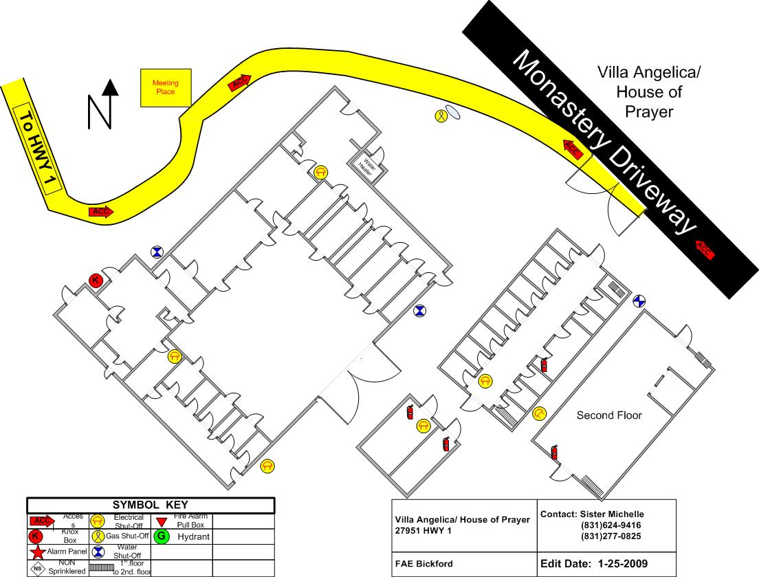
Villa Angelica.jpg
2011-10-01 14:40
126K