| Name | Last modified | Size | Description | |
|---|---|---|---|---|
| Parent Directory | - | |||
| IAP_Mapbook_11x17_land_20160904_2100_Cedar_CASQF002595.pdf | 2016-09-05 00:45 | 14M | ||
| OPS_Arch_E_land_20160904_1802_Cedar_CASQF002595.pdf | 2016-09-04 23:51 | 35M | ||
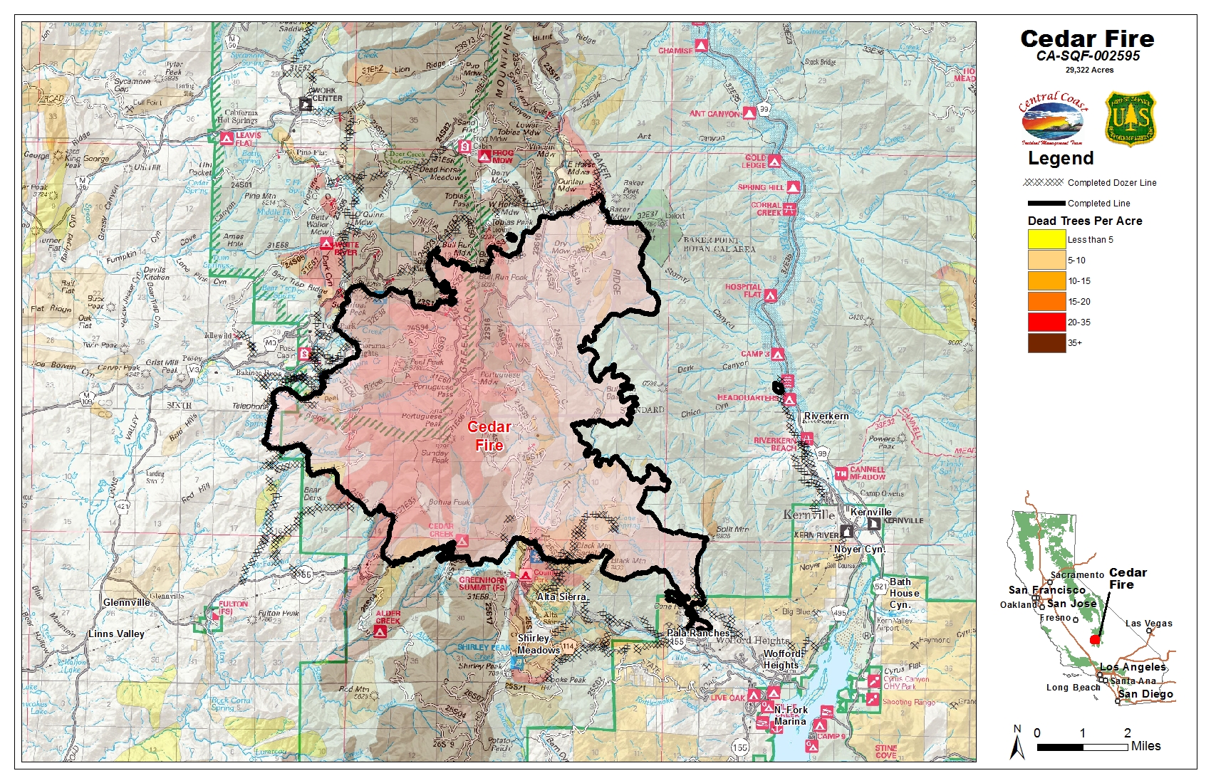
| PIO_11x17_land_20160904_1802_Cedar_CASQF002595.jpg | 2016-09-04 23:41 | 1.9M | ||
| PIO_11x17_land_20160904_1802_Cedar_CASQF002595.pdf | 2016-09-04 23:41 | 1.2M | ||
| PIO_Arch_E_land_20160904_1802_Cedar_CASQF002595.pdf | 2016-09-04 23:45 | 6.7M | ||
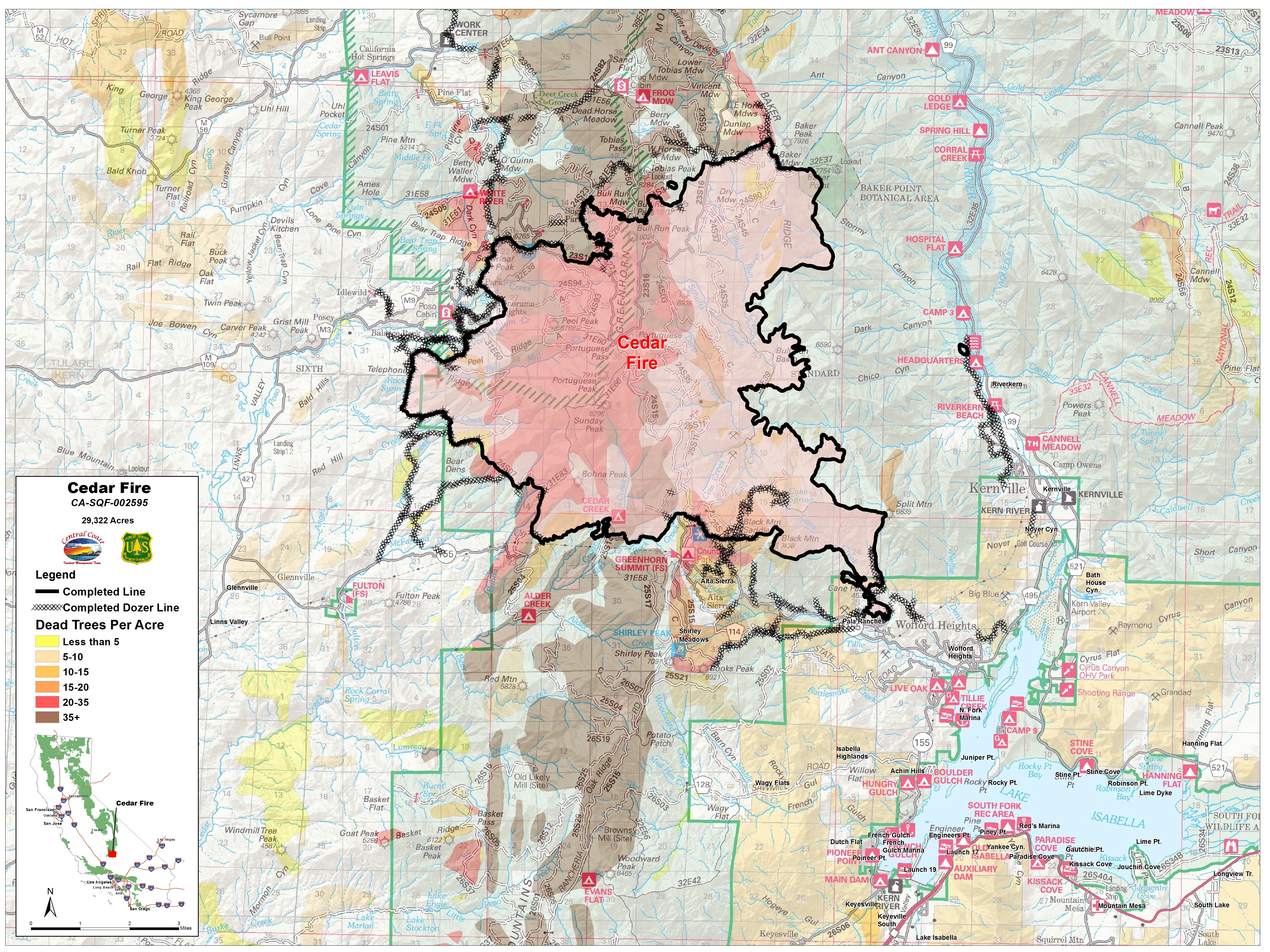
| PIO_Arch_E_land_20160904_1802_Cedar_CASQF2595.jpg | 2016-09-04 23:52 | 12M | ||
| Progression_11x17_land_20160904_1802_Cedar_CASQF002595.pdf | 2016-09-04 23:52 | 1.9M | ||
| Progression_Arch_E_land_20160904_1802_Cedar_CASQF002595.pdf | 2016-09-05 00:00 | 15M | ||
| Suppression_Arch_E_land_20160904_1802_Cedar_CASQF002595.pdf | 2016-09-05 00:00 | 12M | ||