| Name | Last modified | Size | Description | |
|---|---|---|---|---|
| Parent Directory | - | |||
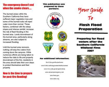
| BAER_flooding_brochure_Page_1.jpg | 2016-07-05 13:24 | 33K | ||
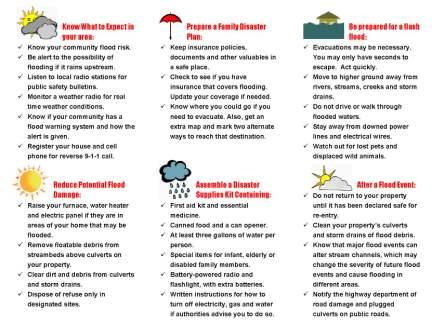
| BAER_flooding_brochure_Page_2.jpg | 2016-07-05 13:24 | 37K | ||
| DOI BAER Archaeologist assesses damages to an historic adobe structure on the Poomacha Fire.JPG | 2016-07-05 13:24 | 26K | ||
| DOIBAER watershed specialist discusses flood risk with local residents_compressed.JPG | 2016-07-05 13:24 | 5.1K | ||
| DOIBAER watershed specialists measure cross section of channel_compressed.JPG | 2016-07-05 13:24 | 5.6K | ||