| Name | Last modified | Size | Description | |
|---|---|---|---|---|
| Parent Directory | - | |||
| BAM_20150915_0000_Tepee.pdf | 2015-09-14 23:31 | 7.9M | ||
| Transportation_E_20150914_0000_Tepee.pdf | 2015-09-14 23:38 | 6.3M | ||
| Ops_E_FSTopo_20150915_0000_Tepee.pdf | 2015-09-14 23:33 | 6.0M | ||
| AirOperations_E_20150915_0000_Tepee.pdf | 2015-09-14 23:27 | 5.6M | ||
| AirOperations_Pilot_Map_And_Table_11x17_20150915_0000_Tepee.pdf | 2015-09-14 23:28 | 4.7M | ||
| Ops_DivLK_E_FSTopo_20150914_0000_Tepee.pdf | 2015-09-14 23:32 | 4.4M | ||
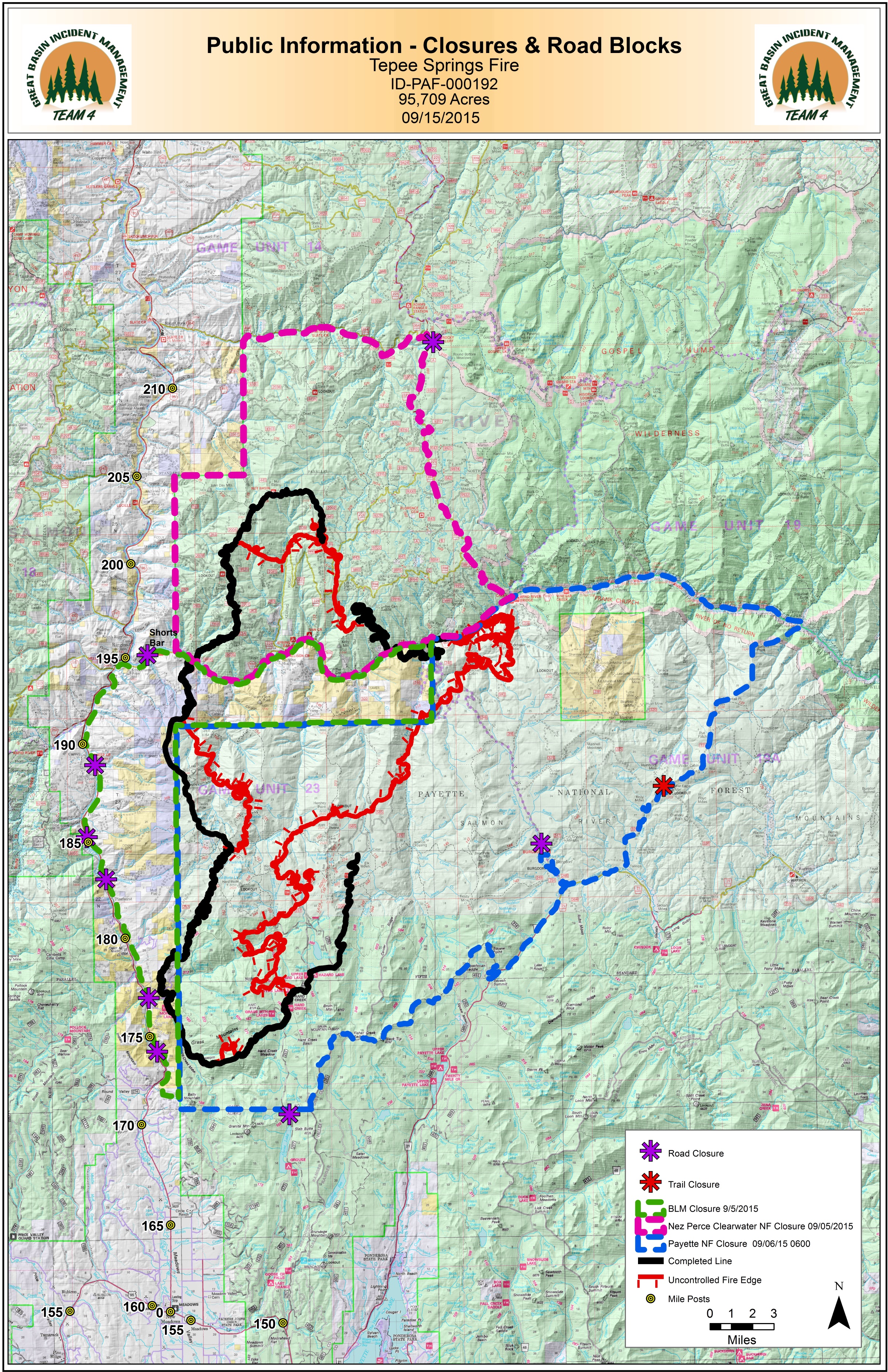
| PIO_WithClosures_11x17_20150915_0000_Tepee.jpg | 2015-09-14 23:36 | 4.3M | ||
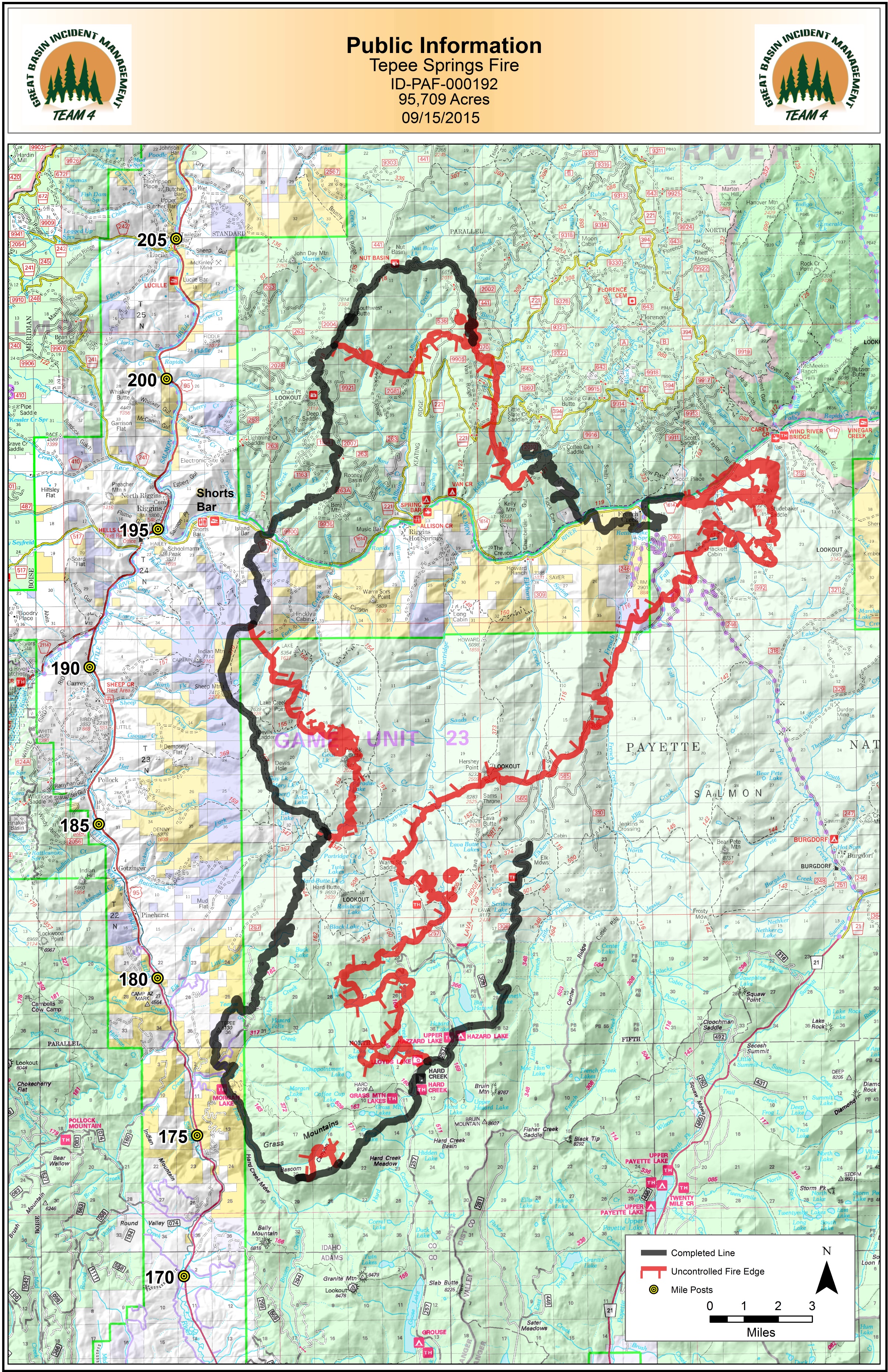
| PIO_11x17_20150915_0000_Tepee.jpg | 2015-09-14 23:34 | 3.9M | ||
| IAP_tiles/ | 2015-09-14 23:42 | - | ||