Index of /public/incident_specific_data/great_basin/2016_Incidents/Berry_WY-GTP/GIS/products/20160912
Name
Last modified
Size
Description
Parent Directory
-
AirOpsBriefing_E_land_Berry_20160912_WYGTP1621.pdf
2016-09-12 12:10
10M
AirOpsPilot_11x17_land_Berry_20160912_WYGTP1621.pdf
2016-09-12 09:05
6.0M
Briefing_E_land_Berry_20160912_WYGTP1621.pdf
2016-09-12 12:09
4.4M
IAP_11x17_land_Berry_20160912_WYGTP1621.pdf
2016-09-12 10:51
1.9M
OpsPlanning_E_land_Berry_20160912_WYGTP1621.pdf
2016-09-12 12:10
10M
Planning_E_land_Berry_20160912_WYGTP1621.pdf
2016-09-12 18:00
11M
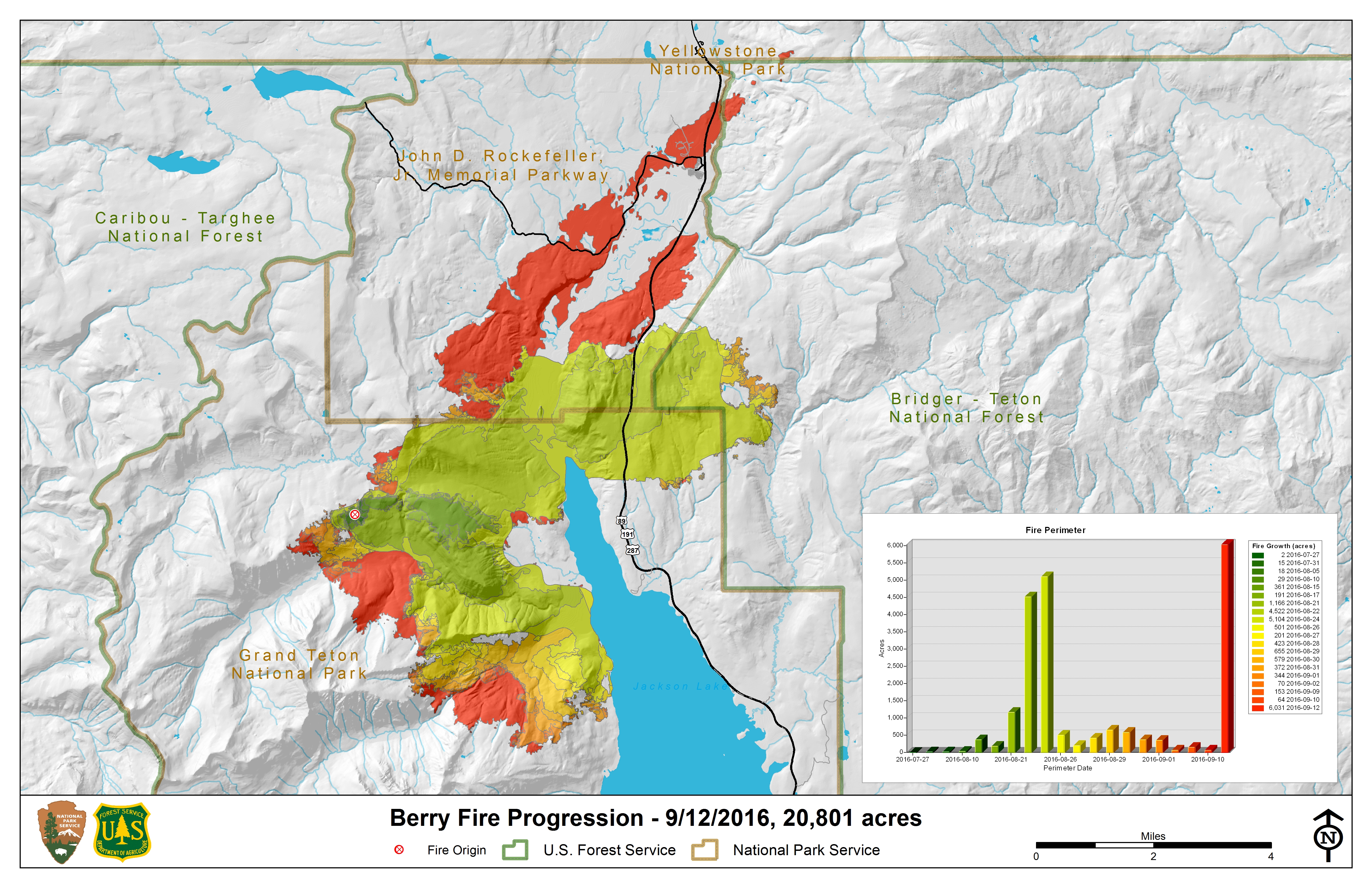
Progression_11x17_20160912_Berry_WYGTP1621.jpg
2016-09-12 20:07
7.3M
Progression_11x17_20160912_Berry_WYGTP1621.pdf
2016-09-12 20:07
2.2M
ops_C_land_20160912_Berry_WYGTP1621.pdf
2016-09-12 12:09
2.1M
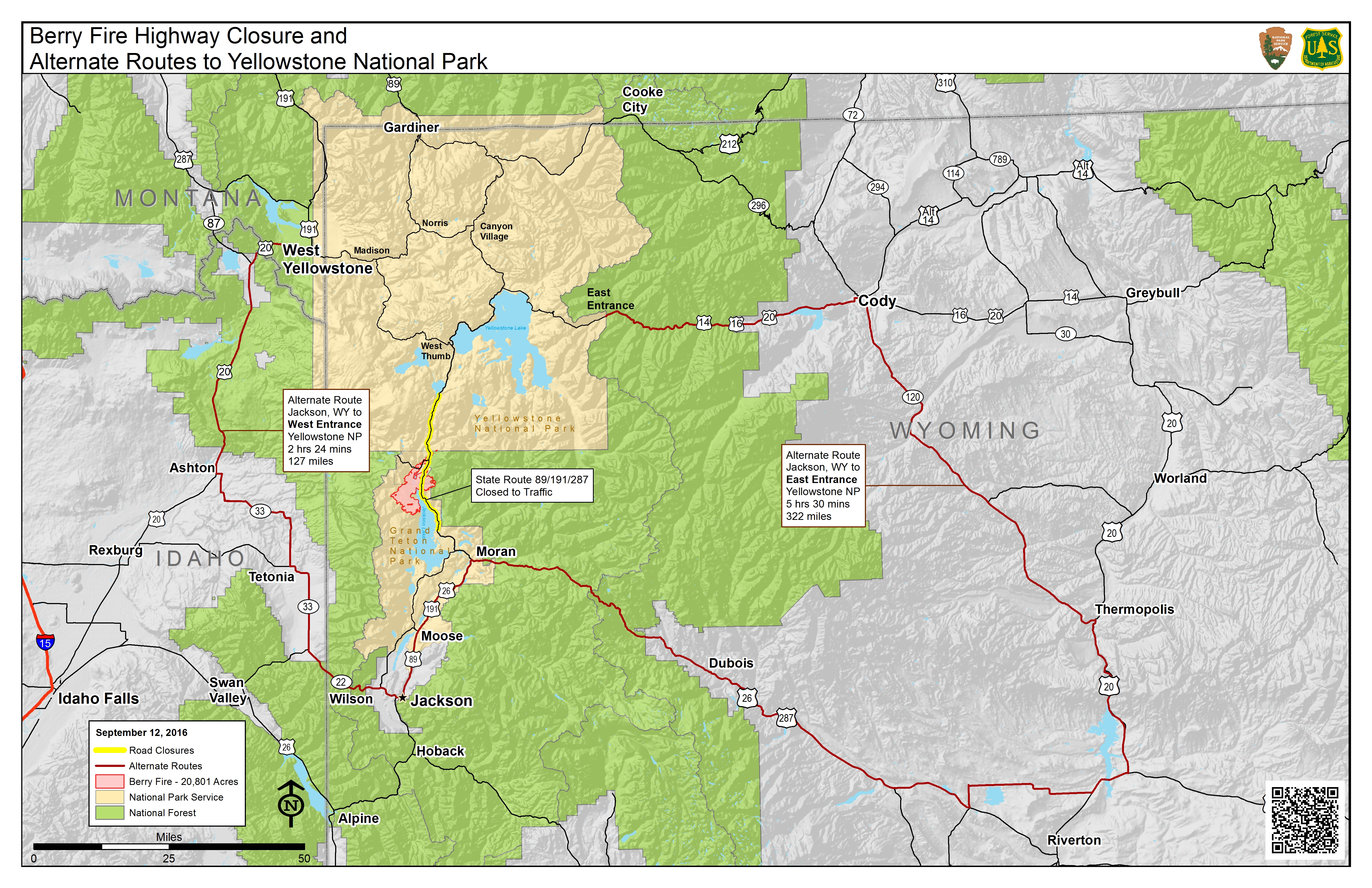
pio_AltRoute_11x17_land_20160912_Berry_WYGTP1621.jpg
2016-09-12 10:18
9.4M
pio_AltRoute_11x17_land_20160912_Berry_WYGTP1621.pdf
2016-09-12 10:17
2.6M
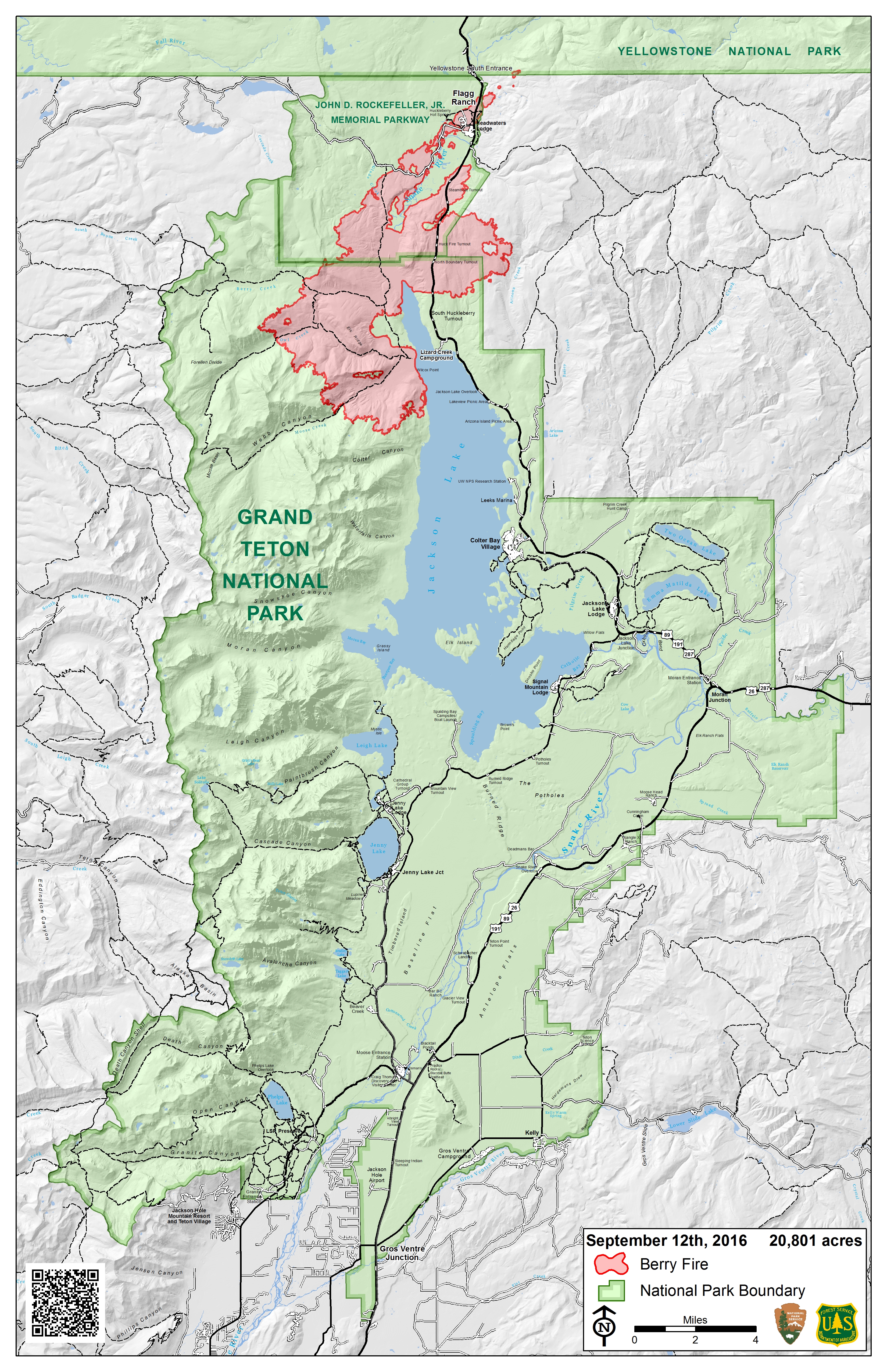
pio_parkmap_11x17_port_20160912_Berry_WYGTP1621.jpg
2016-09-12 12:26
9.7M
pio_parkmap_11x17_port_20160912_Berry_WYGTP1621.pdf
2016-09-12 12:26
821K
pio_parkmap_closure_11x17_port_2016_Berry_WYGTP1621.pdf
2016-09-12 12:31
2.7M
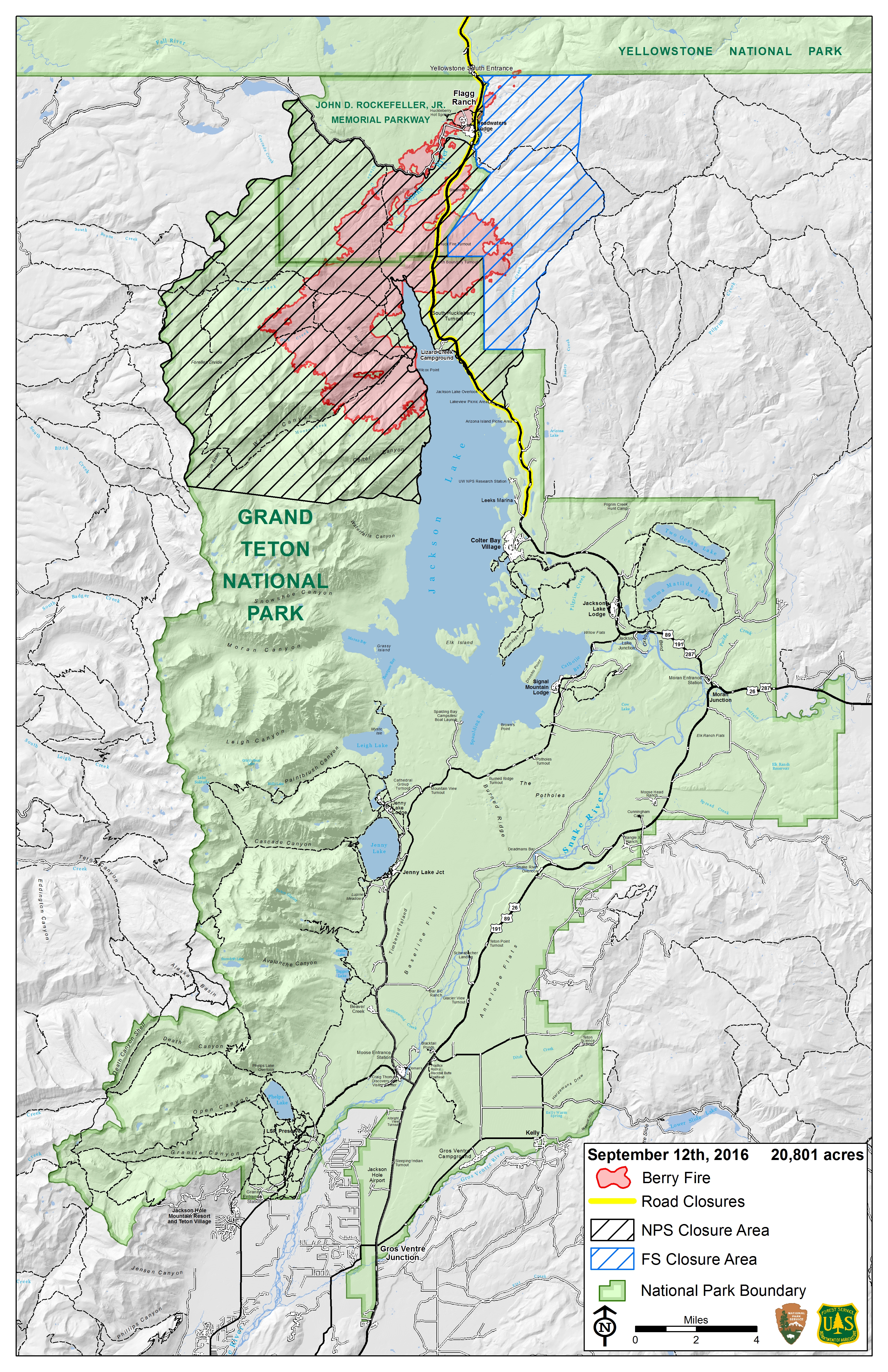
pio_parkmap_closure_11x17_port_20160912_Berry_WYGTP1621.jpg
2016-09-12 12:32
10M