| Name | Last modified | Size | Description | |
|---|---|---|---|---|
| Parent Directory | - | |||
| trans_8x11_land_20230826_1628_BowlesCreek_MTBDF006210_0827day.pdf | 2023-08-26 17:31 | 2.4M | ||
| pio_ansi_e_land_20230826_1736_BowlesCreek_MTBDF006210_0827.pdf | 2023-08-26 18:48 | 3.6M | ||
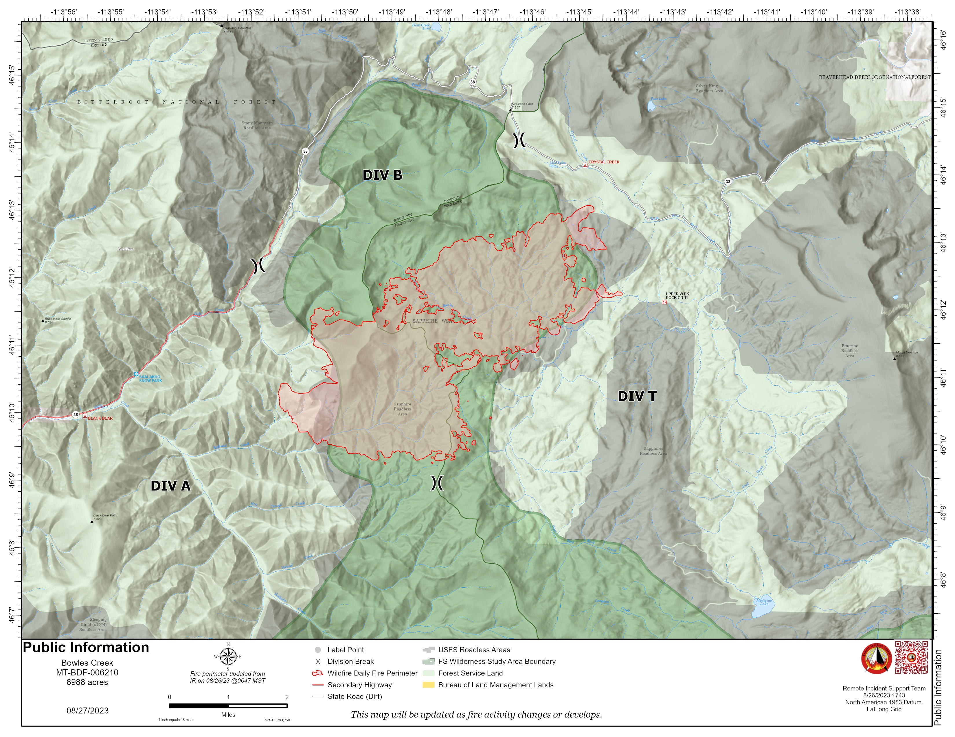
| pio_8x11_land_20230826_1740_BowlesCreek_MTBDF006210_0827.png | 2023-08-26 18:48 | 7.4M | ||
| pio_8x11_land_20230826_1740_BowlesCreek_MTBDF006210_0827.pdf | 2023-08-26 18:48 | 1.3M | ||
| ops_ansi_e_land_20230826_1716_BowlesCreek_MTBDF006210_0827day.pdf | 2023-08-26 20:52 | 7.1M | ||
| iap_8x11_land_20230826_1632_BowlesCreek_MTBDF006210_0827.pdf | 2023-08-26 17:31 | 3.7M | ||
| div_t_ops_ansi_e_land_20230826_1716_BowlesCreek_MTBDF006210_0827day.pdf | 2023-08-26 20:52 | 3.5M | ||
| div_ b_ops_ansi_e_land_20230826_1716_BowlesCreek_MTBDF006210_0827day.pdf | 2023-08-26 20:52 | 2.4M | ||
| div_a_ops_ansi_e_land_20230826_1716_BowlesCreek_MTBDF006210_0827day.pdf | 2023-08-26 20:51 | 15M | ||
| brief_ansi_e_land_20230826_1703_BowlesCreek_MTBDF006210_0827.pdf | 2023-08-26 18:46 | 4.4M | ||