Index of /public/incident_specific_data/n_rockies/2023_Fires/2023_BowlesCreek/GIS/20230831
Name
Last modified
Size
Description
Parent Directory
-
trans_8x11_land_20230830_1526_BowlesCreek_MTBDF006210_0831.pdf
2023-08-30 16:40
8.9M
iap_8x11_land_20230830_1516_BowlesCreek_MTBDF006210_0831.pdf
2023-08-30 16:40
2.6M
pio_8x11_land_20230830_2032_BowlesCreek_MTBDF006210_0831day.pdf
2023-08-30 21:54
9.5M
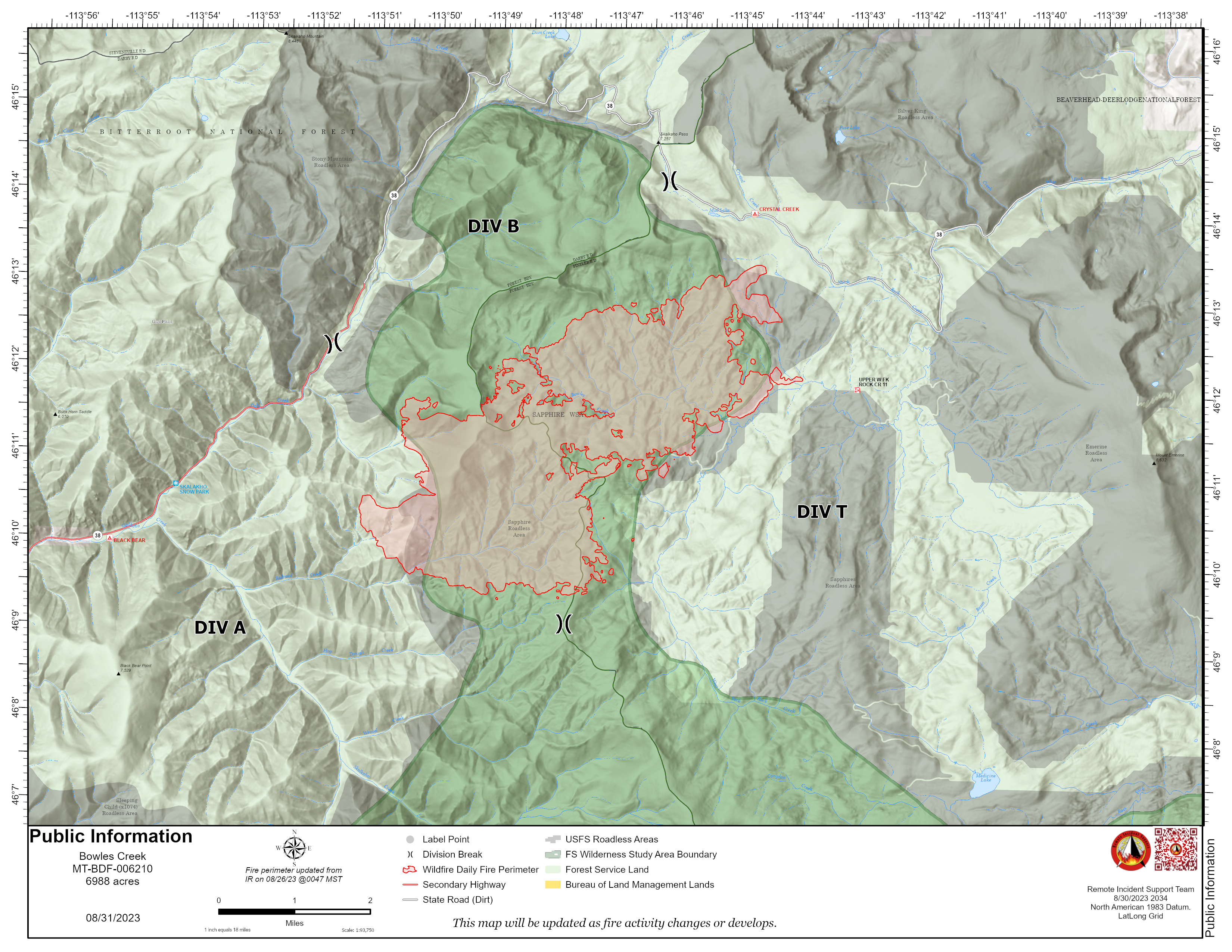
pio_8x11_land_20230830_2032_BowlesCreek_MTBDF006210_0831day.png
2023-08-30 21:54
7.4M
pio_ansi_e_land_20230830_2028_BowlesCreek_MTBDF006210_0831day.pdf
2023-08-30 21:54
3.0M
rehab_ansi_e_land_20230830_2037_BowlesCreek_MTBDF006210_0831day.pdf
2023-08-30 21:55
6.9M
acc_prop_ansi_e_land_20230830_2037_BowlesCreek_MTBDF006210_0831day.pdf
2023-08-30 21:55
5.7M
brief_ansi_e_land_20230830_1925_BowlesCreek_MTBDF006210_0831.pdf
2023-08-30 21:55
7.2M
div_a_ops_ansi_e_land_20230830_2011_BowlesCreek_MTBDF006210_0831.pdf
2023-08-30 21:55
4.7M
div_b_ops_ansi_e_land_20230830_2011_BowlesCreek_MTBDF006210_0831.pdf
2023-08-30 21:55
3.2M
div_t_ops_ansi_e_land_20230830_2011_BowlesCreek_MTBDF006210_0831.pdf
2023-08-30 21:56
4.4M
ops_ansi_e_land_20230830_2011_BowlesCreek_MTBDF006210_0831.pdf
2023-08-30 21:56
6.6M