Index of /public/incident_specific_data/n_rockies/Historic_archived NIROPS/2015_fires/2015_MotorwayComplex/GIS/product/20150824
Name
Last modified
Size
Description
Parent Directory
-
OPS_StructureBuffer_20150824_1900.pdf
2015-08-25 14:37
326K
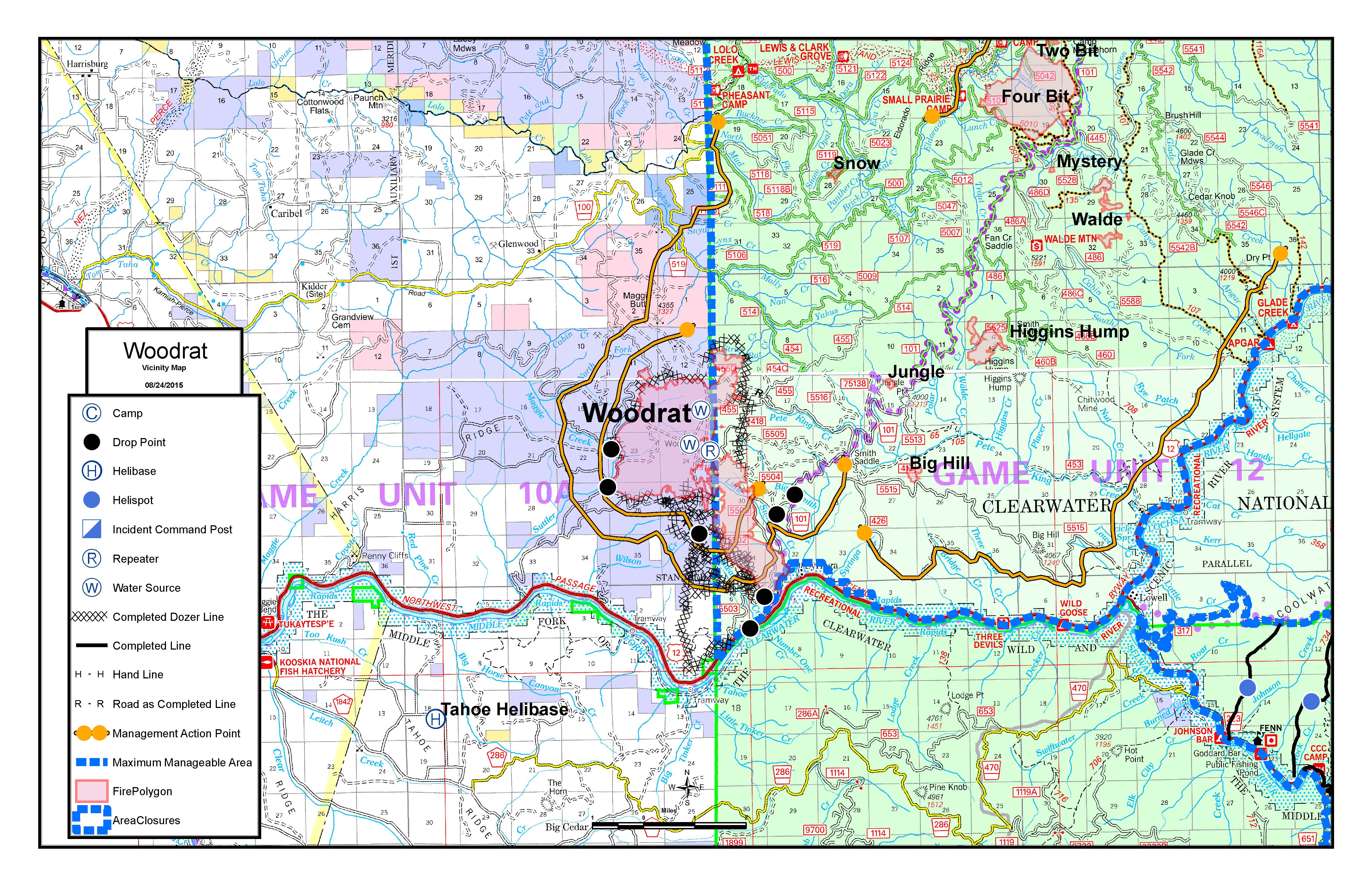
INFO_VincinityMap_Woodrat_11x17_Land.pdf
2015-08-24 11:12
2.0M
INFO_VincinityMap_Woodrat_11x17_Land.jpg
2015-08-24 11:12
2.7M
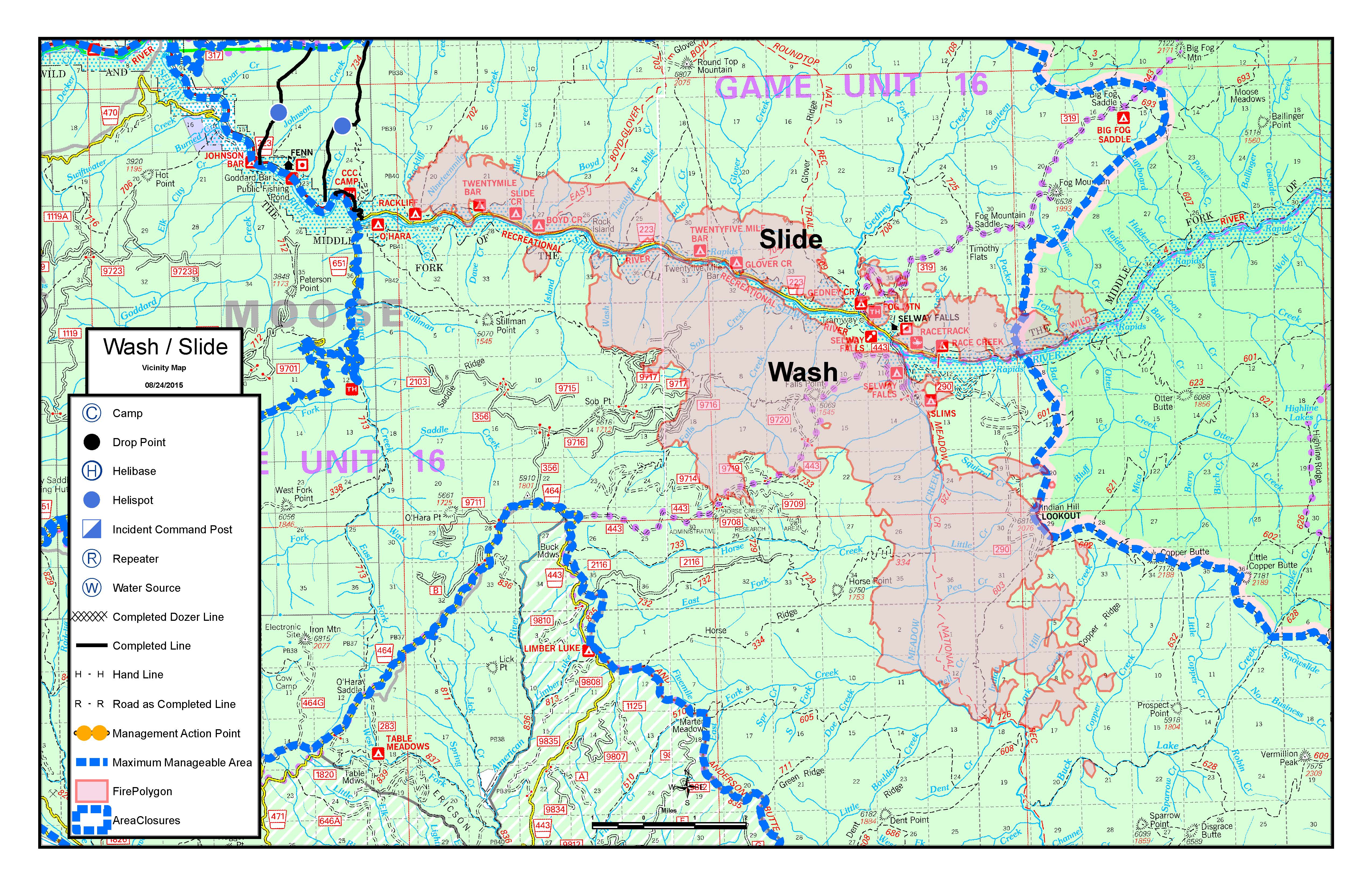
INFO_VincinityMap_SlideWash_11x17_Land.jpg
2015-08-24 11:12
2.3M
INFO_VincinityMap_SlideWash_11x17_Land.pdf
2015-08-24 11:11
1.7M
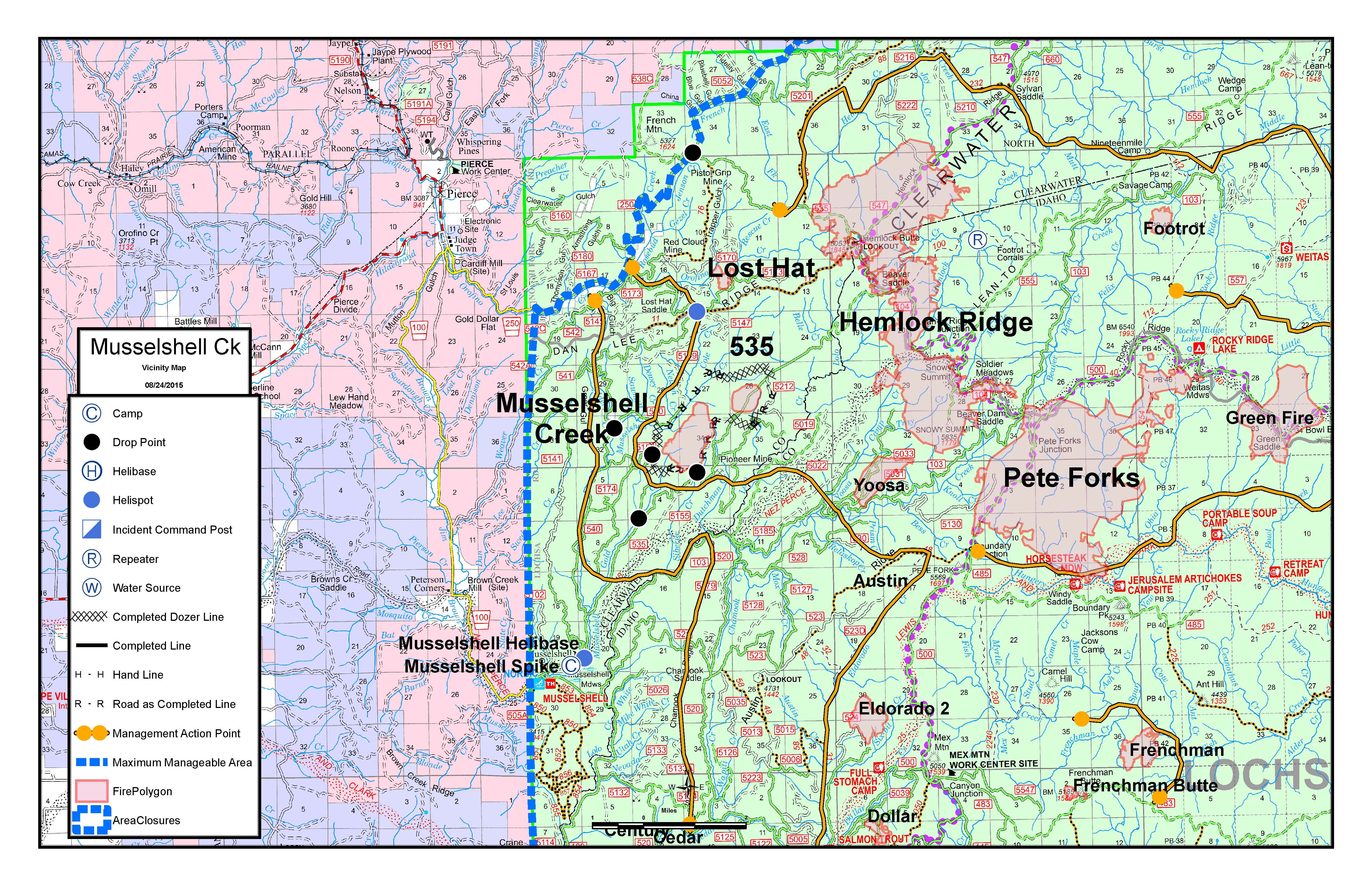
INFO_VincinityMap_Musselshell_11x17_Land.pdf
2015-08-24 11:11
2.3M
INFO_VincinityMap_Musselshell_11x17_Land.jpg
2015-08-24 11:11
2.8M
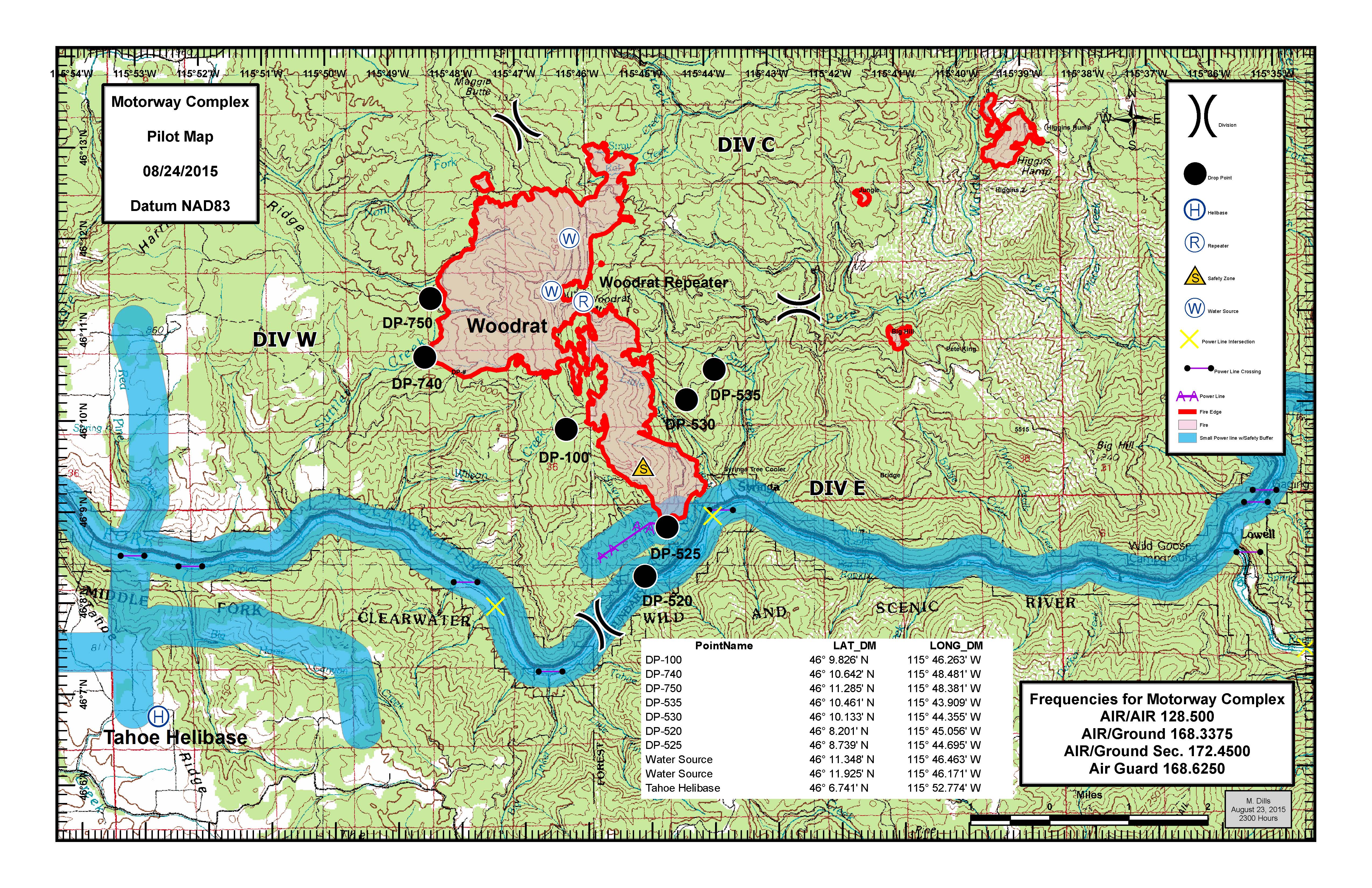
AirOps_PilotMap_MotorwayComplex_20150824_2300_11x17_Landscape_md.pdf
2015-08-24 01:37
2.1M
AirOps_PilotMap_MotorwayComplex_20150824_2300_11x17_Landscape_md.jpg
2015-08-24 01:37
2.7M
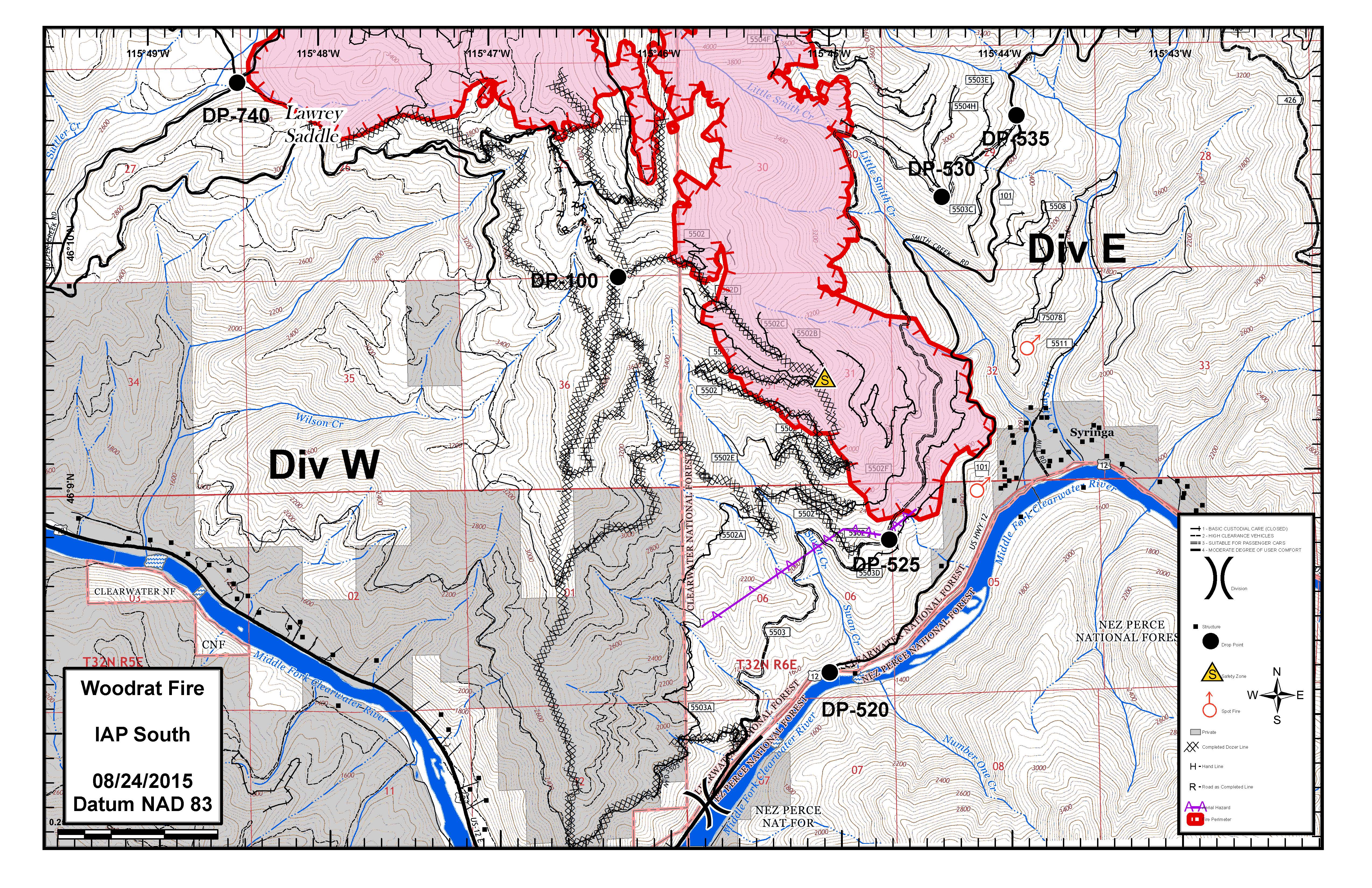
IAP_Woodrat_South_20150824_0600_11X17_Land_MM.pdf
2015-08-24 01:24
4.5M
IAP_Woodrat_South_20150824_0600_11X17_Land_MM.jpg
2015-08-24 01:24
3.4M
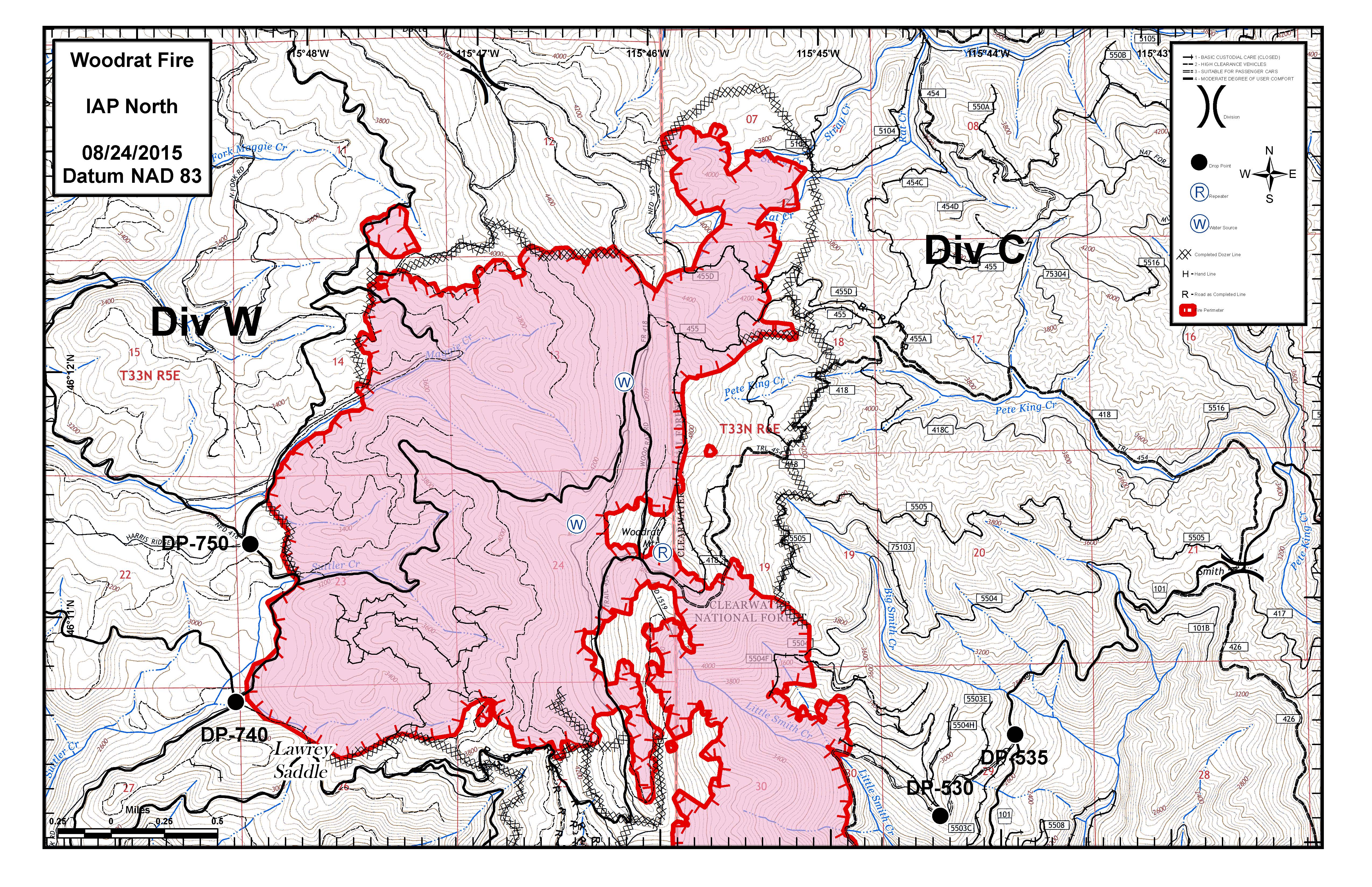
IAP_Woodrat_North_20150824_0600_11X17_Land_MM.pdf
2015-08-24 01:24
3.7M
IAP_SlideWash_20150824_0600_11x17_Land_md.jpg
2015-08-24 01:24
10M
IAP_Woodrat_North_20150824_0600_11X17_Land_MM.jpg
2015-08-24 01:24
2.9M
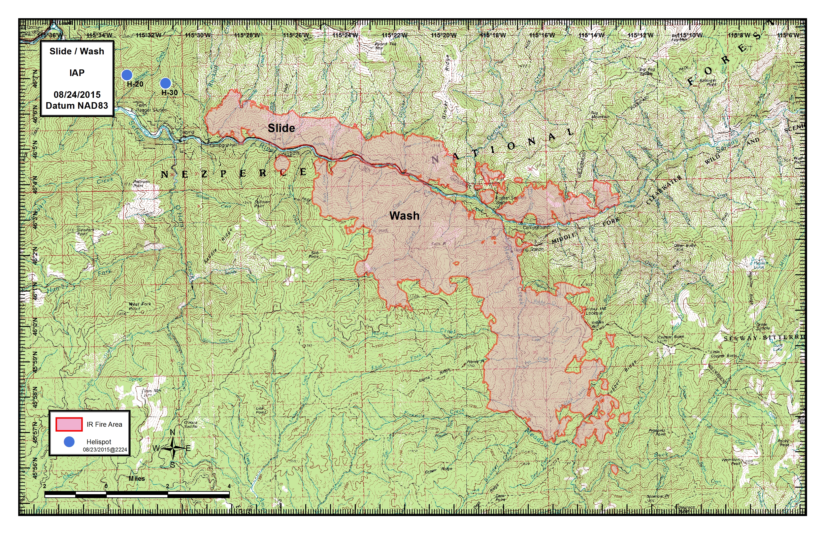
IAP_SlideWash_20150824_0600_11x17_Land_md.pdf
2015-08-24 01:23
3.8M
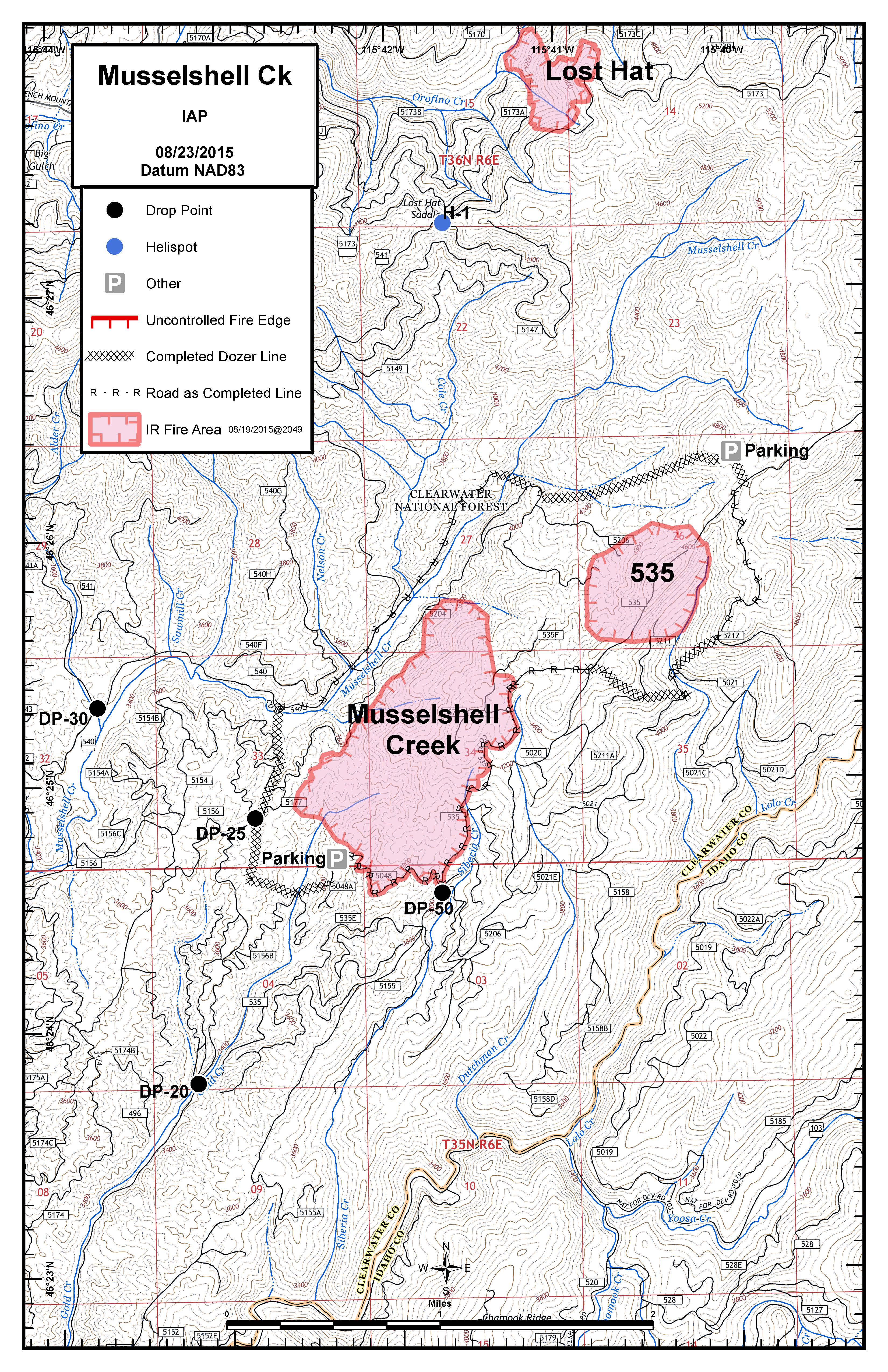
IAP_MusselshellCk_20150824_0600_11x17_Portrait_jh.pdf
2015-08-24 01:23
3.9M
IAP_MusselshellCk_20150824_0600_11x17_Portrait_jh.jpg
2015-08-24 01:23
3.1M
Briefing_SlideWash_20150824_0600_ArchE_Land_md.jpg
2015-08-24 01:23
74M
Briefing_SlideWash_20150824_0600_ArchE_Land_md.pdf
2015-08-24 01:22
54M
Briefing_MusselshellCk_20150824_0600_ArchE_Portrait_jh.pdf
2015-08-24 01:17
31M
BriefingMap_Woodrat_20150824_0900_ArchE_Land_MM.pdf
2015-08-24 01:15
30M
Briefing_MusselshellCk_20150824_0600_ArchE_Portrait_jh.jpg
2015-08-24 01:14
12M
BriefingMap_Woodrat_20150824_0900_ArchE_Land_MM.jpg
2015-08-24 01:13
12M
BriefingMap_Complex_20150824_0900_ArchE_Land_MM.pdf
2015-08-24 01:12
17M
BriefingMap_Complex_20150824_0900_ArchE_Land_MM.jpg
2015-08-24 01:12
10M