Index of /public/incident_specific_data/n_rockies/Historic_archived NIROPS/2017_fires/2017_EastFork/GIS/Products/20170906
Name
Last modified
Size
Description
Parent Directory
-
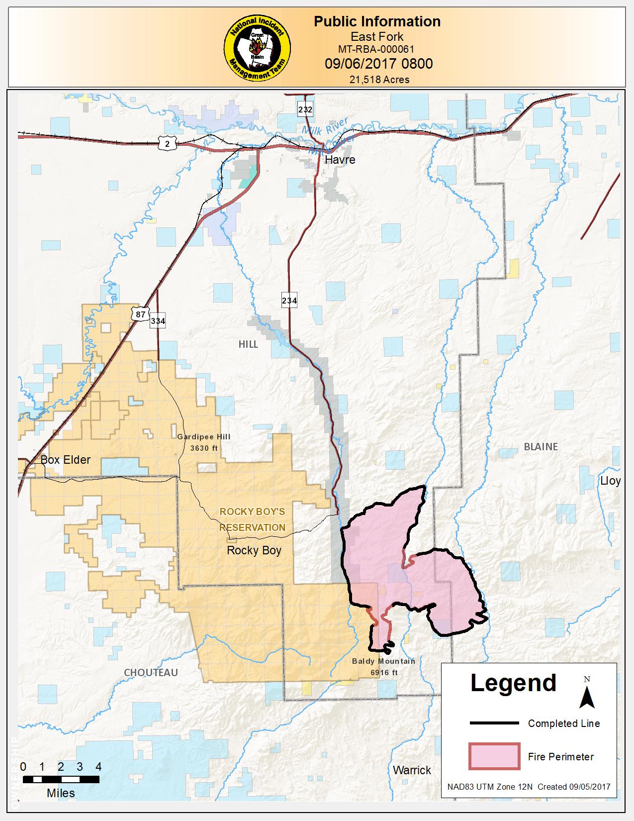
PIO_8_5x11_port_2017_EastFork_MTRBA601.jpg
2017-09-05 22:17
286K
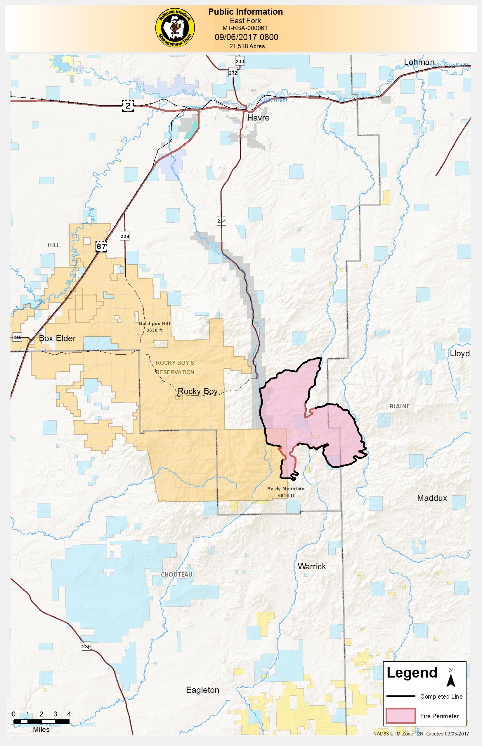
PIO_11x17_port_2017_EastFork_MTRBA601.jpg
2017-09-05 22:17
487K
Transport_8x11_port_2017_EastFork_MTRBA60.pdf
2017-09-05 22:18
489K
PIO_8_5x11_port_2017_EastFork_MTRBA601.pdf
2017-09-05 22:17
545K
IAP_8x11_land_2017_EastFork_MTRBA60.pdf
2017-09-05 22:16
757K
PIO_11x17_port_2017_EastFork_MTRBA601.pdf
2017-09-05 22:17
866K
AirOps_Combined_11X17_portrait_2017_EastFork_MTBRA000060.pdf
2017-09-05 22:16
1.0M
AirOps_11X17_portrait_2017_EastFork_MTBRA000060.pdf
2017-09-05 22:16
1.1M
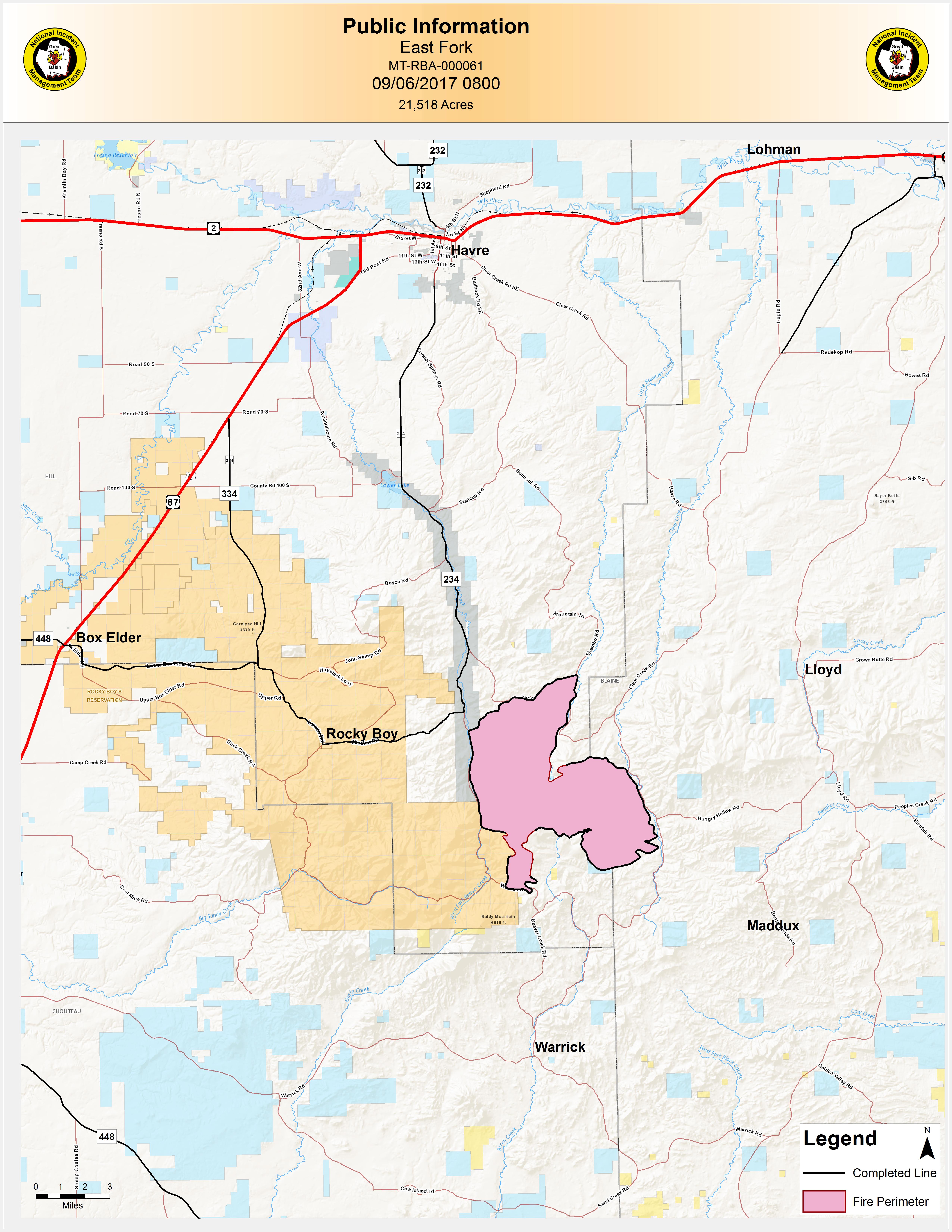
PIO_ANSI_E_port_2017_EastFork_MTRBA000060.jpg
2017-09-05 22:17
2.4M
PIO_ANSI_E_port_2017_EastFork_MTRBA000060.pdf
2017-09-05 22:18
3.9M
OwnershipAgency_ANSI_E_portrait_2017_EastFork_MTBRA000060.pdf
2017-09-05 22:17
8.3M
Ownership_ANSI_E_portrait_2017_EastFork_MTBRA000060.pdf
2017-09-05 22:17
8.6M
BAM_ANSI_E_portrait_2017_EastFork_MTBRA000060.pdf
2017-09-05 22:16
9.0M
AirOps_ANSI_E_portrait_2017_EastFork_MTBRA000060.pdf
2017-09-05 22:16
9.1M
Ops_ANSI_E_portrait_2017_EastFork_MTBRA000060.pdf
2017-09-05 22:17
9.2M