Index of /public/incident_specific_data/n_rockies/Historic_archived NIROPS/2017_fires/2017_Liberty/GIS/Products/20170825
Name
Last modified
Size
Description
Parent Directory
-
AirOps_11x17_land_20170824_2145_Liberty_MTFHA105.pdf
2017-08-24 23:41
1.2M
AirOps_11x17_land_20170824_2230_RiceRidge.pdf
2017-08-24 23:41
369K
Trans_ArchD_land_20170824_2025_Liberty_MTFHA105.pdf
2017-08-24 23:42
2.9M
BAM_ArchE_land_20170824_2130_Liberty_MTFHA105.pdf
2017-08-24 23:42
1.9M
DIVAB_AnsiC_land_20170824_2000_Liberty_MTFHA105.pdf
2017-08-24 23:42
2.1M
DIVCM_AnsiC_land_2017_Liberty_MTFHA105.pdf
2017-08-24 23:42
1.4M
IAP_85x11_land_20170824_1840_Liberty_MTFHA105.pdf
2017-08-24 23:43
537K
DIVTU_AnsiC_land_2017_Liberty_MTFHA105.pdf
2017-08-24 23:43
1.3M
OPS_ArchE_land_20170824_2150_Liberty_MTFHA105.pdf
2017-08-24 23:44
3.1M
OPS_AnsiC_land_20170824_2120_Liberty_MTFHA105.pdf
2017-08-24 23:44
3.4M
TFR_ArchE_land_20170824_2200_Liberty_MTFHA105.pdf
2017-08-24 23:45
2.5M
Trans_85X11_land_20170824_1840_Liberty_MTFHA105.pdf
2017-08-24 23:45
199K
Repair_ArchE_land_20170824_2201_Liberty_MTFHA105.pdf
2017-08-24 23:45
4.7M
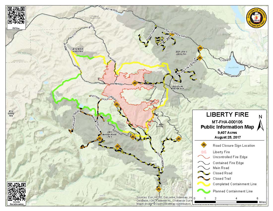
PIO_8x11_land_20170825_0900_Liberty_MTFHA105.pdf
2017-08-25 09:58
280K
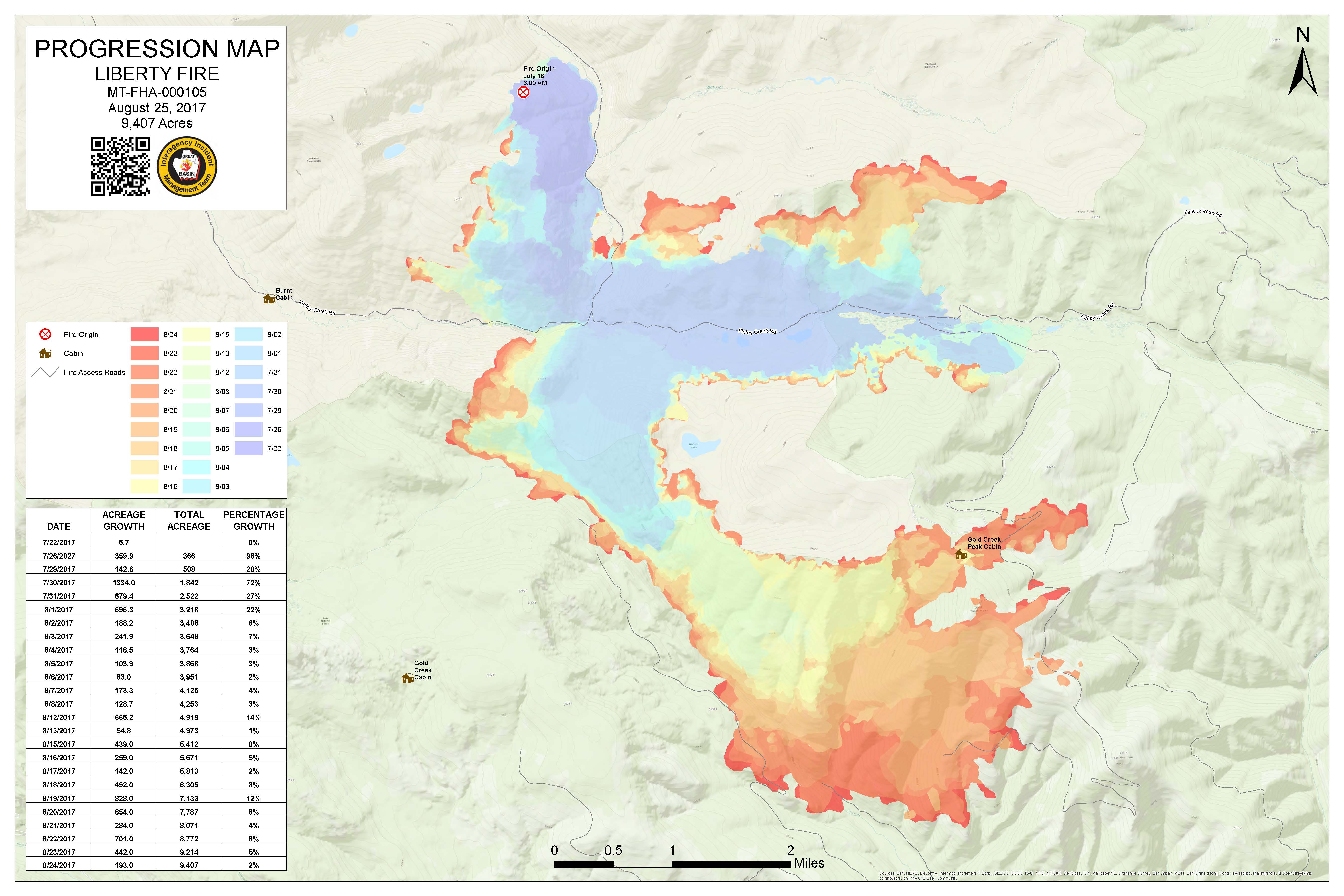
Progression_archD_land_20170825_0830_Liberty_MTFHA105.jpg
2017-08-25 09:58
962K
PIO_8x11_land_20170825_0900_Liberty_MTFHA105.jpg
2017-08-25 09:58
146K
Progression_archD_land_20170825_0830_Liberty_MTFHA105.pdf
2017-08-25 09:58
1.2M