Index of /public/incident_specific_data/n_rockies/Historic_archived NIROPS/2017_fires/2017_Liberty/GIS/Products/20170828
Name
Last modified
Size
Description
Parent Directory
-
AirOps_11x17_land_20170827_2230__Liberty_MTFHA105.pdf
2017-08-28 10:05
374K
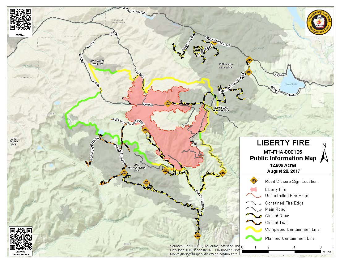
PIO_8x11_land_20170828_0710_Liberty_MTFHA105.pdf
2017-08-28 10:01
283K
PIO_8x11_land_20170828_0710_Liberty_MTFHA105.jpg
2017-08-28 10:01
146K
OPS_AnsiC_land_imagery_20170828_0730_Liberty_MTFHA105.pdf
2017-08-28 08:33
895K
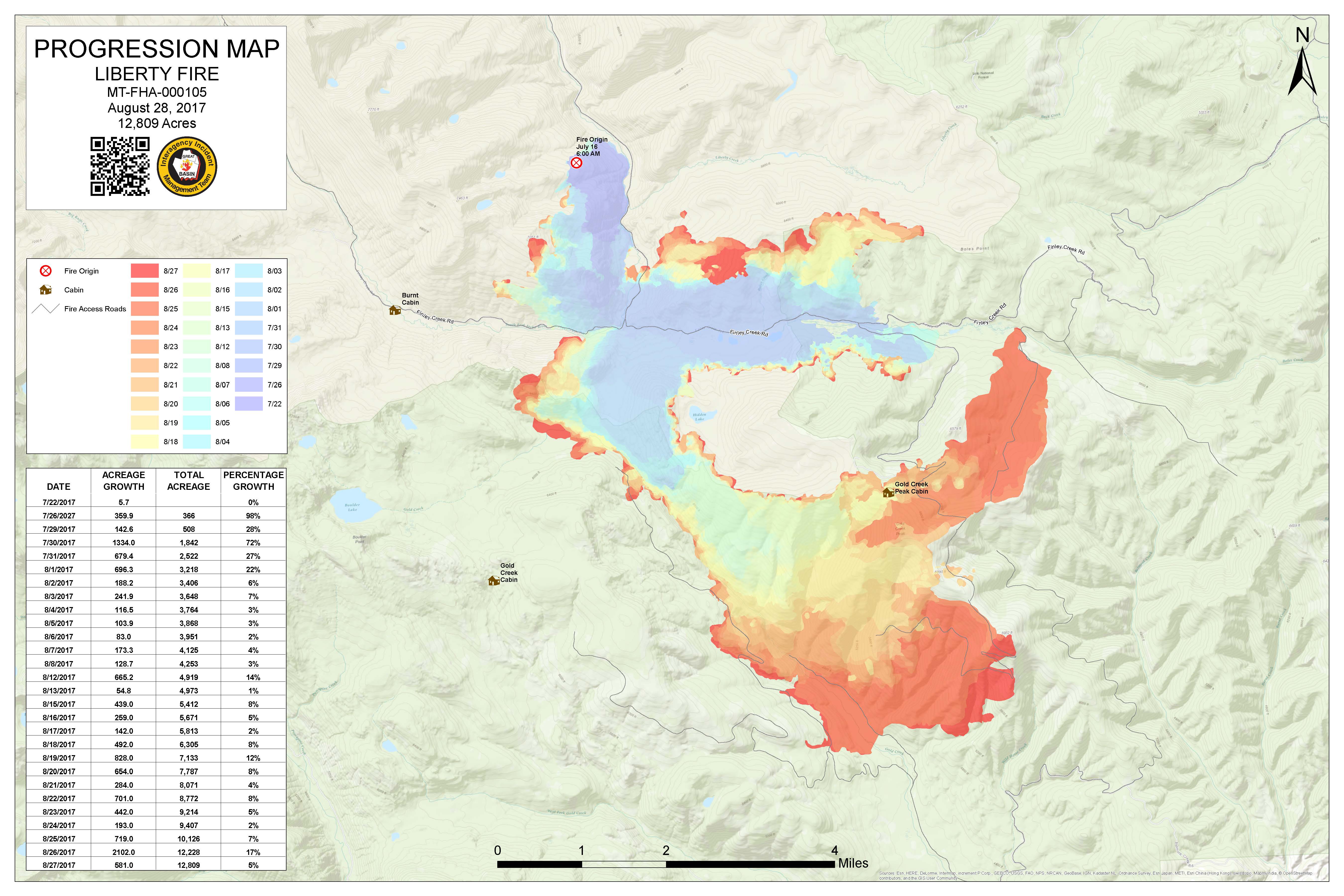
Progression_archD_land_20170828_0700_Liberty_MTFHA105.pdf
2017-08-28 08:27
1.4M
Progression_archD_land_20170828_0700_Liberty_MTFHA105.jpg
2017-08-28 08:27
1.1M
Trans_ArchD_land_20170827_2350_Liberty_MTFHA105.pdf
2017-08-28 00:53
2.0M
RepairDIVMTU_AnsiC_land_20170827_2200_Liberty_MTFHA105.pdf
2017-08-28 00:13
1.6M
RepairDIVC_AnsiC_land_20170827_2200_Liberty_MTFHA105.pdf
2017-08-28 00:06
1.6M
TFR_ArchE_land_20170827_2211_Liberty_MTFHA105.pdf
2017-08-27 23:50
2.5M
Trans_85X11_land_20170827_1840_Liberty_MTFHA105.pdf
2017-08-27 23:50
200K
RepairDIVAB_AnsiC_land_20170827_2200_Liberty_MTFHA105.pdf
2017-08-27 23:49
2.8M
OPS_ArchE_land_20170827_2220_Liberty_MTFHA105.pdf
2017-08-27 23:48
3.1M
OPS_AnsiC_land_20170827_2210_Liberty_MTFHA105.pdf
2017-08-27 23:48
3.6M
OPS_AnsiC_land_20170827_2140_Liberty_MTFHA105.pdf
2017-08-27 23:47
3.6M
IAP_85x11_land_20170827_1840_Liberty_MTFHA105.pdf
2017-08-27 23:46
511K
DIVU_AnsiC_land_20170827_2200_Liberty_MTFHA105.pdf
2017-08-27 23:46
1.9M
DIVT_AnsiC_land_20170827_2200_Liberty_MTFHA105.pdf
2017-08-27 23:46
2.2M
DIVM_AnsiC_land_20170827_2130_Liberty_MTFHA105.pdf
2017-08-27 23:45
2.3M
BAM_ArchE_land_20170827_2150_Liberty_MTFHA105.pdf
2017-08-27 23:45
1.9M