| Name | Last modified | Size | Description | |
|---|---|---|---|---|
| Parent Directory | - | |||
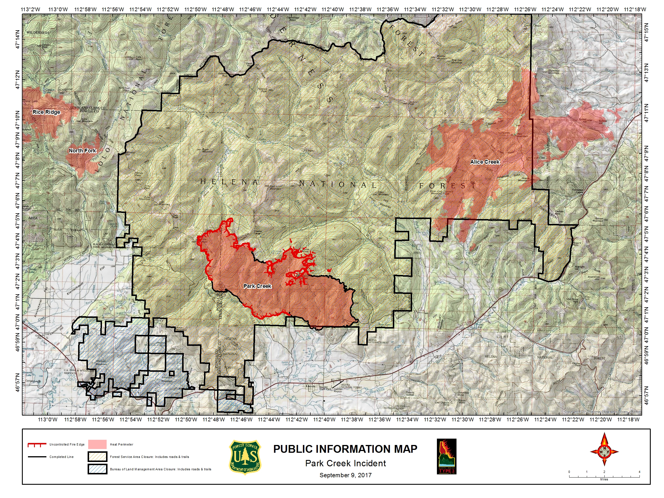
| PIO_With_Rice_Ridge_Fire_C_land_20170909_Park_MT-HLF-000146.jpg | 2017-09-09 18:59 | 4.3M | ||
| Planning_Ops_E_land_20170908_Park_MT-HLF-000146_Op.pdf | 2017-09-09 19:01 | 7.3M | ||
| Structures_North_LincolnProper_land_11x17_20170909_ParkCreekMTHLF000146.pdf | 2017-09-09 19:02 | 2.3M | ||
| Structures_South_LincolnProper_land_11x17_20170909_ParkCreekMTHLF000146.pdf | 2017-09-09 19:02 | 2.1M | ||
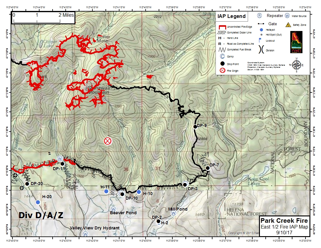
| IAP_Park_Creek_East_Half_land_8x11_20170909_ParkCreekMTHLF000146.jpg | 2017-09-09 20:17 | 776K | ||
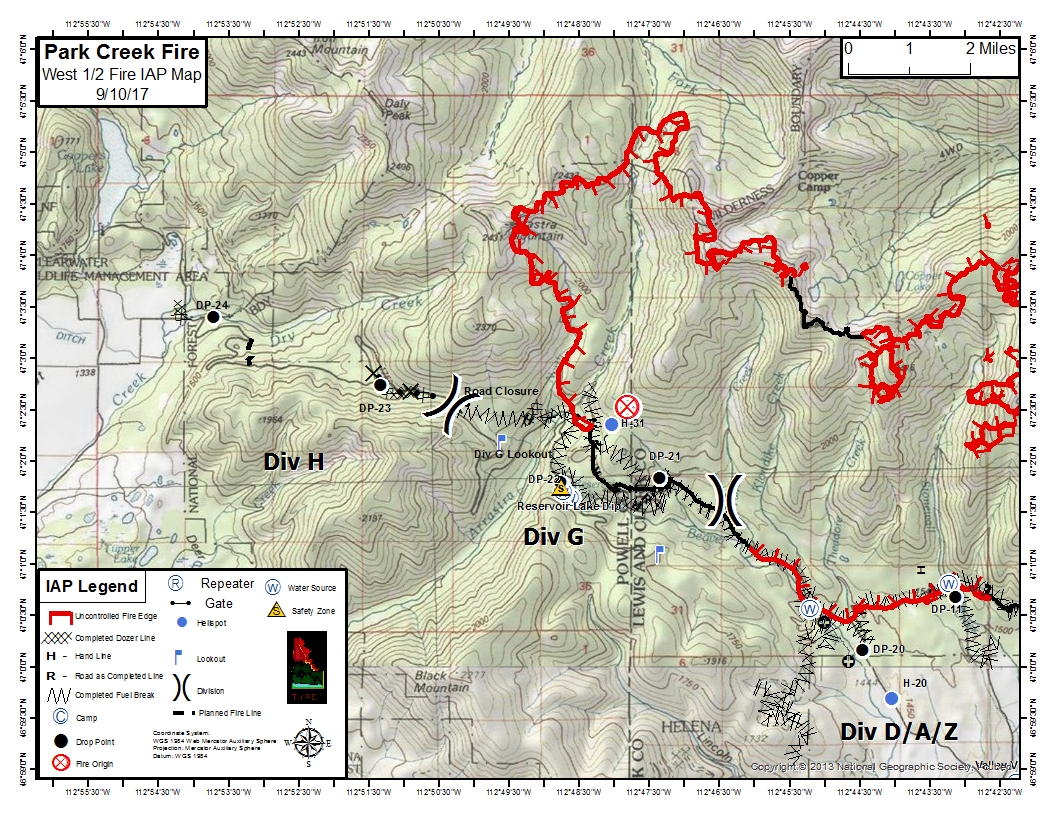
| IAP_Park_Creek_West_Half_land_8x11_20170909_ParkCreekMTHLF000146.jpg | 2017-09-09 20:17 | 877K | ||