| Name | Last modified | Size | Description | |
|---|---|---|---|---|
| Parent Directory | - | |||
| preIR/ | 2018-08-26 10:13 | - | ||
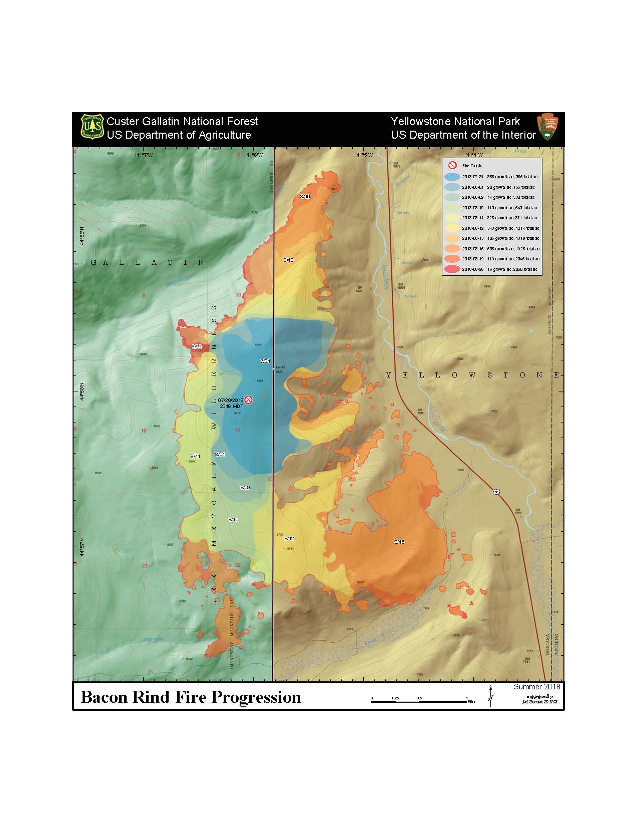
| prog_8x11_port_20180826_2018_BaconRind_MTCGF000095ArcMap_10_5.jpg | 2018-08-26 10:16 | 140K | ||
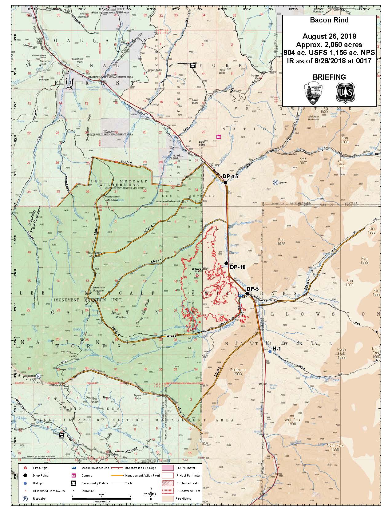
| briefing_8x11_port_20180826_2018_BaconRind_MTCGF000095ArcMap_10_5.jpg | 2018-08-26 10:13 | 302K | ||
| prog_8x11_port_20180826_2018_BaconRind_MTCGF000095ArcMap_10_5.pdf | 2018-08-26 10:16 | 313K | ||
| briefing_8x11_port_20180826_2018_BaconRind_MTCGF000095ArcMap_10_5.pdf | 2018-08-26 10:13 | 940K | ||
| iap_8x11_port_20180826_2018_BaconRind_MTCGF000095ArcMap_10_5.pdf | 2018-08-26 10:14 | 1.1M | ||
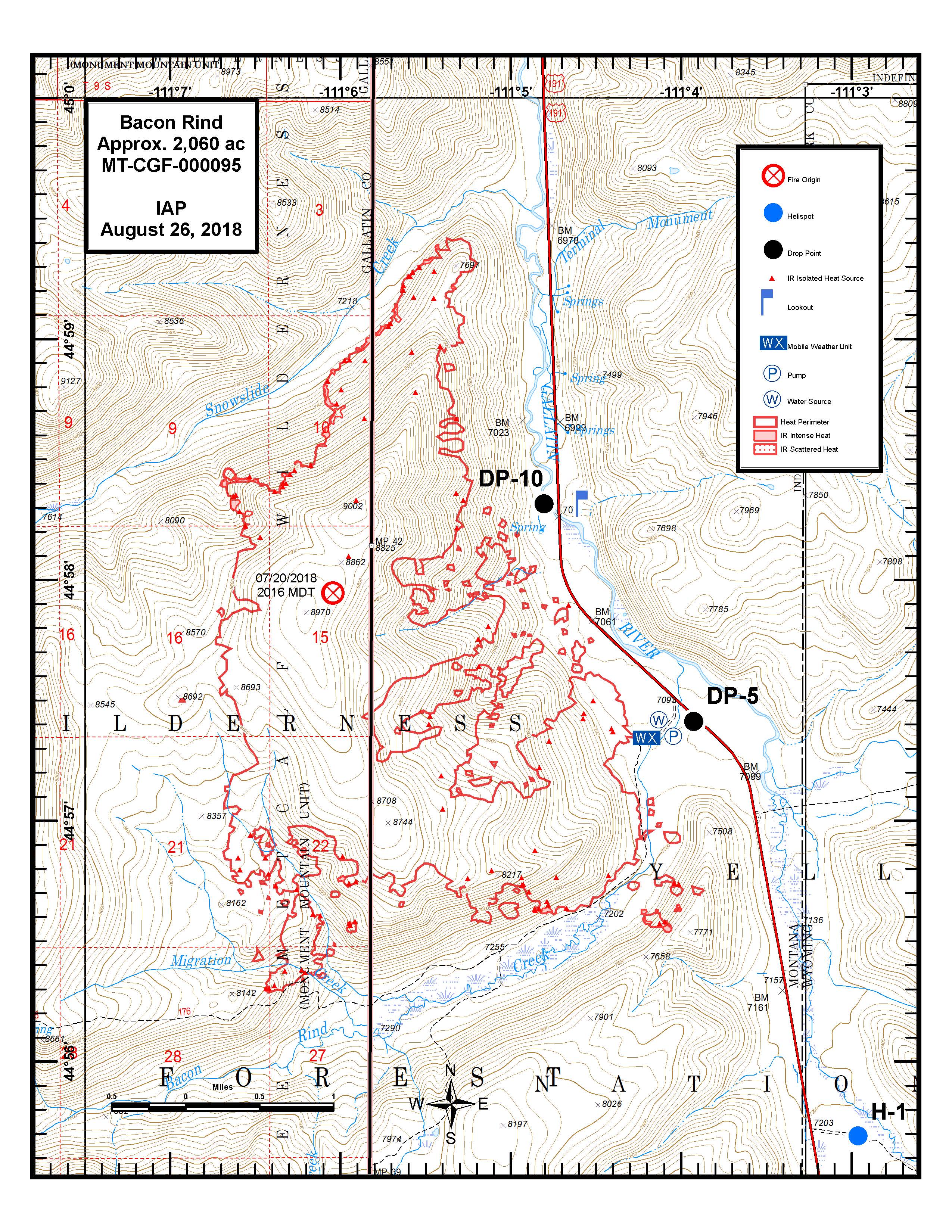
| iap_8x11_port_20180826_2018_BaconRind_MTCGF000095ArcMap_10_5.jpg | 2018-08-26 10:13 | 1.6M | ||
| prog_24x36_port_20180826_2018_BaconRind_MTCGF000095ArcMap_10_5.pdf | 2018-08-26 10:16 | 9.2M | ||
| briefing_36x48_port_20180826_2018_BaconRind_MTCGF000095ArcMap_10_5.pdf | 2018-08-26 10:15 | 16M | ||
| ir_36x48_land_20180826_2018_BaconRind_MTCGF000095_ArcMap_10_5.pdf | 2018-08-26 10:17 | 39M | ||