| Name | Last modified | Size | Description | |
|---|---|---|---|---|
| Parent Directory | - | |||
| iap_8x11_port_20180827_2018_BaconRind_MTCGF000095ArcMap_10_5.pdf | 2018-08-26 16:35 | 1.2M | ||
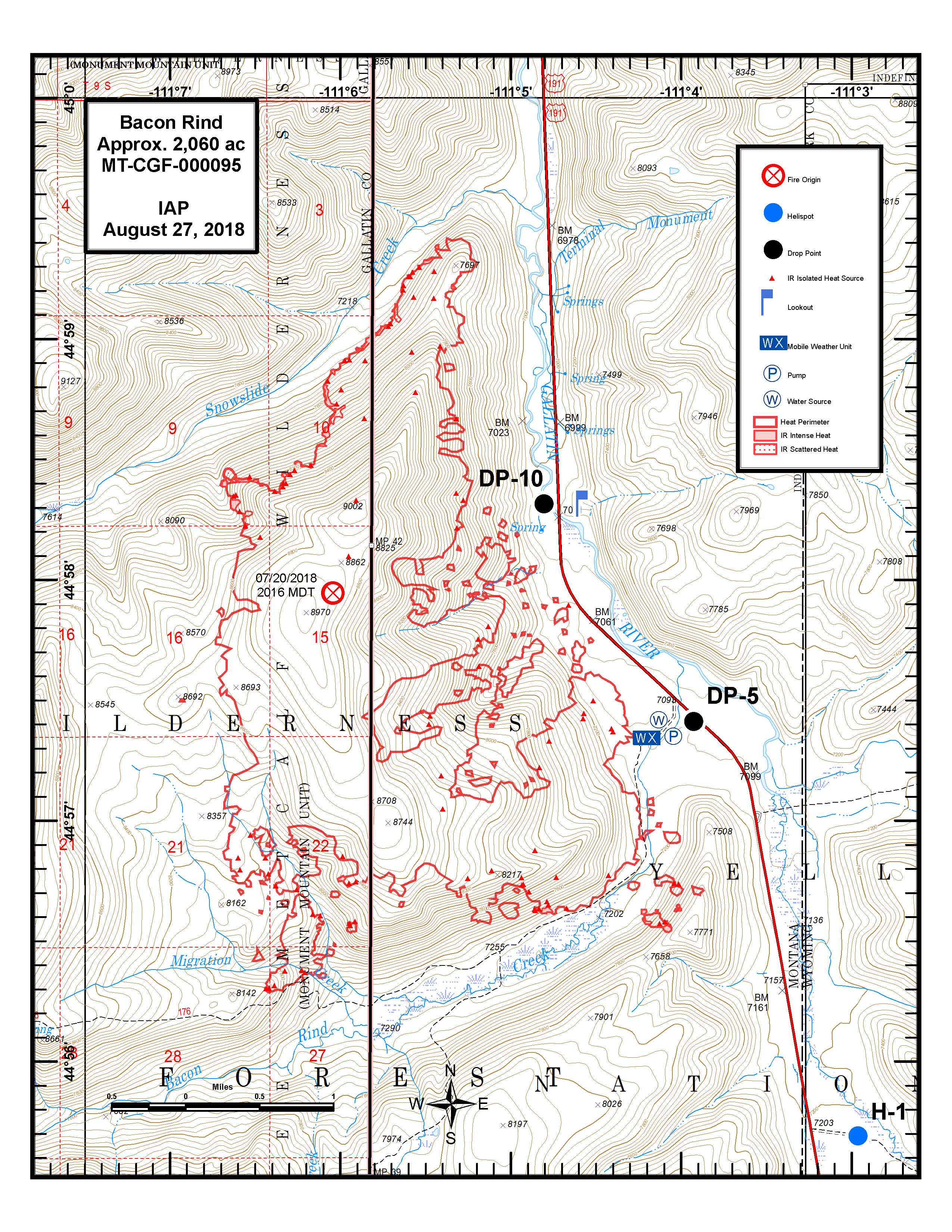
| iap_8x11_port_20180827_2018_BaconRind_MTCGF000095ArcMap_10_5.jpg | 2018-08-26 16:35 | 1.6M | ||
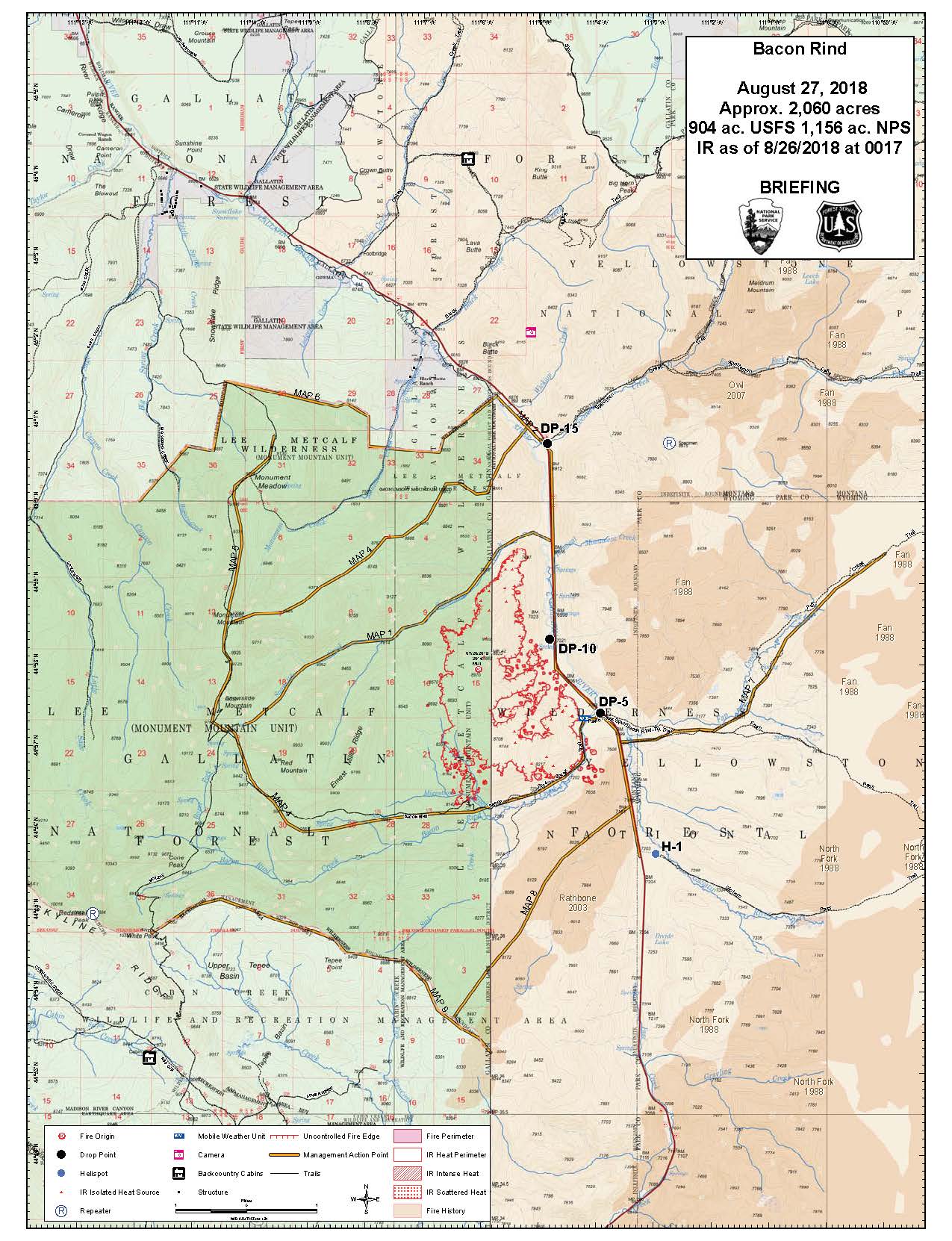
| briefing_36x48_port_20180827_2018_BaconRind_MTCGF000095ArcMap_10_5.pdf | 2018-08-26 21:54 | 16M | ||
| briefing_8x11_port_20180827_2018_BaconRind_MTCGF000095ArcMap_10_5.pdf | 2018-08-26 21:53 | 953K | ||
| briefing_8x11_port_20180827_2018_BaconRind_MTCGF000095ArcMap_10_5.jpg | 2018-08-26 21:53 | 301K | ||