| Name | Last modified | Size | Description | |
|---|---|---|---|---|
| Parent Directory | - | |||
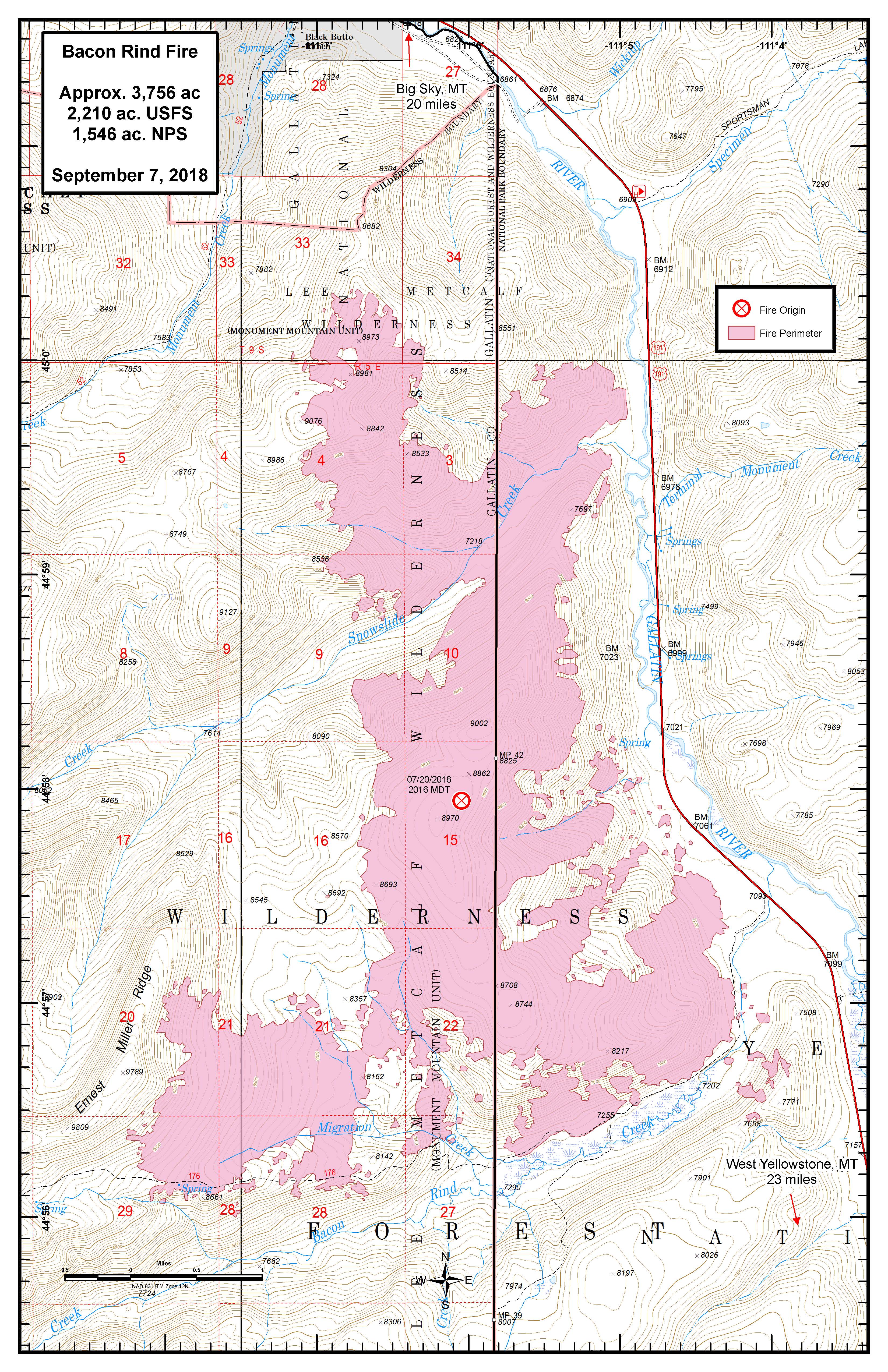
| prog_24x36_port_20180907_2018_BaconRind_MTCGF000095ArcMap_10_5.pdf | 2018-09-07 17:56 | 13M | ||
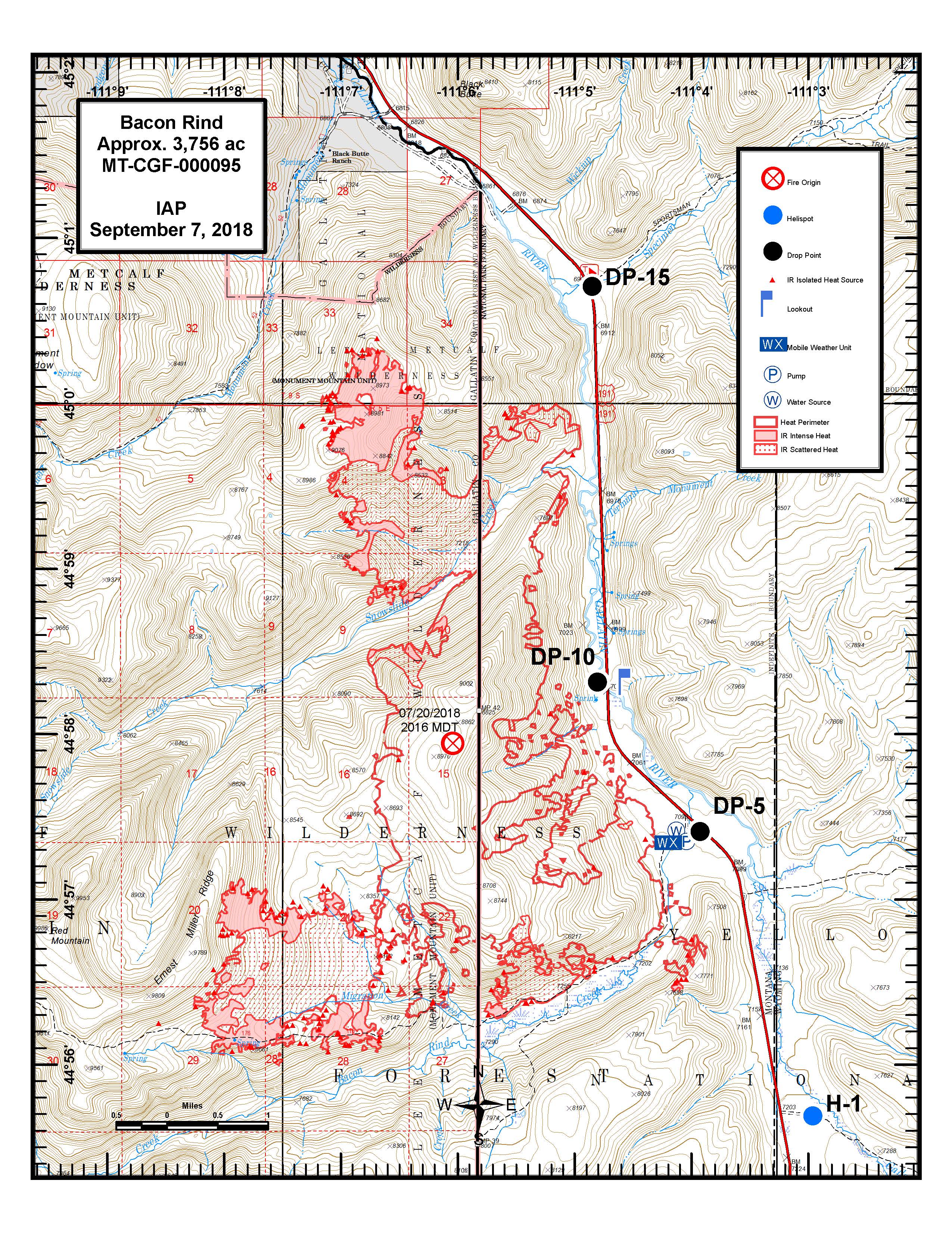
| iap_11x14_port_20180907_2018_BaconRind_MTCGF000095ArcMap_10_5.pdf | 2018-09-07 17:55 | 2.1M | ||
| iap_11x14_port_20180907_2018_BaconRind_MTCGF000095ArcMap_10_5.jpg | 2018-09-07 17:55 | 3.0M | ||
| iap_8x11_port_20180907_2018_BaconRind_MTCGF000095ArcMap_10_5.pdf | 2018-09-07 17:55 | 1.5M | ||
| iap_8x11_port_20180907_2018_BaconRind_MTCGF000095ArcMap_10_5.jpg | 2018-09-07 17:55 | 2.0M | ||
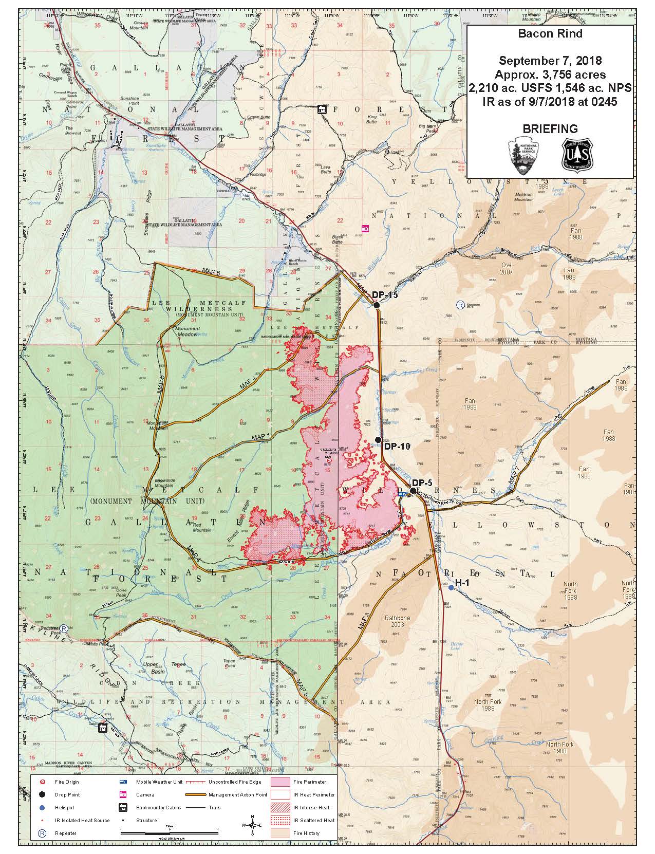
| briefing_36x48_port_20180907_2018_BaconRind_MTCGF000095ArcMap_10_5.pdf | 2018-09-07 17:55 | 16M | ||
| briefing_8x11_port_20180907_2018_BaconRind_MTCGF000095ArcMap_10_5.pdf | 2018-09-07 17:55 | 949K | ||
| briefing_8x11_port_20180907_2018_BaconRind_MTCGF000095ArcMap_10_5.jpg | 2018-09-07 17:55 | 300K | ||
| 20180907_NR_NonEvent_AccountablePropertyLIST.csv | 2018-09-07 18:04 | 4.0K | ||