| Name | Last modified | Size | Description | |
|---|---|---|---|---|
| Parent Directory | - | |||
| Whitmore IAP.pdf | 2013-08-13 11:08 | 871K | ||
| SandSix IAP.pdf | 2013-08-13 11:08 | 1.4M | ||
| iap_85x11_landscape_2013_milepost10_221LBL.pdf | 2013-08-13 11:09 | 1.4M | ||
| StarvationBriefing.pdf | 2013-08-13 11:08 | 1.6M | ||
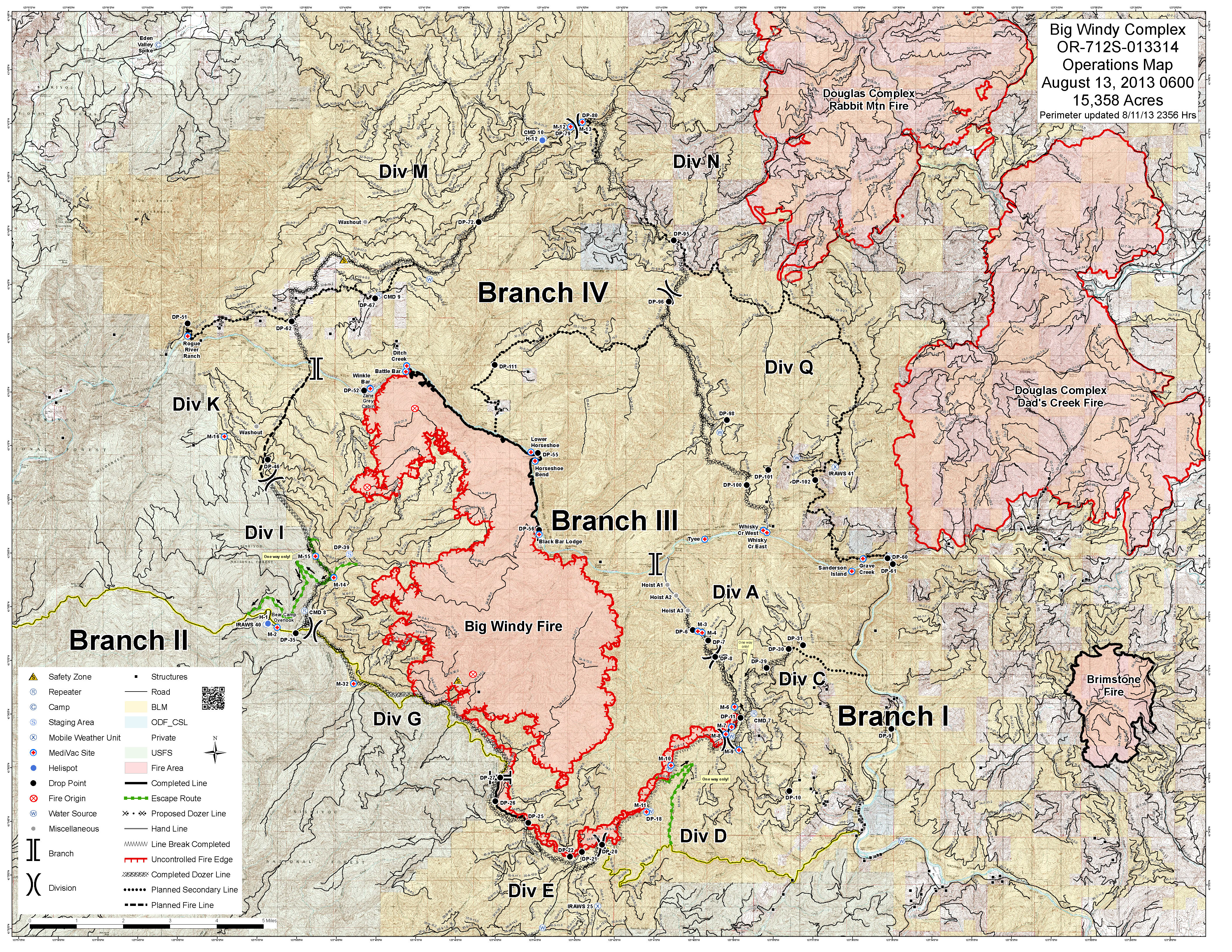
| 20130813_Operations_e_land_2013_BigWindy_OR712S013314_optim.jpg | 2013-08-13 11:08 | 5.9M | ||
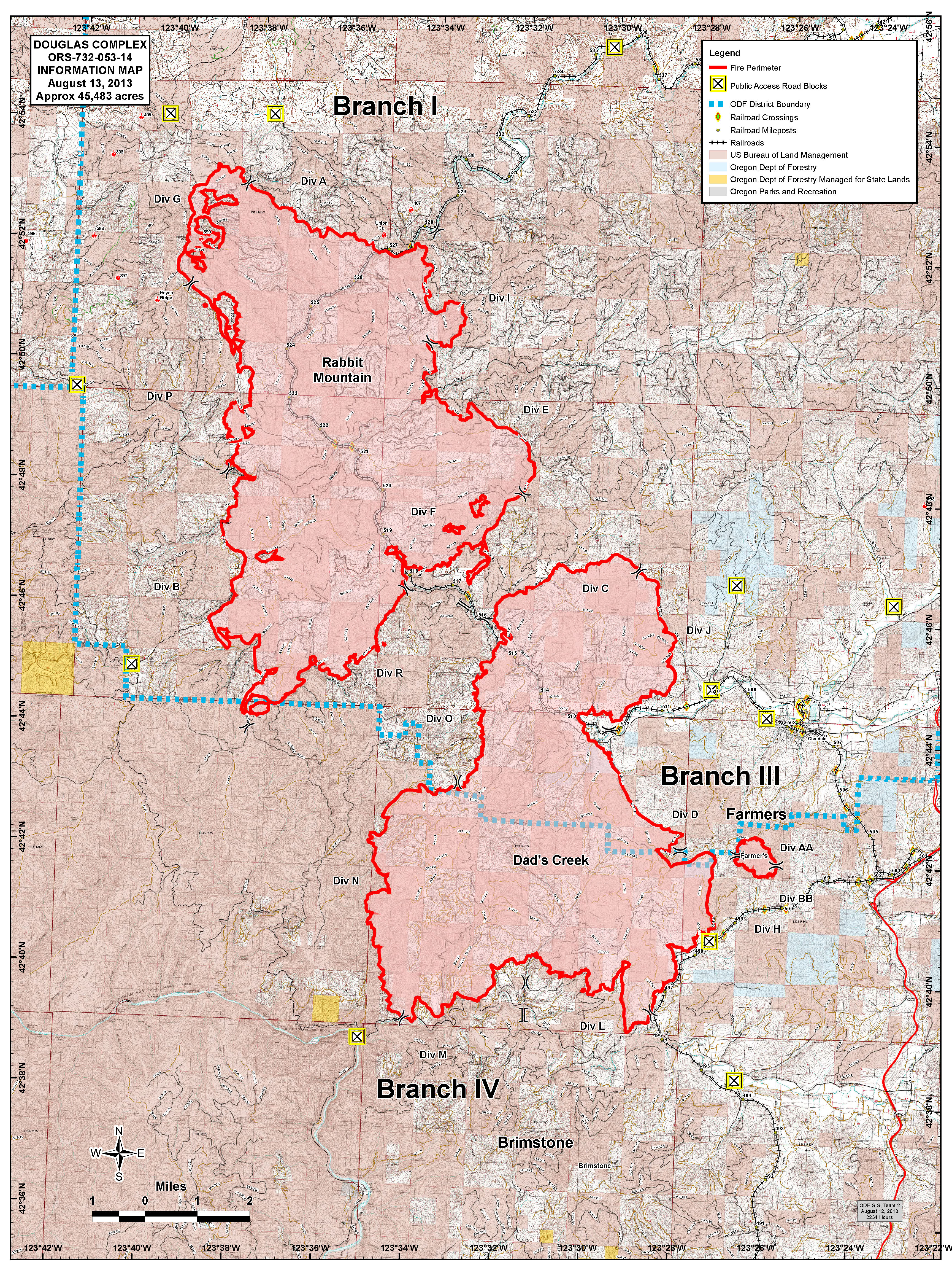
| InfoDetail_ArcE_port_20130812_2230_DouglasComplex_Day.jpg | 2013-08-13 11:08 | 6.7M | ||
| ops_18x24_port_2013_colockumtarps_divd_221lbd_2.pdf | 2013-08-13 11:09 | 12M | ||
| OpsPlanning_48x36_port_20130812_2200_WhiskeyComplex_OR-UPF-1301321_0813Day.pdf | 2013-08-13 11:10 | 13M | ||