Index of /public/incident_specific_data/southwest/GACC_Incidents/2021/2021_Horton/GIS/Products/20210621
Name
Last modified
Size
Description
Parent Directory
-
20210621_Horton_IR_Imagery_Map.pdf
2021-06-21 07:26
530K
20210621_Horton_IR_Topo_Map.pdf
2021-06-21 07:26
635K
airops_11x17_land_20210621_0630_Horton_AZASF613_0621day_print.pdf
2021-06-21 08:38
2.9M
airops_11x17_land_20210621_0630_Horton_AZASF613_0621day_geo.pdf
2021-06-21 08:38
2.9M
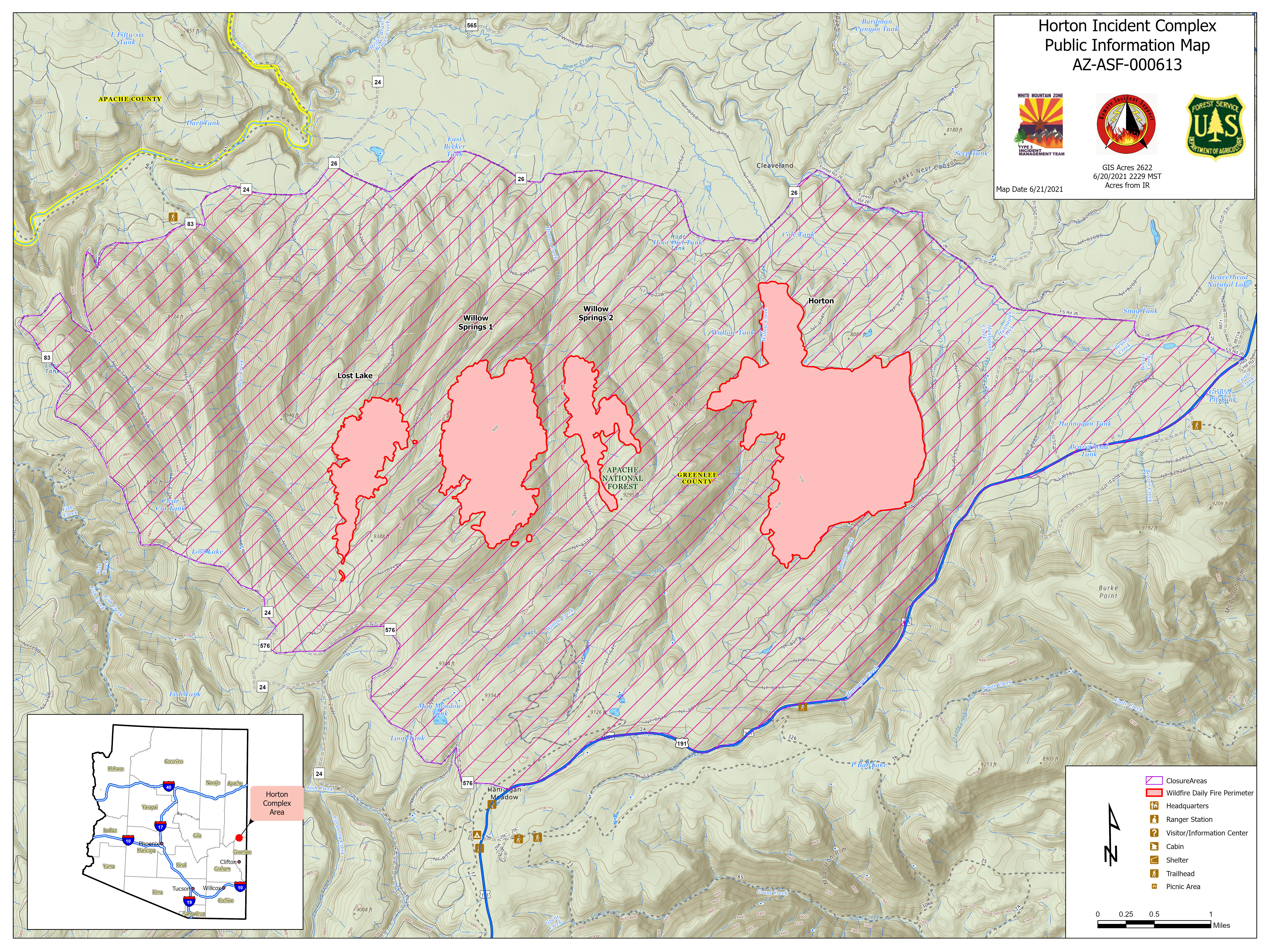
pio_arch_c_land_20210621_0613_Horton_AZASF613_0621day.jpg
2021-06-21 08:41
10M
pio_arch_c_land_20210621_0610_Horton_AZASF613_0621day_print.pdf
2021-06-21 08:40
15M
pio_arch_c_land_20210621_0610_Horton_AZASF613_0621day_geo.pdf
2021-06-21 08:40
15M
ops_arch_d_land_20210621_0620_Horton_AZASF613_0621day_print.pdf
2021-06-21 08:39
16M
ops_arch_d_land_20210621_0620_Horton_AZASF613_0621day_geo.pdf
2021-06-21 08:38
16M
Ops_arch_e_land_20210621_0621_Horton_AZASF613_0621day_geo.pdf
2021-06-21 08:39
17M
Ops_arch_e_land_20210621_0621_Horton_AZASF613_0621day_print.pdf
2021-06-21 08:40
17M
trans_arch_e_land_20210621_0606_Horton_AZASF613_0621day_print.pdf
2021-06-21 08:42
47M
trans_arch_e_land_20210621_0608_Horton_AZASF613_0621day_geo.pdf
2021-06-21 08:43
47M