| Name | Last modified | Size | Description | |
|---|---|---|---|---|
| Parent Directory | - | |||
| airops_arch_e_land_20220424_2003_CerroPelado_NMSNF00049_0425day.pdf | 2022-04-24 22:16 | 5.4M | ||
| MgmtActPts_arch_e_land_20220424_2005_CerroPelado_NMSNF00049_0425day.pdf | 2022-04-24 22:18 | 6.6M | ||
| ops_arch_e_land_20220424_2036_CerroPelado_NMSNF00049_0425day.pdf | 2022-04-24 22:20 | 8.9M | ||
| pio_11x17_land_20220424_2007_CerroPelado_NMSNF00049_0425day.pdf | 2022-04-24 22:20 | 1.4M | ||
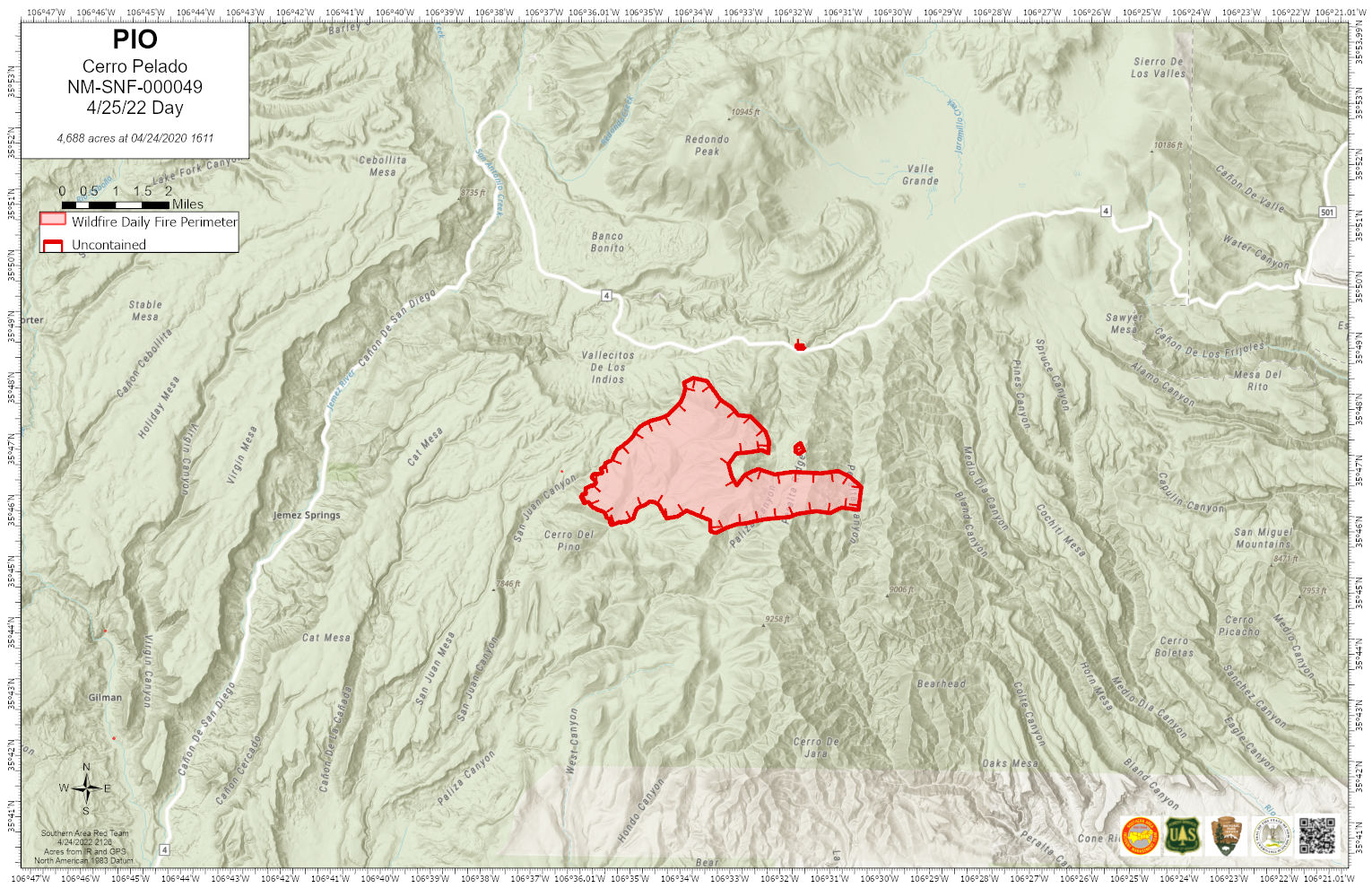
| pio_11x17_land_20220424_2007_CerroPelado_NMSNF00049_0425day.jpg | 2022-04-24 22:26 | 333K | ||
| pub_meet_arch_e_land_2022025_0909_Cerro Pelado_NMSNF00049_0425day.pdf | 2022-04-25 10:25 | 16M | ||
| Cerro_Pelado_Fire_Polygon_20220425.kmz | 2022-04-25 14:15 | 20K | ||