| Name | Last modified | Size | Description | |
|---|---|---|---|---|
| Parent Directory | - | |||
| trans_11x17_land_20180730_2310_Cranston_CABDF11390_0731day.pdf | 2018-07-31 02:08 | 638K | ||
| pio_8x11_land_20180730_2317_Cranston_CABDF11390_0731day.pdf | 2018-07-31 02:07 | 1.4M | ||
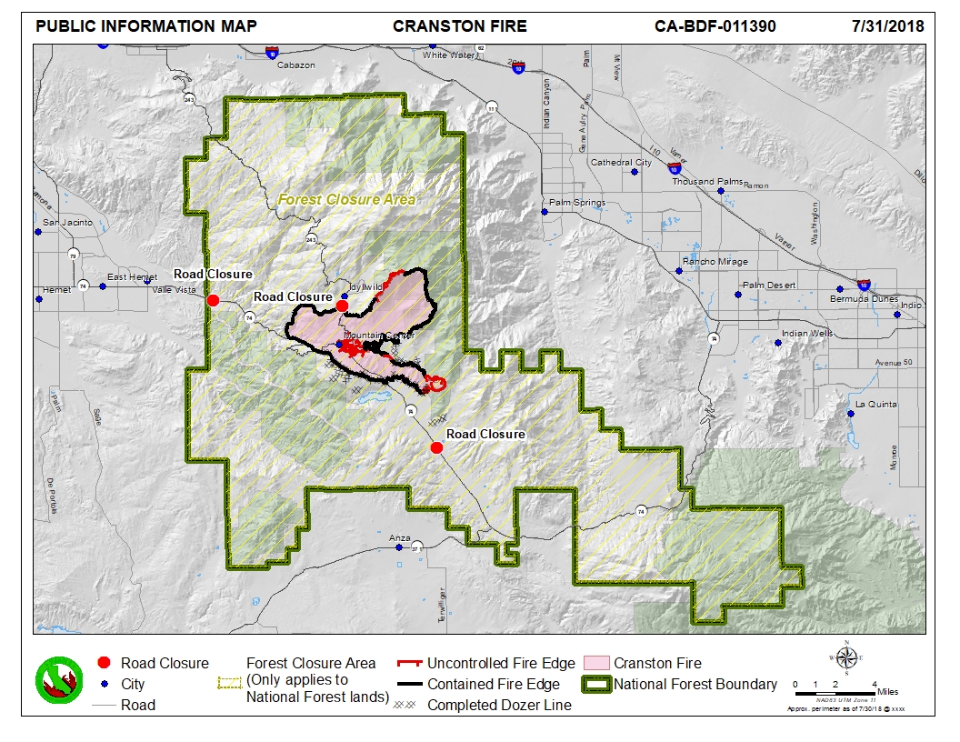
| pio_8x11_land_20180730_2317_Cranston_CABDF11390_0731day.jpg | 2018-07-31 02:09 | 742K | ||
| iap_ALL_index_MP_11x17_land_20180730_2328_Cranston_CABDF11390_0731Day.pdf | 2018-07-31 02:28 | 15M | ||
| airops_11x17_land_20180730_2320_Cranston_CABDF11390_0731day.pdf | 2018-07-31 02:07 | 1.7M | ||
| Repair_ansiD_land_20180730_2300_Cranston_CABDF11390_0731Day.pdf | 2018-07-31 02:08 | 8.0M | ||
| BRIEF_ArchE_land_20180730_2315_Cranston_CABDF11390_0731Day.pdf | 2018-07-31 02:08 | 23M | ||