| Name | Last modified | Size | Description | |
|---|---|---|---|---|
| Parent Directory | - | |||
| iap_MP16_11x17_land_20180731_2023_Cranston_CABDF11390_0801day.pdf | 2018-08-01 01:31 | 15M | ||
| Repair_ansiD_land_20180731_2156_Cranston_CABDF11390_0801Day.pdf | 2018-08-01 01:08 | 8.4M | ||
| PIO_8x11_land_20180731_2311_Cranston_CABDF11390_0801Day.pdf | 2018-08-01 01:31 | 1.4M | ||
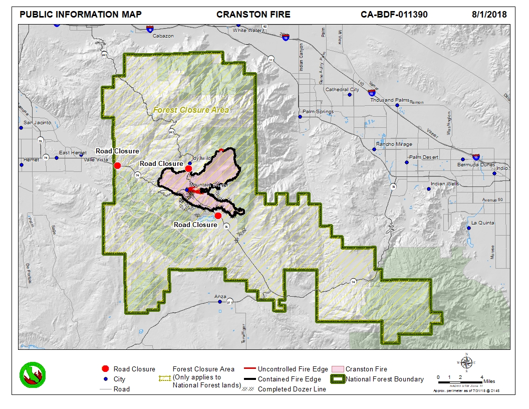
| PIO_8x11_land_20180731_2311_Cranston_CABDF11390_0801Day.jpg | 2018-08-01 01:34 | 735K | ||
| OPS_Repair_DPA_ansiD_land_20180731_2156_Cranston_CABDF11390_0801Day.pdf | 2018-08-01 01:31 | 8.4M | ||
| BRIEF_ArchE_land_20180731_2250_Cranston_CABDF11390_0801Day.pdf | 2018-08-01 01:09 | 19M | ||