Index of /public/incident_specific_data/calif_s/Historic/2009/CA_2631_2009_La_Brea/MAPS
Name
Last modified
Size
Description
Parent Directory
-
20090810_1800_IAP_11x17_land_index.pdf
2016-07-11 16:58
92K
20090810_1800_IAP_11x17_land_p1.pdf
2016-07-11 16:58
2.3M
20090810_1800_IAP_11x17_land_p2.pdf
2016-07-11 16:58
2.4M
20090810_1800_IAP_11x17_land_p3.pdf
2016-07-11 16:58
2.4M
20090811_day_IAP_11x17_land_index.pdf
2016-07-11 16:58
127K
20090811_day_IAP_11x17_land_p1.pdf
2016-07-11 16:58
2.2M
20090811_day_IAP_11x17_land_p2.pdf
2016-07-11 16:58
2.4M
20090811_day_IAP_11x17_land_p3.pdf
2016-07-11 16:58
2.3M
20090811_day_IAP_11x17_land_p4.pdf
2016-07-11 16:58
2.4M
20090811_day_IAP_11x17_land_p5.pdf
2016-07-11 16:58
2.4M
20090811_day_IAP_11x17_land_p6.pdf
2016-07-11 16:58
2.3M
20090811_day_IAP_11x17_land_p7.pdf
2016-07-11 16:58
2.5M
La Brea IAP Maps 08-10-09 0600.pdf
2016-07-11 16:58
1.6M
La Brea IAP Maps 08-10-09 1800.pdf
2016-07-11 16:58
2.7M
La Brea IAP Maps 08-11-09 0600.pdf
2016-07-11 16:58
5.5M
snf_rec_no_latlong.aux
2016-07-11 16:58
500K
snf_rec_no_latlong.jgw
2016-07-11 16:58
222
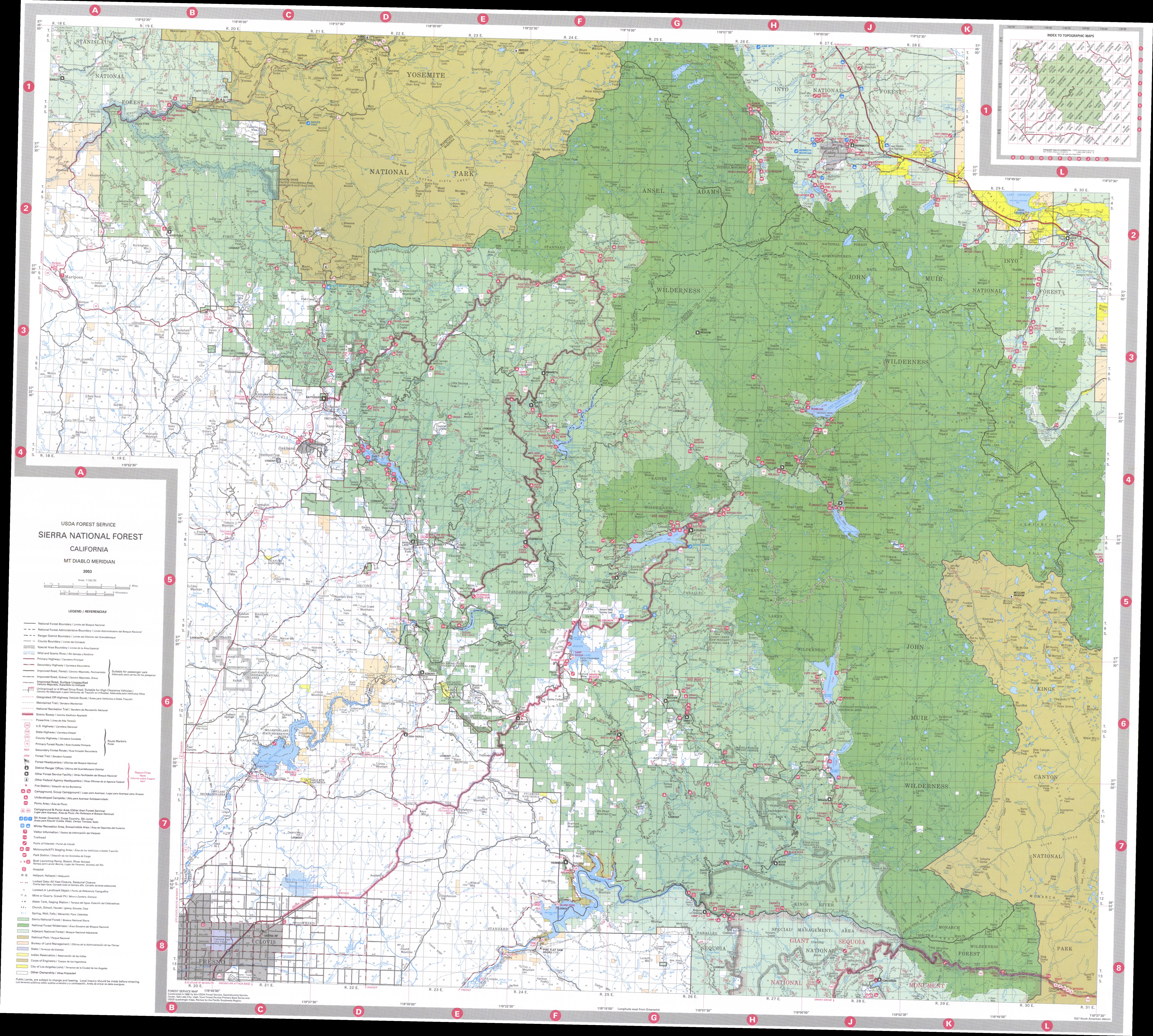
snf_rec_no_latlong.jpg
2016-07-11 16:59
8.3M
snf_rec_no_latlong.jpg.aux.xml
2016-07-11 16:59
1.0K
snf_rec_no_latlong.jpg.xml
2016-07-11 16:59
7.1K