| Name | Last modified | Size | Description | |
|---|---|---|---|---|
| Parent Directory | - | |||
| IAP_tiles/ | 2015-09-14 07:37 | - | ||
| AirOperations_Pilot_Table_11x17_20150914_Tepee.pdf | 2015-09-14 07:37 | 64K | ||
| AirOps_Pilot_11x17_Map_20150914_Tepee.pdf | 2015-09-14 07:22 | 833K | ||
| AirOperations_Pilot_Map_And_Table_11x17_20150914_Tepee.pdf | 2015-09-14 07:37 | 893K | ||
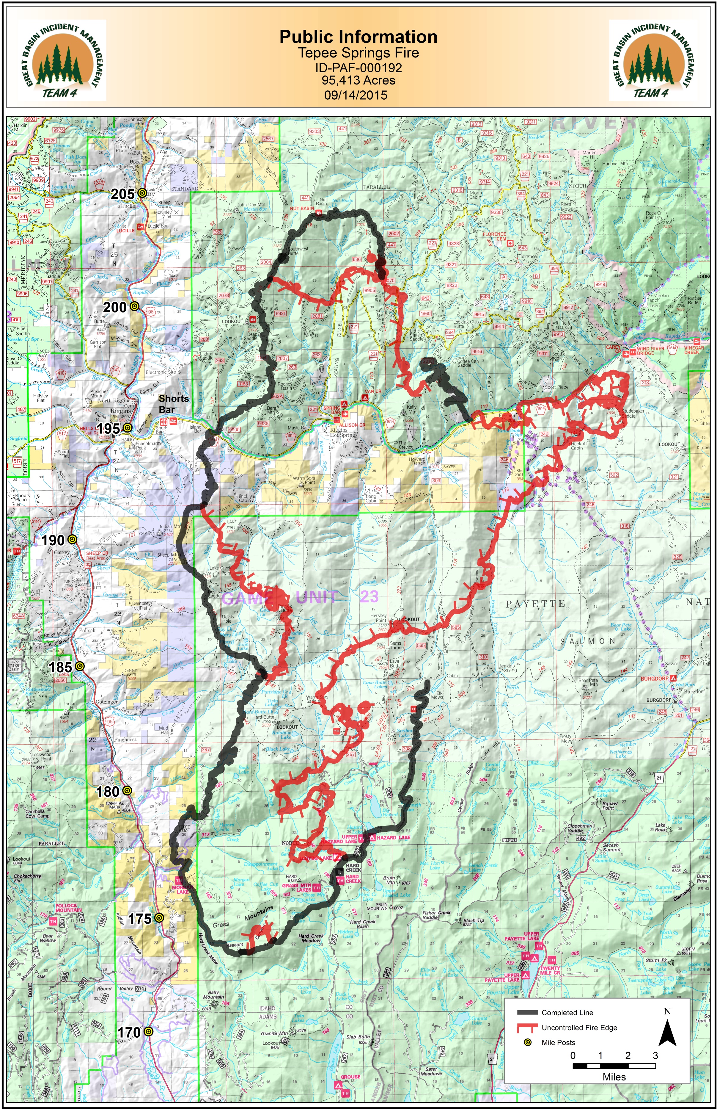
| PIO_11x17_20150914_0000_Tepee.jpg | 2015-09-14 07:50 | 3.9M | ||
| PIO_WithClosures_11x17_20150914_0000_Tepee.jpg | 2015-09-14 07:25 | 4.3M | ||
| Ops_DivCD_E_FSTopo_20150914_0000_Tepee_.pdf | 2015-09-14 07:22 | 4.3M | ||
| Ops_DivLK_36X36_FSTopo_20150914_0000_Tepee.pdf | 2015-09-14 07:49 | 4.4M | ||
| Ops_DivCAZYT_E_FSTopo_20150914_0600_Tepee.pdf | 2015-09-14 07:49 | 4.7M | ||
| AirOps_E_20150914_Tepee.pdf | 2015-09-14 07:38 | 5.6M | ||
| Ops_E_FSTopo_20150914_0000_Tepee.pdf | 2015-09-14 07:50 | 6.0M | ||
| BAM_20150914_1500_Tepee.pdf | 2015-09-14 17:06 | 7.9M | ||
| IR_11X17_20150914_Tepee.pdf | 2015-09-14 07:25 | 10M | ||
| Transportation_E_20150914_0000_Tepee.pdf | 2015-09-14 07:52 | 14M | ||
| PIO_E_20150914_0000_Tepee.pdf | 2015-09-14 07:23 | 17M | ||