| Name | Last modified | Size | Description | |
|---|---|---|---|---|
| Parent Directory | - | |||
| Rehab_E_20150921_0700_All_Tepee.pdf | 2015-09-21 10:12 | 22M | ||
| Transportation_E_20150921_0000_Tepee.pdf | 2015-09-20 22:48 | 15M | ||
| PIO_WithClosures_E_20150921_0000_Tepee.pdf | 2015-09-20 22:49 | 6.9M | ||
| Ops_E_FSTopo_20150921_0000_Tepee.pdf | 2015-09-20 22:50 | 6.1M | ||
| AirOperations_E_20150921_0000_Tepee.pdf | 2015-09-20 22:52 | 5.6M | ||
| AirOperations_Pilot_Map_And_Table_11x17_20150921_0000_Tepee.pdf | 2015-09-20 22:51 | 4.7M | ||
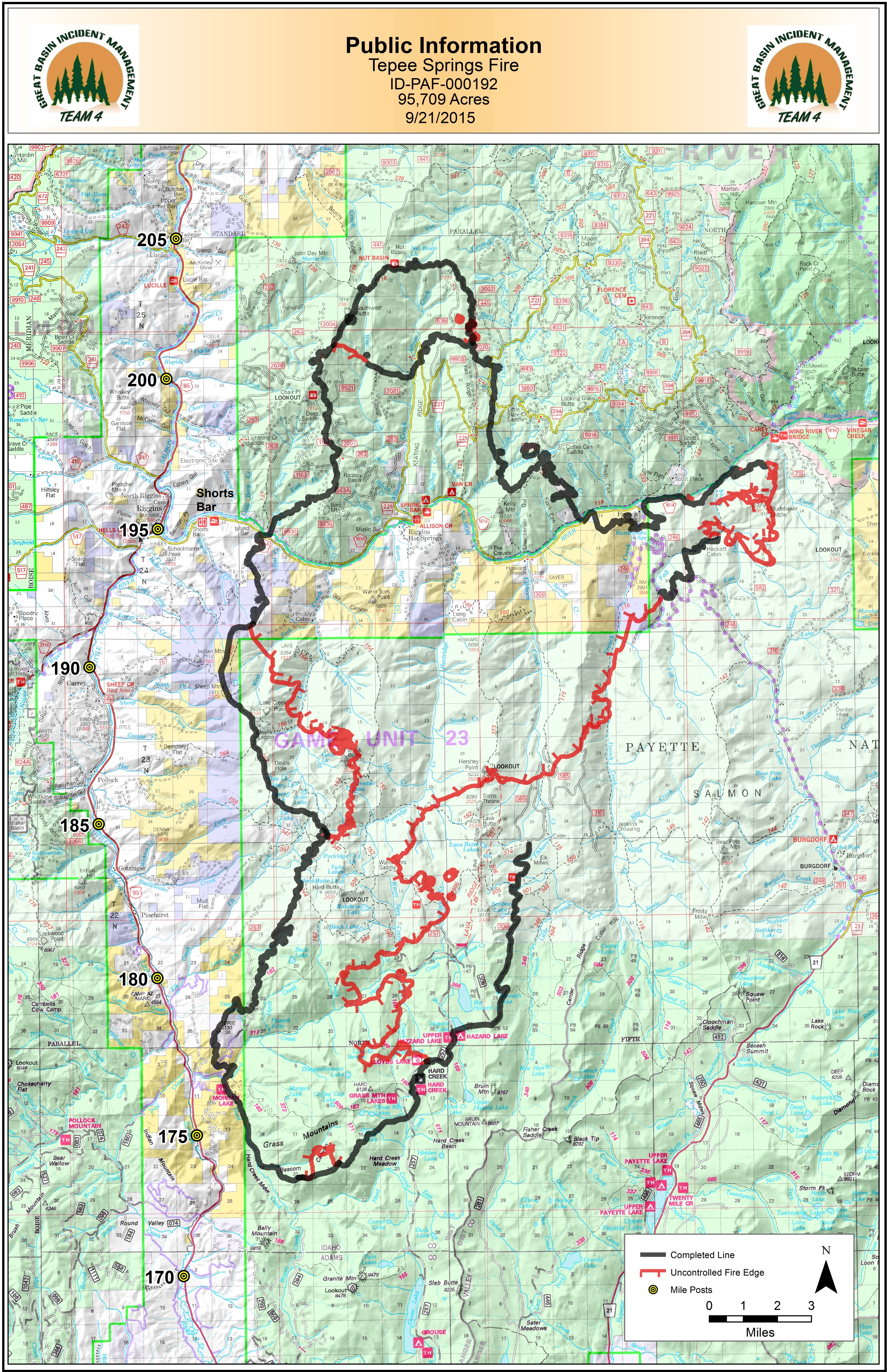
| PIO_11x17_20150921_0000_Tepee.jpg | 2015-09-20 23:02 | 3.9M | ||
| AirOperations_Pilot_map_11x17_20150921_0000_Tepee.pdf | 2015-09-20 22:51 | 830K | ||
| 20150919_2030_Tepee_Rehab_L_ExportTable.xlsx | 2015-09-21 12:04 | 111K | ||
| AirOperations_Pilot_Table_11x17_20150921_0000_Tepee.pdf | 2015-09-20 22:50 | 64K | ||
| 20150921_0730_Tepee_Rehab_L_ExportTable.pdf | 2015-09-21 12:04 | 62K | ||
| IAP_tiles/ | 2015-09-20 22:44 | - | ||