Index of /public/incident_specific_data/n_rockies/2023_Fires/2023_BowlesCreek/GIS/20230830
Name
Last modified
Size
Description
Parent Directory
-
trans_8x11_land_20230829_1626_BowlesCreek_MTBDF006210_0830day.pdf
2023-08-29 17:32
8.9M
rehab_ansi_e_land_20230829_2106_BowlesCreek_MTBDF006210_0830day.pdf
2023-08-29 22:15
7.0M
pio_ansi_e_land_20230829_2053_BowlesCreek_MTBDF006210_0830.pdf
2023-08-29 22:15
121M
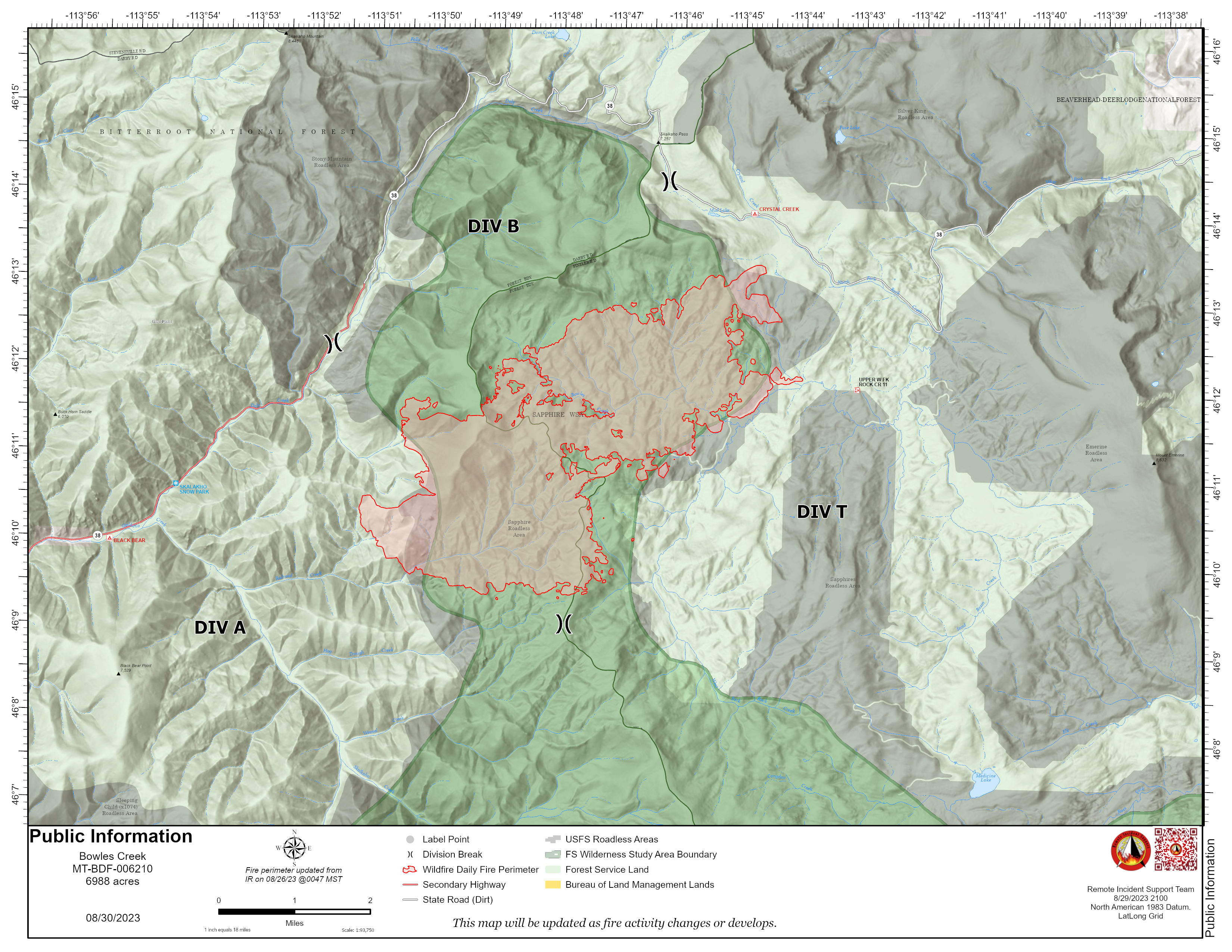
pio_8x11_land_20230829_2054_BowlesCreek_MTBDF006210_0830.png
2023-08-29 22:10
7.4M
pio_8x11_land_20230829_2054_BowlesCreek_MTBDF006210_0830.pdf
2023-08-29 22:17
9.5M
ops_ansi_e_land_20230829_2036_BowlesCreek_MTBDF006210_0830day.pdf
2023-08-29 22:16
6.6M
iap_8x11_land_20230829_1624_BowlesCreek_MTBDF006210_0830day.pdf
2023-08-29 17:32
2.6M
div_t_ops_ansi_e_land_20230829_2036_BowlesCreek_MTBDF006210_0830day.pdf
2023-08-29 22:16
4.4M
div_b_ops_ansi_e_land_20230829_2036_BowlesCreek_MTBDF006210_0830day.pdf
2023-08-29 22:16
3.2M
div_a_ops_ansi_e_land_20230829_2036_BowlesCreek_MTBDF006210_0830day.pdf
2023-08-29 22:16
4.7M
brief_ansi_e_land_20230829_2027_BowlesCreek_MTBDF006210_0830.pdf
2023-08-29 22:15
7.2M
acc_prop__ansi_e_land_20230829_2102_BowlesCreek_MTBDF006210_0830day.pdf
2023-08-29 22:15
2.8M