| Name | Last modified | Size | Description | |
|---|---|---|---|---|
| Parent Directory | - | |||
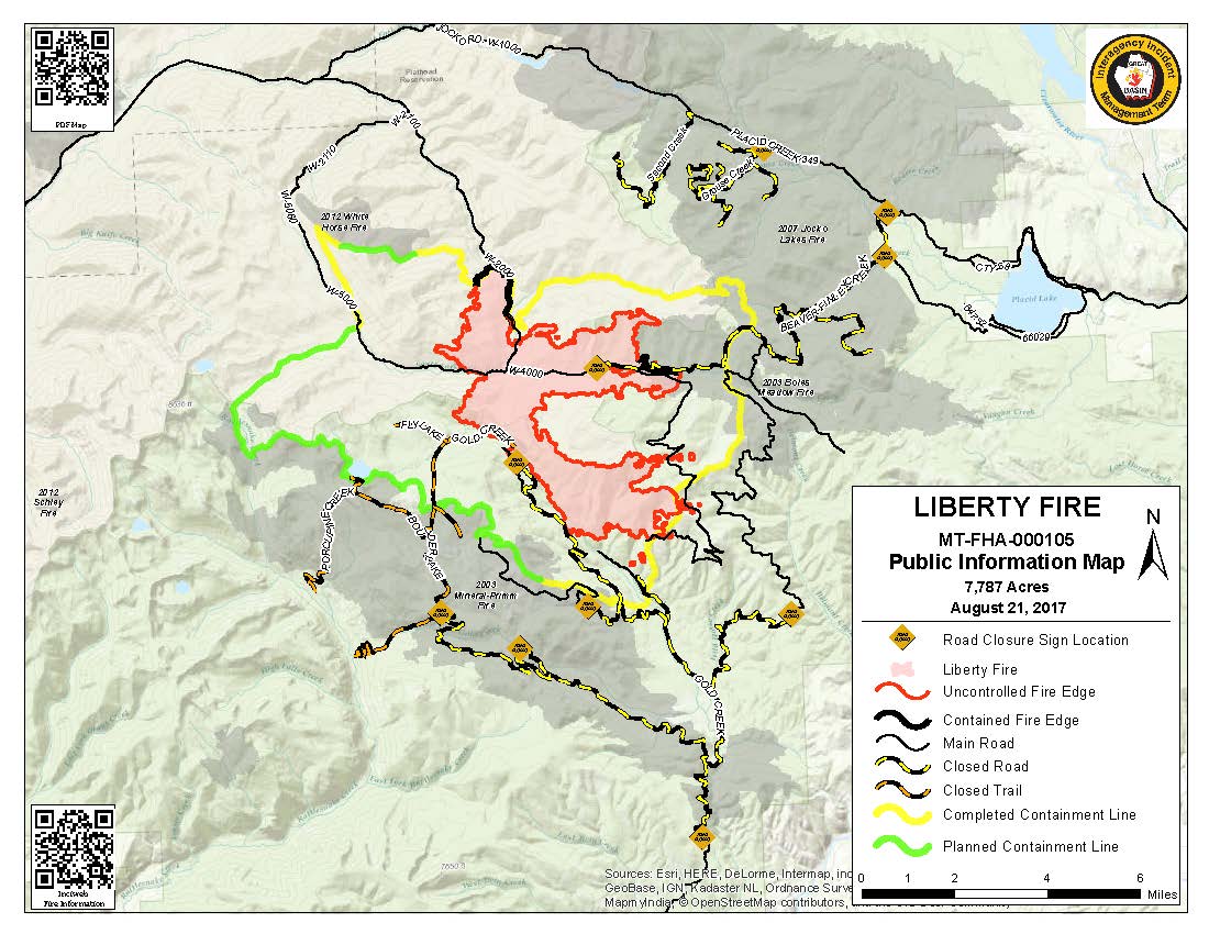
| PIO_8x11_land_20170821_0650_Liberty_MTFHA105.jpg | 2017-08-21 08:58 | 156K | ||
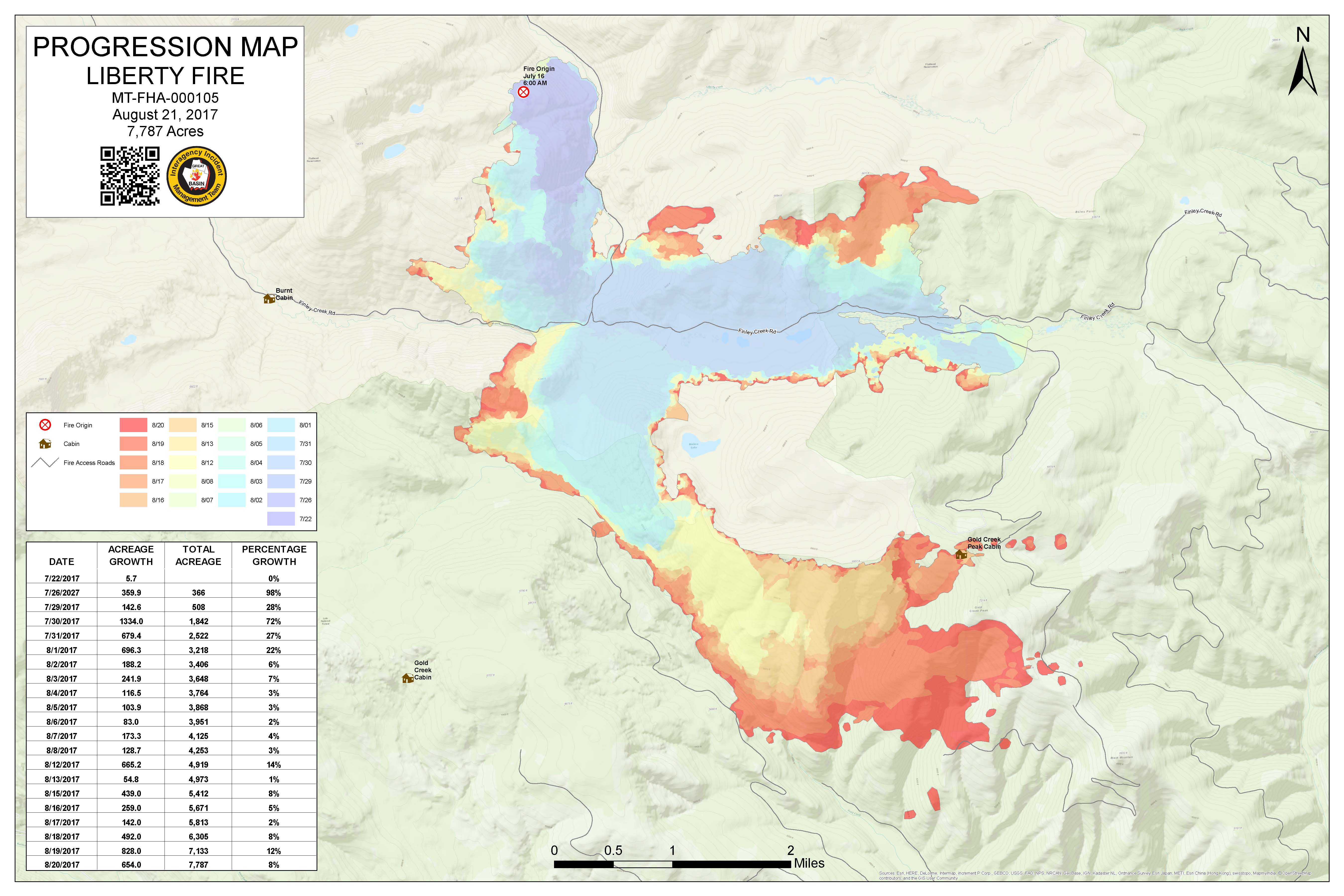
| Progression_archD_land_20170821_0755_MTFHA105.jpg | 2017-08-21 08:58 | 1.0M | ||
| Progression_archD_land_20170821_0755_MTFHA105.pdf | 2017-08-21 08:58 | 1.2M | ||
| BAM_ArchE_land_20170803_0056_Liberty_MTFHA105_0803Day.pdf | 2017-08-03 02:47 | 3.2M | ||
| PIO_11x17_land_20170803_0120_Liberty_MTFHA105_0803Day.pdf | 2017-08-03 02:49 | 3.7M | ||
| Airops_8x11_land_20170802_2230_Liberty_MTFHA105_0803Day.pdf | 2017-08-03 02:47 | 5.1M | ||
| IAP_ArchD_land_20170803_0056_Liberty_MTFHA105_0803Day.pdf | 2017-08-03 02:48 | 5.5M | ||
| Trans_11x17_land_20170803_1420_Liberty_MTFHA105_0803Day.pdf | 2017-08-07 14:22 | 7.4M | ||
| PLAN_ArchE_land_20170803_1520_Liberty_MTFHA105_0803_1800.pdf | 2017-08-07 14:22 | 20M | ||
| WFDSS_NTFB_ArchE_land_20170803_1645_Liberty_MTFHA105_0803_1800.pdf | 2017-08-07 14:20 | 59M | ||
| OPS_ArchE_land_20170802_2345_Liberty_MTFHA105_0803Day.pdf | 2017-08-03 02:58 | 73M | ||
| WFDSS_FSPro_ArchE_land_20170803_1615_Liberty_MTFHA105_0803_1800.pdf | 2017-08-07 14:18 | 74M | ||