Index of /public/incident_specific_data/n_rockies/Historic_archived NIROPS/2017_fires/2017_Liberty/GIS/Products/20170829
Name
Last modified
Size
Description
Parent Directory
-
Trans_85X11_land_20170828_1740_Liberty_MTFHA105.pdf
2017-08-29 00:16
204K
TFR_ArchE_land_20170828_2215_Liberty_MTFHA105.pdf
2017-08-29 00:16
2.5M
RepairDIVMTU_AnsiC_land_20170828_2240_Liberty_MTFHA105.pdf
2017-08-29 00:16
6.1M
RepairDIVC_AnsiC_land_20170828_2240_Liberty_MTFHA105.pdf
2017-08-29 00:15
6.0M
RepairDIVAB_AnsiC_land_20170828_2240_Liberty_MTFHA105.pdf
2017-08-29 00:14
6.8M
Progression_archD_land_20170829_0700_Liberty_MTFHA105.pdf
2017-08-29 08:15
1.2M
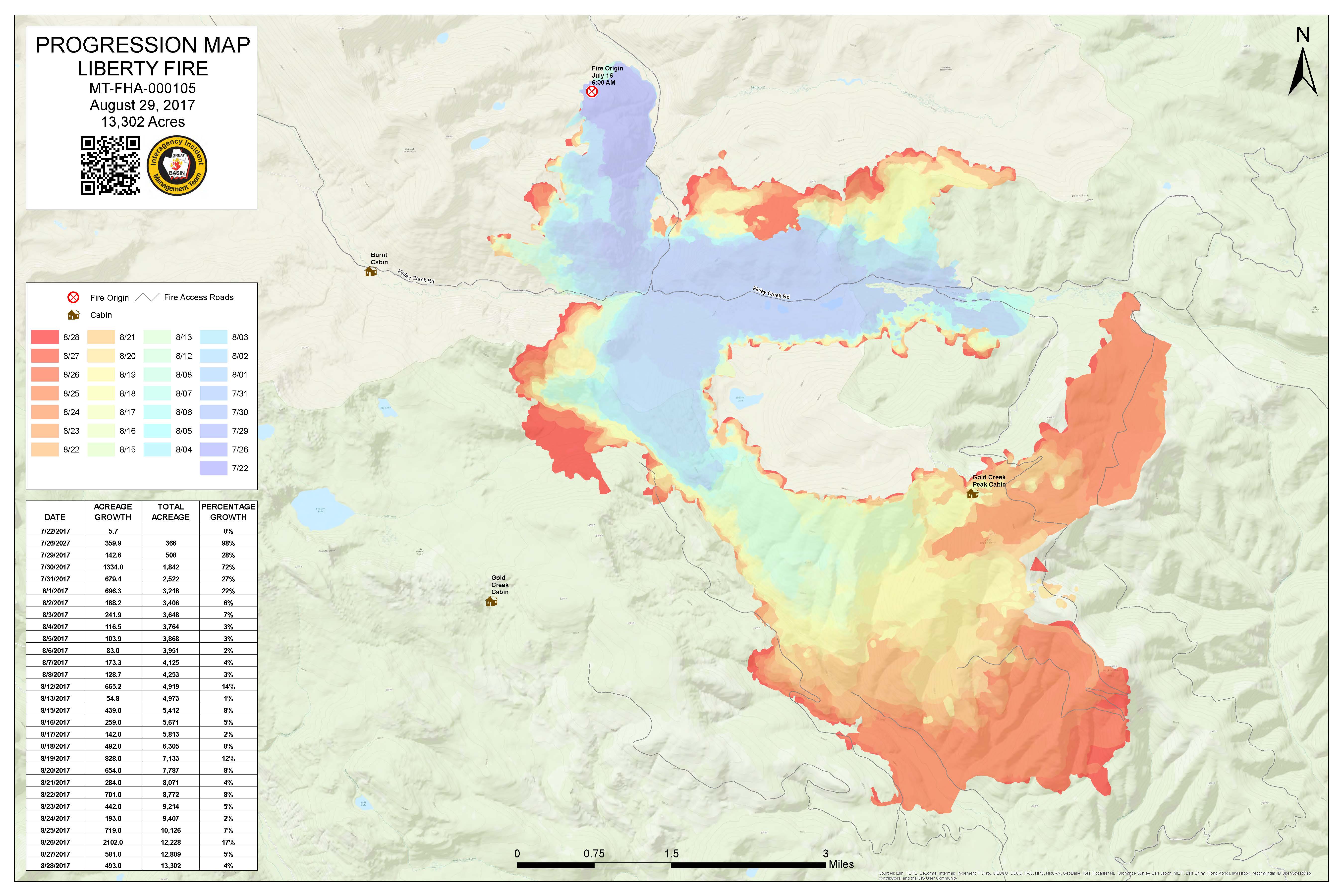
Progression_archD_land_20170829_0700_Liberty_MTFHA105.jpg
2017-08-29 08:15
1.0M
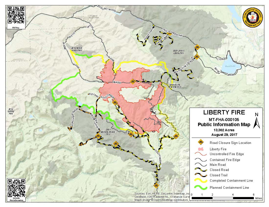
PIO_8x11_land_20170829_0708_Liberty_MTFHA105.pdf
2017-08-29 08:14
284K
PIO_8x11_land_20170829_0708_Liberty_MTFHA105.jpg
2017-08-29 08:14
147K
OPS_ArchE_land_20170828_2230_Liberty_MTFHA105.pdf
2017-08-29 00:13
3.1M
OPS_AnsiC_land_20170828_2210_Liberty_MTFHA105.pdf
2017-08-29 00:12
3.1M
IA_ArchE_land_20170828_2300_Liberty_MTFHA105.pdf
2017-08-29 00:12
4.0M
IAP_85x11_land_20170820_1730_Liberty_MTFHA105.pdf
2017-08-29 00:11
512K
DIVU_AnsiC_land_20170828_2140_Liberty_MTFHA105.pdf
2017-08-29 00:11
2.0M
DIVT_AnsiC_land_20170828_2145_Liberty_MTFHA105.pdf
2017-08-29 00:11
2.2M
DIVM_AnsiC_land_20170828_2200_Liberty_MTFHA105.pdf
2017-08-29 00:11
2.3M
BAM_ArchE_land_20170828_2220_Liberty_MTFHA105.pdf
2017-08-29 00:10
1.9M
AirOps_11x17_land_20170828_2215_Liberty_MTFHA105.pdf
2017-08-29 00:10
367K