Index of /public/incident_specific_data/n_rockies/Historic_archived NIROPS/2017_fires/2017_Liberty/GIS/Products/20170904
Name
Last modified
Size
Description
Parent Directory
-
Trans_85X11_land_20170903_1740_Liberty_MTFHA105.pdf
2017-09-03 23:12
205K
TFR_ArchE_land_20170903_2017_Liberty_MTFHA105.pdf
2017-09-03 23:12
2.5M
Repair_ArchE_land_20170903_2310_Liberty_MTFHA105.pdf
2017-09-04 00:12
4.6M
RepairDIVMTU_AnsiC_land_20170903_2000_Liberty_MTFHA105.pdf
2017-09-03 23:12
2.3M
RepairDIVC_AnsiC_land_20170903_2000_Liberty_MTFHA105.pdf
2017-09-03 23:11
2.3M
RepairDIVAB_AnsiC_land_20170903_2000_Liberty_MTFHA105.pdf
2017-09-03 23:11
2.4M
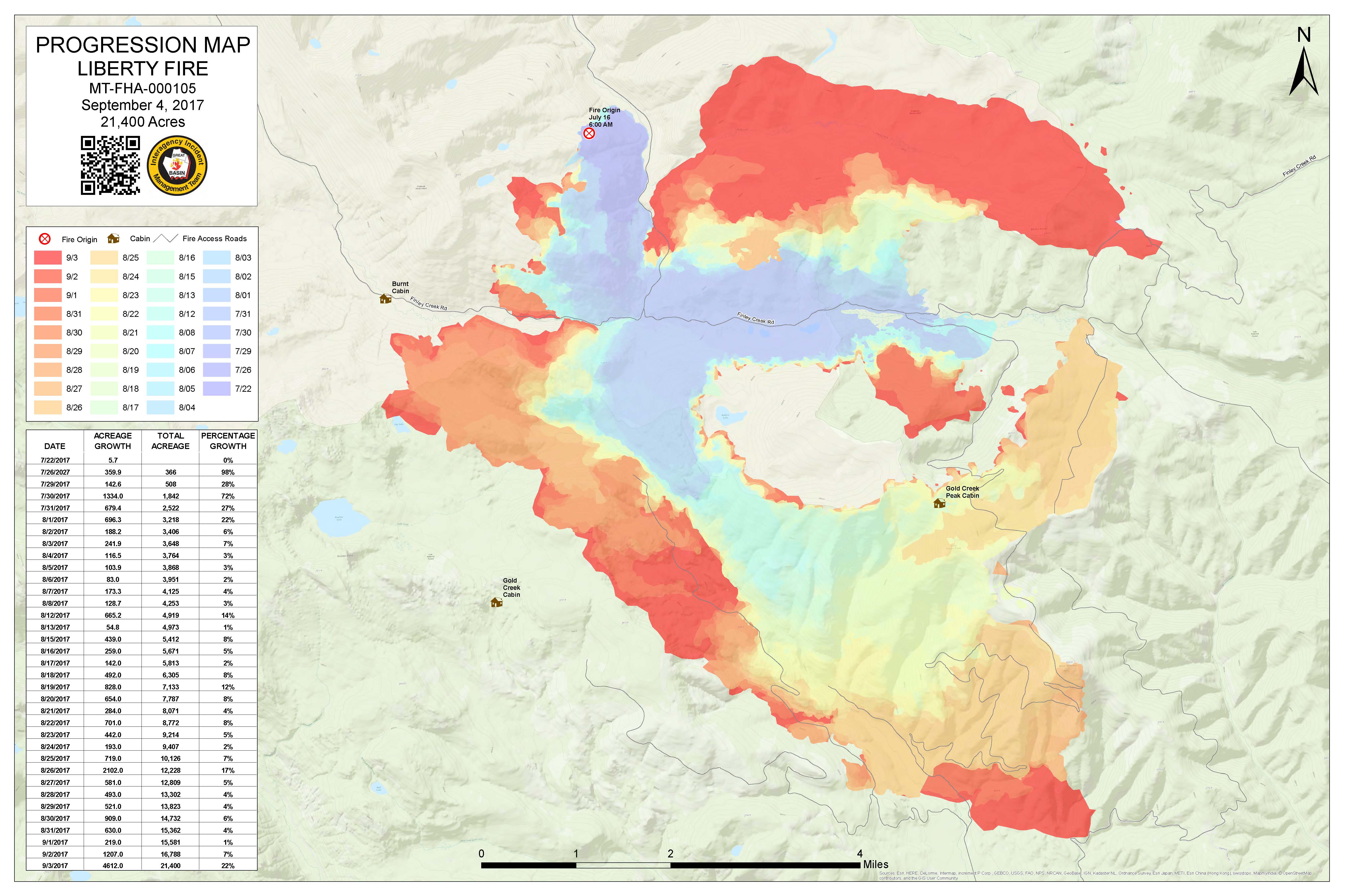
Progression_archD_land_20170904_0635_Liberty_MTFHA105.pdf
2017-09-04 08:09
1.3M
Progression_archD_land_20170904_0635_Liberty_MTFHA105.jpg
2017-09-04 08:09
1.0M
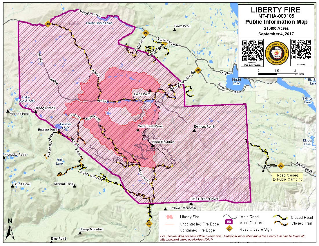
PIO_8x11_land_20170904_0650_Liberty_MTFHA105.pdf
2017-09-04 08:09
386K
PIO_8x11_land_20170904_0650_Liberty_MTFHA105.jpg
2017-09-04 08:09
272K
OPS_ArchE_land_20170903_2150_Liberty_MTFHA105.pdf
2017-09-03 23:10
3.0M
OPS_AnsiC_land_20170903_2150_Liberty_MTFHA105.pdf
2017-09-03 23:10
3.6M
IAP_85x11_land_20170903_1740_Liberty_MTFHA105.pdf
2017-09-03 23:09
518K
DIVU_AnsiC_land_20170903_2000_Liberty_MTFHA105.pdf
2017-09-03 23:09
2.0M
DIVT_AnsiC_land_20170903_2000_Liberty_MTFHA105.pdf
2017-09-03 23:09
911K
DIVM_AnsiC_land_20170903_2000_Liberty_MTFHA105.pdf
2017-09-03 23:09
921K
DIVC_AnsiC_land_20170903_2000_Liberty_MTFHA105.pdf
2017-09-03 23:08
2.1M
DIVAB_AnsiC_land_20170903_2310_Liberty_MTFHA105.pdf
2017-09-04 00:11
897K
BAM_ArchE_land_20170903_2150_Liberty_MTFHA105.pdf
2017-09-03 23:08
1.9M
AirOps_11x17_land_20170903_2145_Liberty_MTFHA105.pdf
2017-09-03 23:08
368K