| Name | Last modified | Size | Description | |
|---|---|---|---|---|
| Parent Directory | - | |||
| 20130820_HouseCreek_IAP_11x17.pdf | 2013-08-20 11:23 | 745K | ||
| VinegarBrief.pdf | 2013-08-20 11:24 | 756K | ||
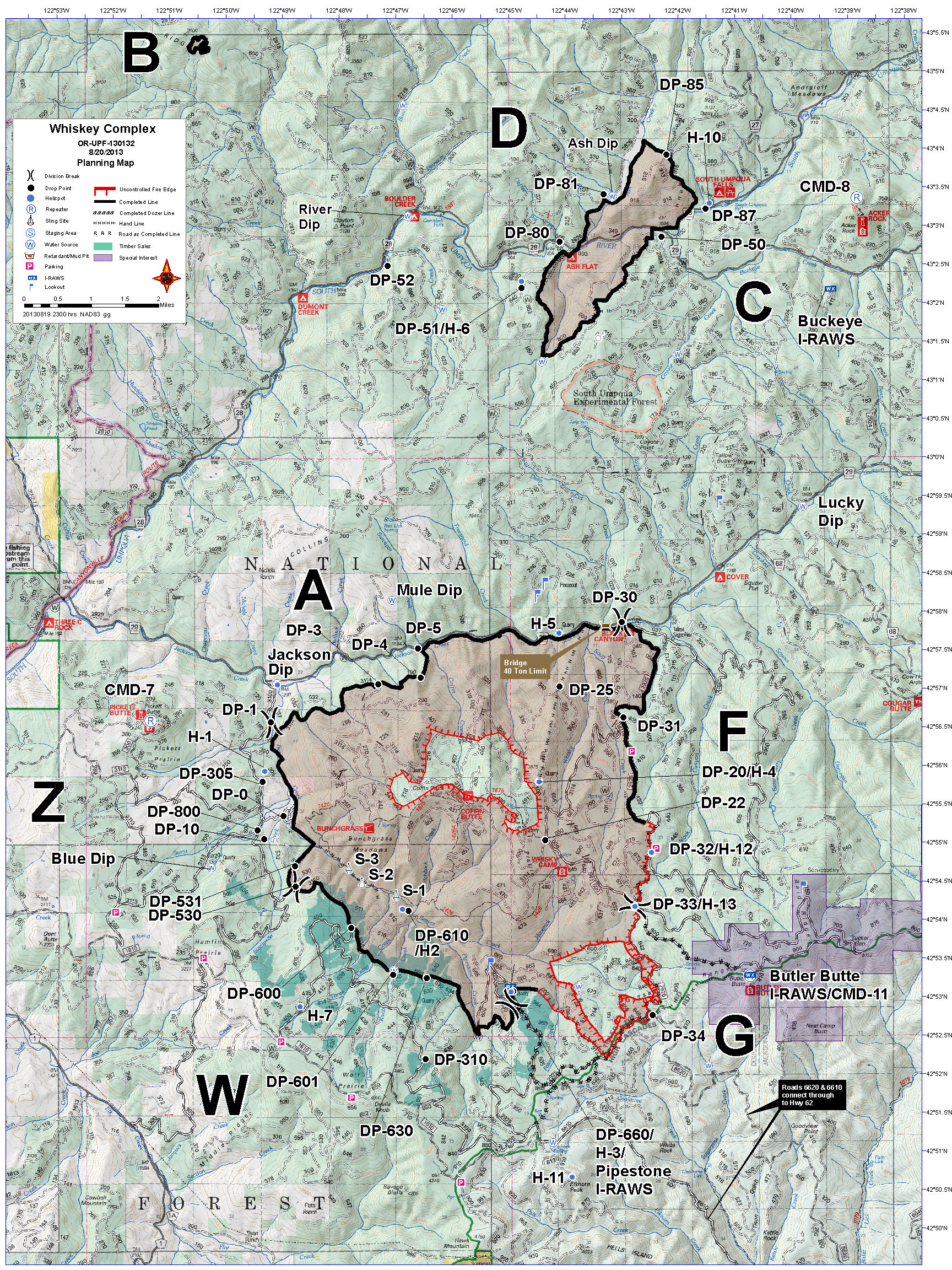
| Planning_11X17_port_20130820_WhiskeyComplex_OR-UPF-130132.jpg | 2013-08-20 11:24 | 1.7M | ||
| brief_11x17_land_20130819_0119_Govt_Flat_Cpx_OR954S0022_0819day.pdf | 2013-08-20 11:23 | 1.9M | ||
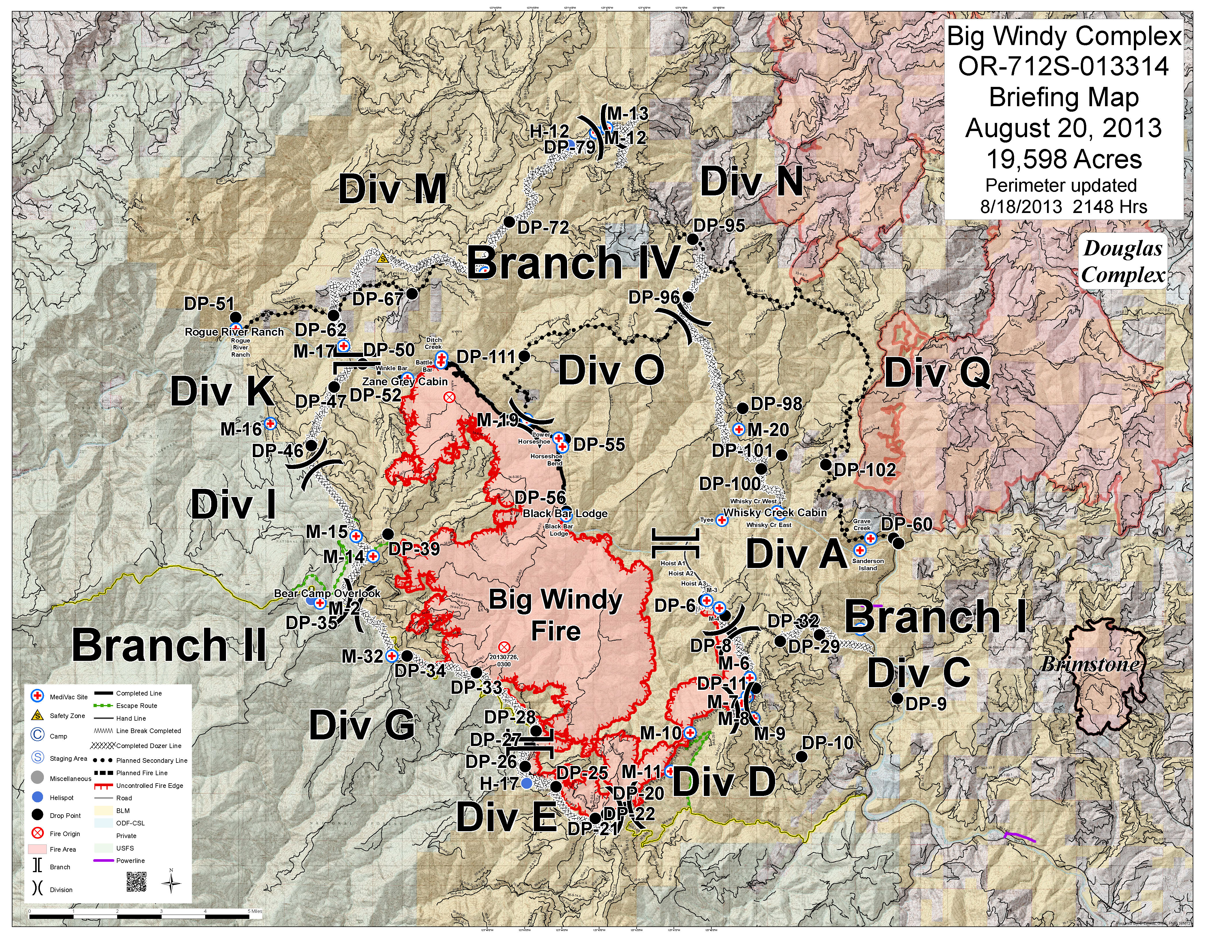
| briefing_e_land_20130819_BigWindy_OR712S013314Opti.jpg | 2013-08-20 11:24 | 5.0M | ||
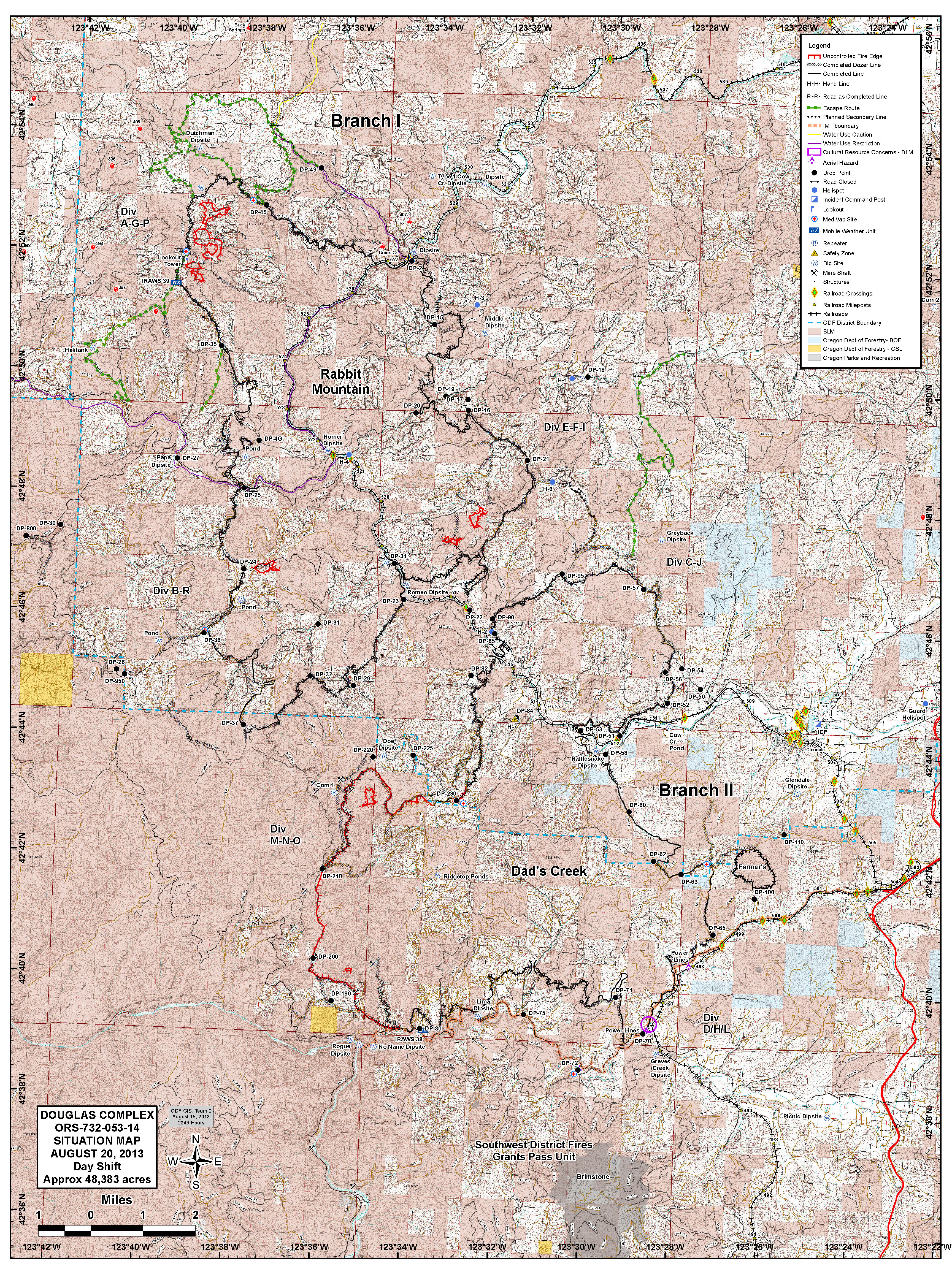
| Sit_ArcE_port_20130819_2248_DouglasComplex_20130820_Day.jpg | 2013-08-20 11:24 | 8.9M | ||