| Name | Last modified | Size | Description | |
|---|---|---|---|---|
| Parent Directory | - | |||
| Sherwood_topo_ortho_36x36_land_20170817_OR_CLP_0004531.jpg | 2017-08-22 23:26 | 608K | ||
| pilot_11x17_port_2017_SpruceLake_OR_CLP_0004531.pdf | 2017-08-22 23:26 | 3.3M | ||
| iap_pg2_11x17_land_2017_SpruceLake_OR_CLP_0004531.pdf | 2017-08-22 23:26 | 591K | ||
| iap_pg1_11x17_land_2017_SpruceLake_OR_CLP_0004531.pdf | 2017-08-22 23:26 | 577K | ||
| divsup_topo_11x17_land_20170823_SpruceLake_OR_CLP_0004531.pdf | 2017-08-22 23:26 | 810K | ||
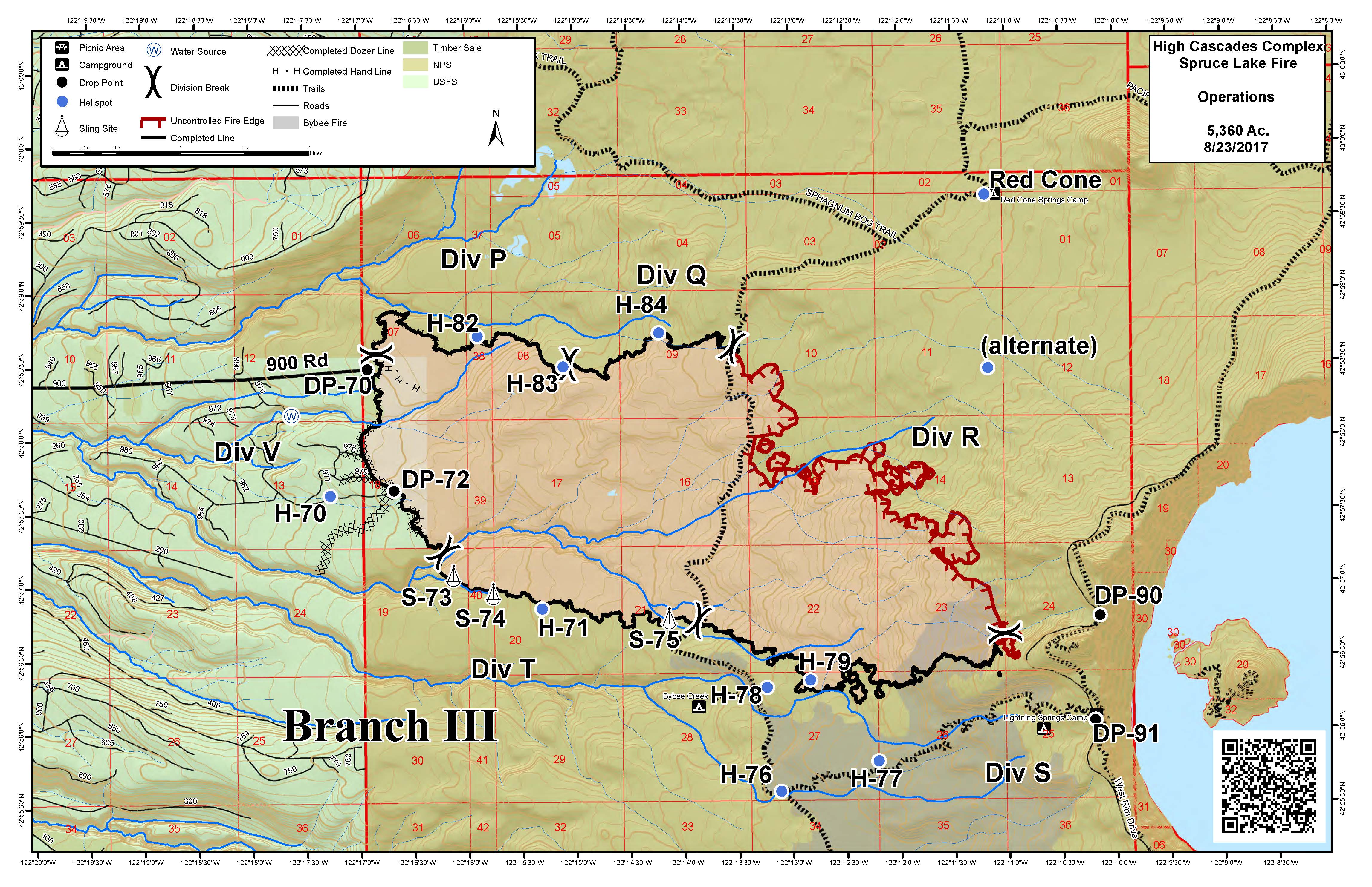
| divsup_topo_11x17_land_20170823_SpruceLake_OR_CLP_0004531.jpg | 2017-08-22 23:26 | 1.4M | ||
| Sherwood_topo_ortho_36x36_land_20170817_OR_CLP_0004531.pdf | 2017-08-22 23:26 | 3.9M | ||
| BrokenLookout_topo_ortho_36x36_land_20170823_OR_CLP_0004531.pdf | 2017-08-22 23:26 | 2.1M | ||