| Name | Last modified | Size | Description | |
|---|---|---|---|---|
| Parent Directory | - | |||
| AirOps_ArchE_20210918_2125_Post_NENES210875_0919day.pdf | 2021-09-19 00:03 | 6.4M | ||
| Operations_ArchE_20210918_2116_Post_NENES210875_0919day.pdf | 2021-09-19 00:06 | 12M | ||
| OperationsImagery_11x17_20210918_2213_Post_NENES210875_0919day.pdf | 2021-09-19 00:12 | 9.1M | ||
| OperationsTopo_11x17_20210918_2228_Post_NENES210875_0919day.pdf | 2021-09-19 00:14 | 8.6M | ||
| Transportation_8x11_20210918_2106_Post_NENES120875_0919day.pdf | 2021-09-19 00:20 | 1.2M | ||
| PublicInformation_8x11_20210919_0911_PostFire_NENES210875.pdf | 2021-09-19 21:32 | 1.2M | ||
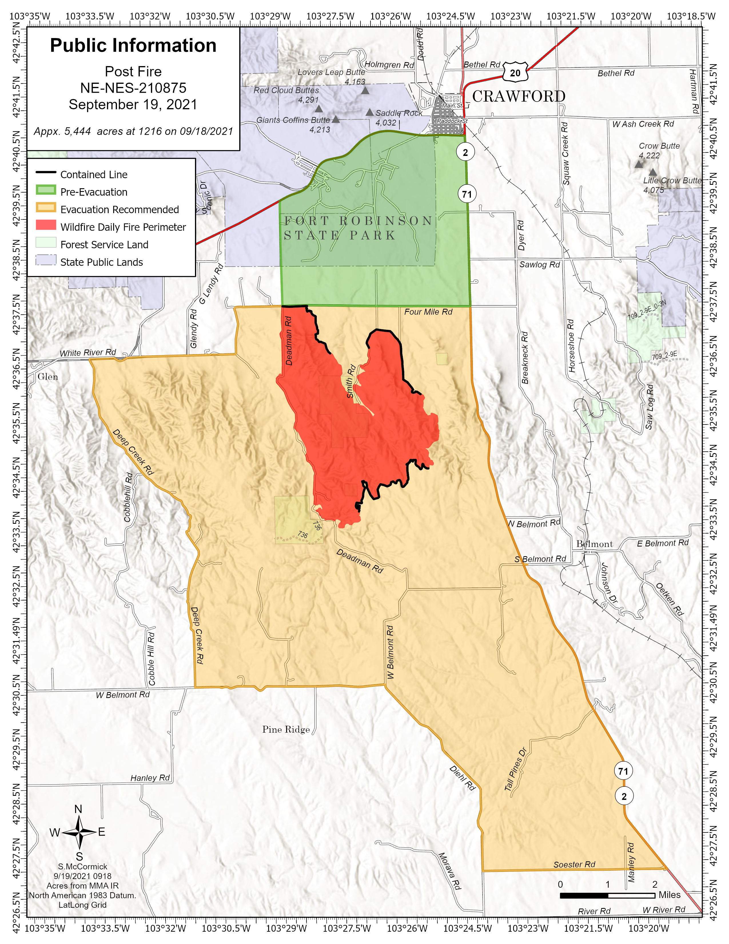
| PublicInformation_20210919_0911_PostFire_NENES210875.jpg | 2021-09-19 21:32 | 1.1M | ||