Index of /public/incident_specific_data/calif_n/2019_FEDERAL_Incidents/CA-SHF-001209_South/GIS/Products/20190920
Name
Last modified
Size
Description
Parent Directory
-
AirOps_arch_e_land_20190919_1950_South_CASHF1209_0920day.pdf
2019-09-19 23:28
7.7M
AirOps_arch_e_land_20190919_1950_South_CASHF1209_0920day_Linked.pdf
2019-09-20 08:25
4.4M
Briefing_arch_e_land_20190919_2100_South_CASHF1209_0920day.pdf
2019-09-19 23:42
6.7M
Progression_arch_e_land_20190919_2100_South_CASHF1209_0920day.pdf
2019-09-19 23:43
3.8M
Transportation_arch_e_land_20190919_2040_South_CASHF1209.pdf
2019-09-19 23:29
2.2M
iap_11x17_land_20190919_1949_South_CASHF1209_0920.pdf
2019-09-19 23:29
13M
operations_arch_e_land_20190919_1933_South_CASHF1209_0920.pdf
2019-09-19 22:16
6.0M
pilot_map_11x17_land_20190919_1950_South_CASHF1209_0920day.pdf
2019-09-19 23:28
1.3M
pilot_map_11x17_land_20190919_1950_South_CASHF1209_0920day_Linked.pdf
2019-09-20 08:25
517K
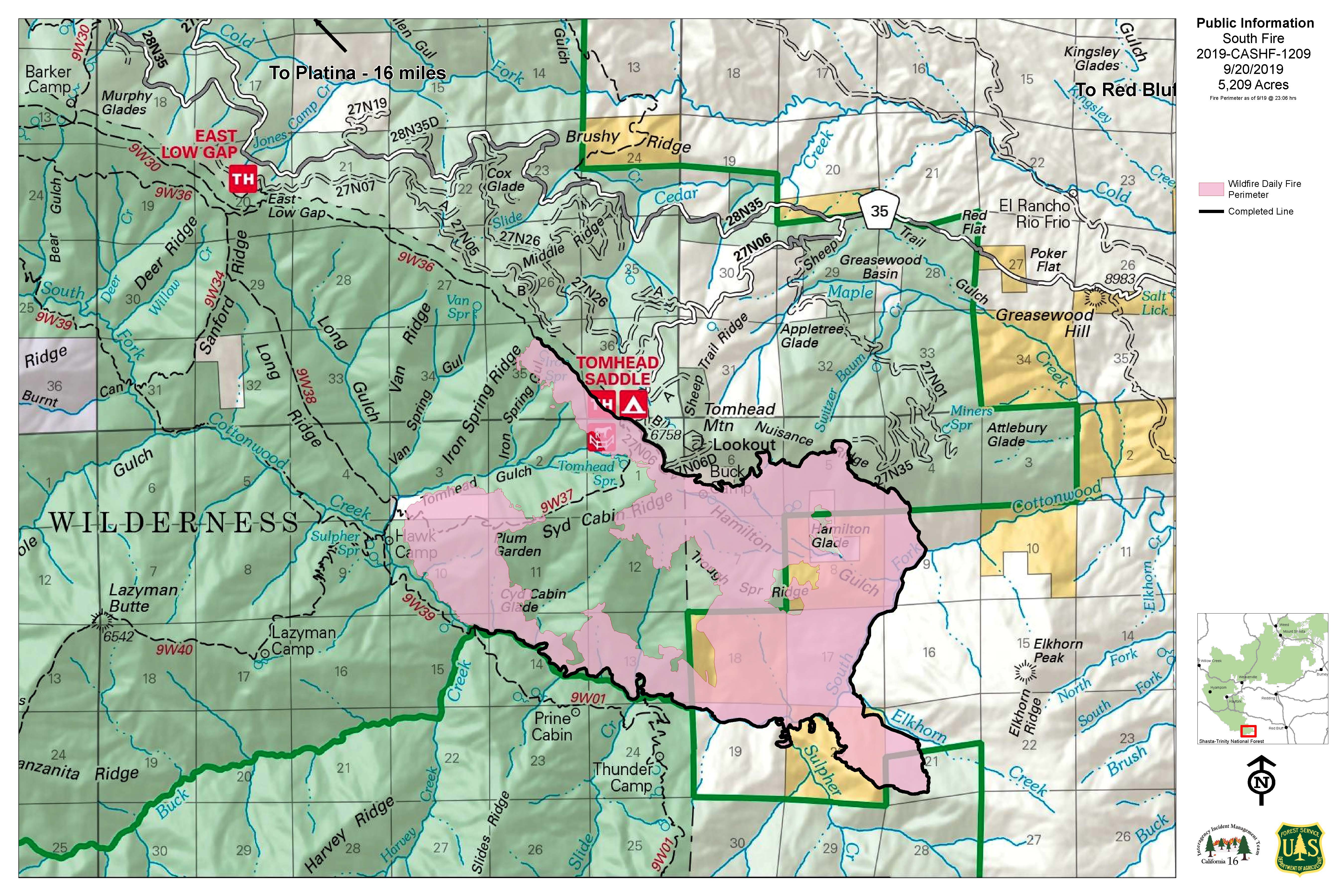
pio_arch_d_land_20190920_0755_South_CASHF1209_0920day.jpg
2019-09-20 09:58
1.6M
pio_arch_d_land_20190920_0755_South_CASHF1209_0920day.pdf
2019-09-20 09:58
3.2M
repair_arch_e_land_20190919_2028_South_CASHF001209_0920_day.pdf
2019-09-19 23:29
19M
trans_tiles_11x17_port_20190919_1951_South_CASHF1209_0920.pdf
2019-09-19 23:29
2.9M