Index of /public/incident_specific_data/calif_n/2020_FEDERAL_Incidents/CA-ANF-003289_Ranch2/CA-PNF-001308_PNF_North_Complex/QR_Maps
Name
Last modified
Size
Description
Parent Directory
-
PilotMap_Table_20200907.pdf
2020-09-07 06:00
94K
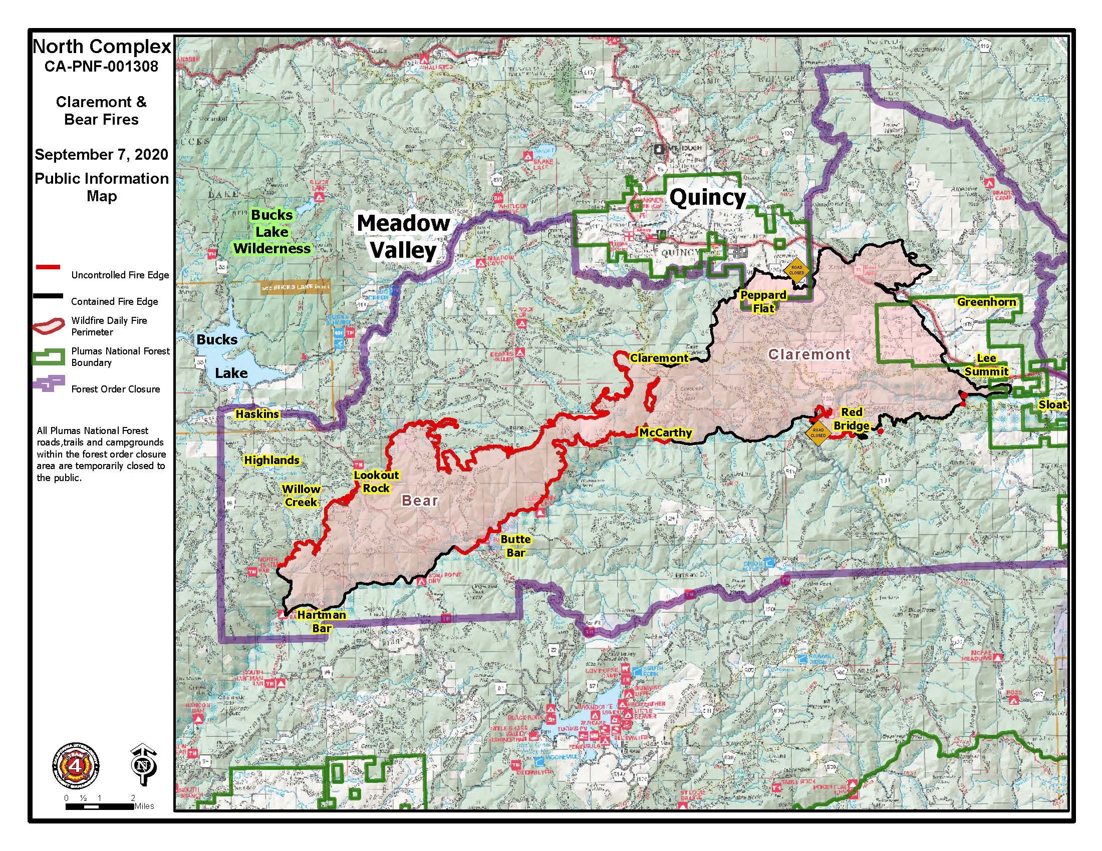
PIO_8x11_land_20200907_0056_North Complex_CA-PNF001308_0907day.jpg
2020-09-07 06:00
603K
PIO_8x11_land_20200907_0056_North Complex_CA-PNF001308_0907day.pdf
2020-09-07 05:29
5.0M
Transportation_11x17_land_20200907_0035_NorthComplex_CAPNF1308_0907day.pdf
2020-09-07 05:31
8.1M
PIO_11x17_land_20200907_0049_North Complex_CA-PNF001308_0907day.pdf
2020-09-07 05:29
10M
OPS_BranchVII_archE_land_20200907_0100_NorthComplex_CAPNF1308_0907Day.pdf
2020-09-07 05:29
13M
OPS_BranchX_archE_land_20200907_0100_NorthComplex_CAPNF1308_0907Day.pdf
2020-09-07 05:29
15M
OPS_BranchII_archE_land_20200907_0100_NorthComplex_CAPNF1308_0907Day.pdf
2020-09-07 05:29
16M
pilot_11x17_land_20200907_0353_North Complex_CA-PNF001308_0907day.pdf
2020-09-07 06:01
23M
OPS_archE_land_20200907_0100_NorthComplex_CAPNF1308_0907Day.pdf
2020-09-07 05:28
25M
PIO_D_land_20200907_0049_North Complex_CA-PNF001308_0907day.pdf
2020-09-07 05:31
41M
airops_arch_e_land_20200907_0145_North Complex_CA-PNF001308_0907day.pdf
2020-09-07 05:33
185M