Index of /public/incident_specific_data/calif_n/2021_FEDERAL_Incidents/CA-SRF-651_McCash/GIS/Products/20210813
Name
Last modified
Size
Description
Parent Directory
-
prog_fuels_arch_e_land_20210812_1958_McCash_CASRF000651_0813day_geo.pdf
2021-08-13 19:44
4.5M
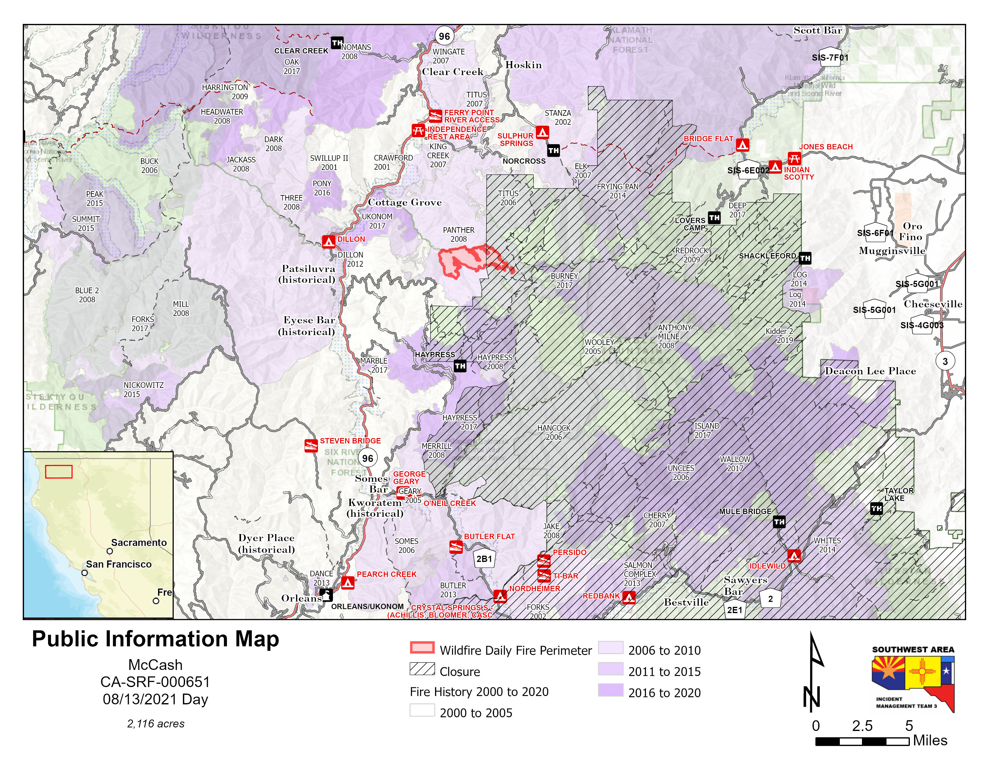
pio_85x11_land_20210813_0748_McCash_CASRF000651_0813day.jpg
2021-08-13 10:07
1.7M
pio_85x11_land_20210813_07461_McCash_CASRF000651_0813day.pdf
2021-08-13 10:07
3.0M
pilot_table_only_11x17_land_20210812_2233_McCash_CASRF000651_0813day.pdf
2021-08-13 01:03
656K
pilot_map_only_11x17_port_20210812_2225_McCash_CASRF000651_0813day.pdf
2021-08-13 00:43
5.6M
ops_structures_topo_arch_e_port_20210812_2220_McCash_CASRF000651_0813day_geo.pdf
2021-08-13 00:43
6.1M
ops_structures_imagery_arch_e_port_20210812_2208_McCash_CASRF000651_0813day_geo.pdf
2021-08-13 00:44
5.7M
ops_E_land_20210813_0354_McCash_CASRF651_0813day_geo.pdf
2021-08-13 06:01
19M
med_ground_arch_e_port_20210812_2203_McCash_CASRF000651_0813day_geo.pdf
2021-08-13 01:04
4.3M
briefing_arch_e_land_20210813_0411_McCash_CASRF000651_0813day.pdf
2021-08-13 06:16
8.2M
air_ops_arch_e_land_20210812_2254_McCash_CASRF000651_0813day.pdf
2021-08-13 01:13
26M