Index of /public/incident_specific_data/calif_n/Historic/2006/2006_UnclesComplex/GIS/PRODUCTS/20060910
Name
Last modified
Size
Description
Parent Directory
-
Info_UnclesCmplx_20060910_ANSI_E_Landscp_20060909_1830.pdf
2016-06-08 10:39
73M
FieldMap_20060910_UnclesComplex.pdf
2016-06-08 10:37
17M
Progression_Map_20060910_UnclesComplex.pdf
2016-06-08 10:39
13M
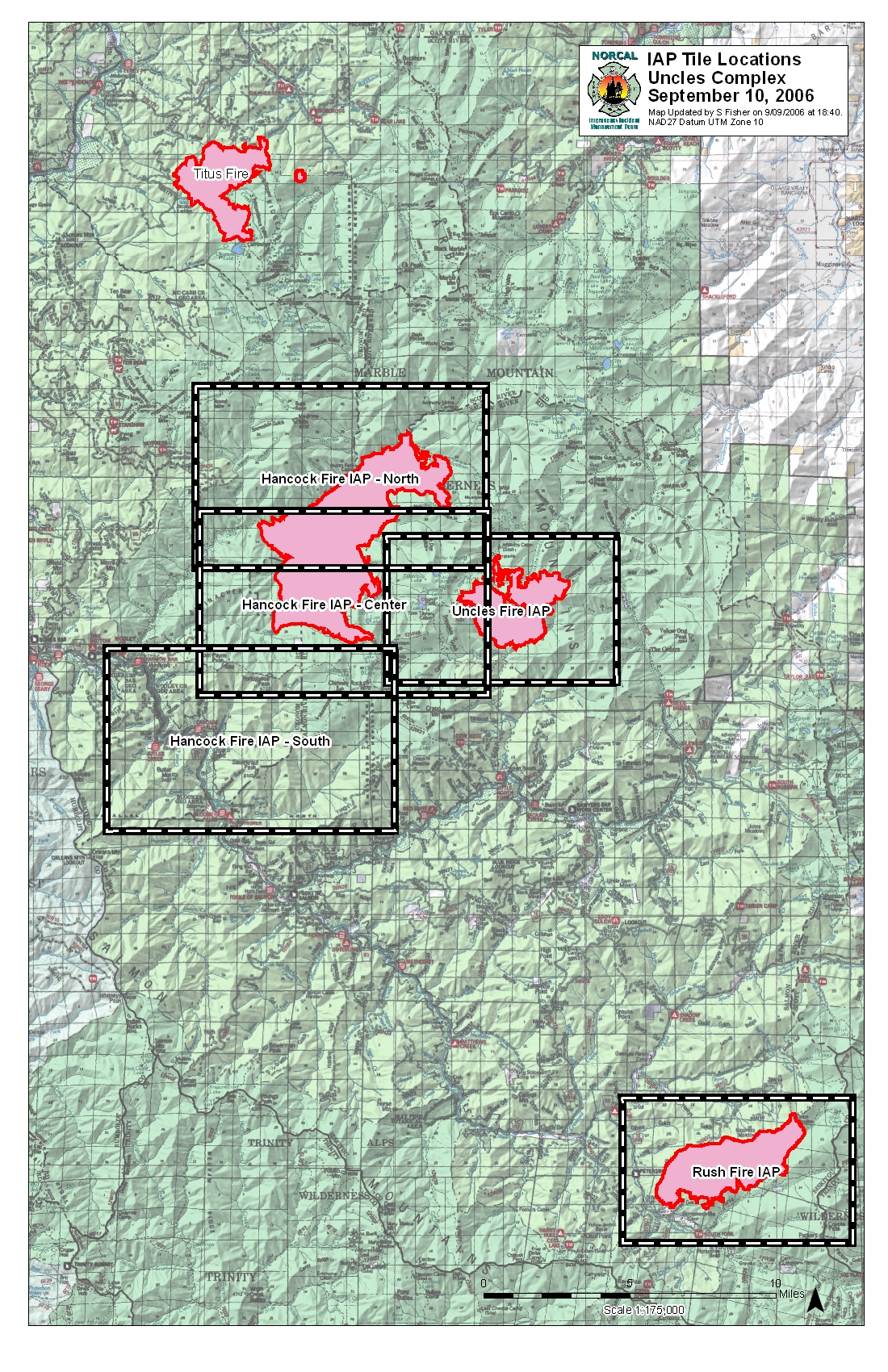
Uncles_Complex_IAP_Tiles_20060910Day_11x17_Portrt_20060909_1840.pdf
2016-06-08 10:39
9.1M
Uncles_Complex_Titus_Info_20060910_11x17_Portrt_20060909_1915.pdf
2016-06-08 10:39
9.1M
PilotMap_20060910_UnclesComplex_.pdf
2016-06-08 10:39
5.4M
Info_UnclesCmplx_20060910_ANSI_E_Landscp_20060909_1830_LoRes.jpg
2016-06-08 10:39
3.4M
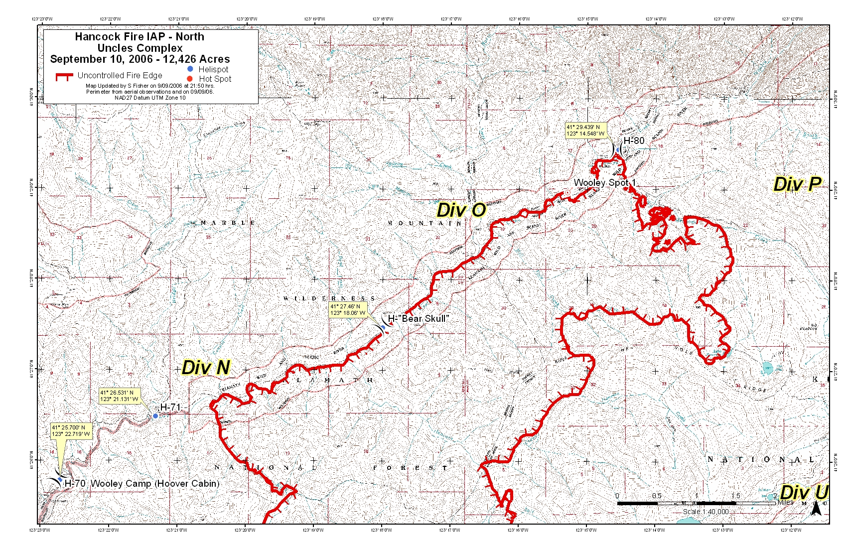
Hancock_IAP_North_20060910Day_11x17_Landscp_20060909_2140_LoRes.jpg
2016-06-08 10:38
2.6M
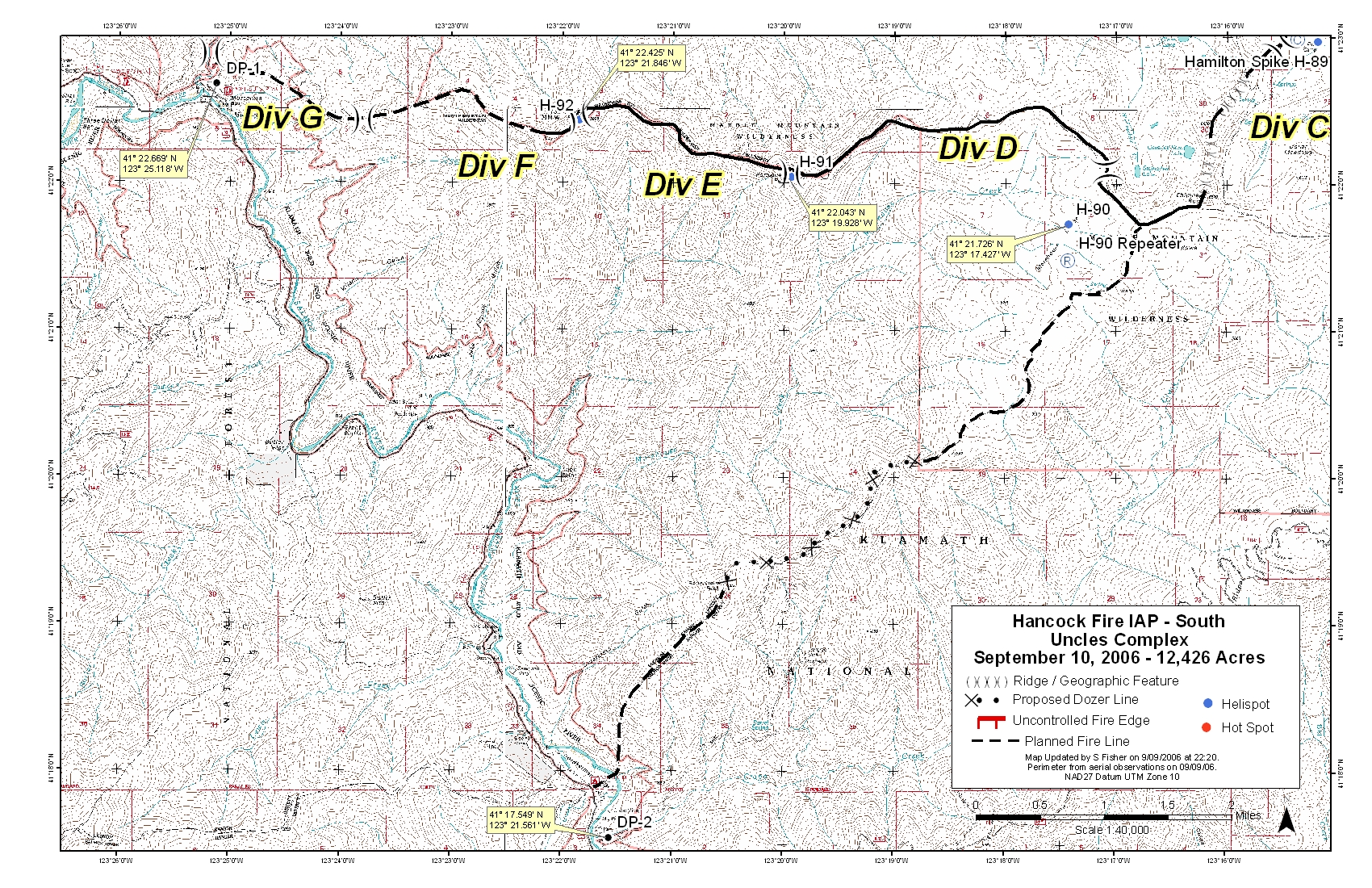
Hancock_IAP_South_20060910Day_11x17_Landscp_20060909_2220_LoRes.jpg
2016-06-08 10:38
2.6M
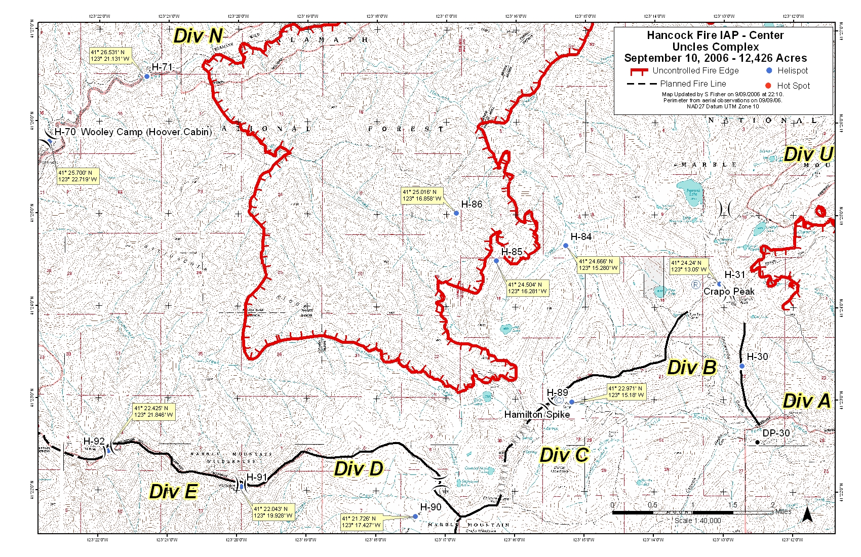
Hancock_IAP_Center_20060910Day_11x17_Landscp_20060909_2155_LoRes.jpg
2016-06-08 10:38
2.6M
Uncles_IAP_20060910Day_11x17_Lndscp_20060909_2120_LoRes.jpg
2016-06-08 10:40
2.5M
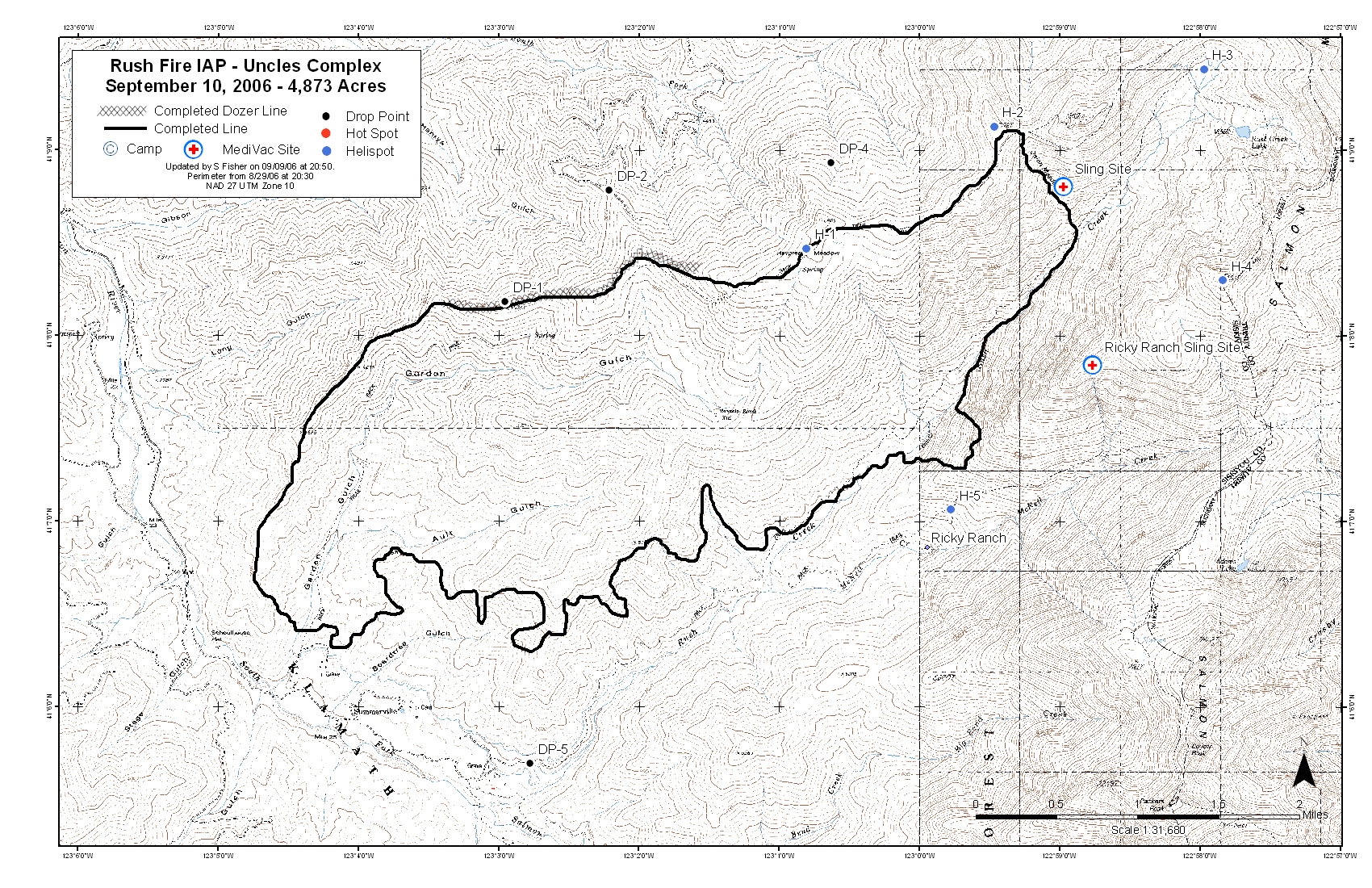
Rush_IAP_20060910Day_11x17_Landscp_20060909_2050_LoRes.jpg
2016-06-08 10:39
2.4M
Uncles_Complex_IAP_Tiles_20060910Day_11x17_Portrt_20060909_1840_LoRes.jpg
2016-06-08 10:39
1.9M
Uncles_Complex_Titus_Info_20060910_11x17_Portrt_20060909_1915_LoRes.jpg
2016-06-08 10:39
1.9M
Rush_IAP_20060910Day_11x17_Landscp_20060909_2050.pdf
2016-06-08 10:39
1.9M
Hancock_IAP_South_20060910Day_11x17_Landscp_20060909_2220.pdf
2016-06-08 10:38
1.8M
Hancock_IAP_North_20060910Day_11x17_Landscp_20060909_2140.pdf
2016-06-08 10:38
1.8M
Hancock_IAP_Center_20060910Day_11x17_Landscp_20060909_2155.pdf
2016-06-08 10:38
1.7M
Uncles_IAP_20060910Day_11x17_Lndscp_20060909_2120.pdf
2016-06-08 10:40
1.5M