| Name | Last modified | Size | Description | |
|---|---|---|---|---|
| Parent Directory | - | |||
| BRIEF_ArchE_land_20180729_0020_Cranston_CABDF11390_0729Day.pdf | 2018-07-29 02:40 | 28M | ||
| PIO_Forest_Closure_Area_2018_2000_Cranston_CABDF11390_0729Day.pdf | 2018-07-29 00:30 | 961K | ||
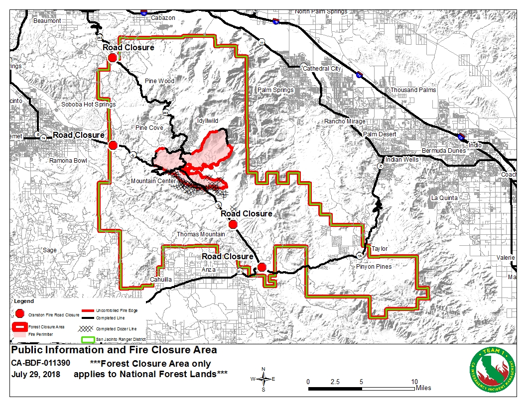
| PIO_Forest_Closure_Area_2018_2000_Cranston_CABDF11390_0729Day.jpg | 2018-07-29 00:30 | 879K | ||
| OPS_DPA_ArchE_land_20180728_2125_Cranston_CABDF11390_0729Day.pdf | 2018-07-29 00:28 | 6.6M | ||
| Pilots_11x17_Land_20180728_Cranston_CABDF01139.pdf | 2018-07-29 00:28 | 815K | ||
| Airops_TFR_11x17_land_20180728_Cranston_CABDR011390.pdf | 2018-07-29 00:28 | 1.1M | ||
| iap_MP_All_11x17_land_20180728_2054_Cranston_CABDF11390.pdf | 2018-07-28 23:33 | 5.6M | ||