| Name | Last modified | Size | Description | |
|---|---|---|---|---|
| Parent Directory | - | |||
| ops_ansi_e_land_20230819_2055_BowlesCreek_MTBDF006210_0820day.pdf | 2023-08-19 22:57 | 6.7M | ||
| pio_ansi_e_land_20230819_2134_BowlesCreek_MTBDF006210_0820day.pdf | 2023-08-19 22:57 | 2.9M | ||
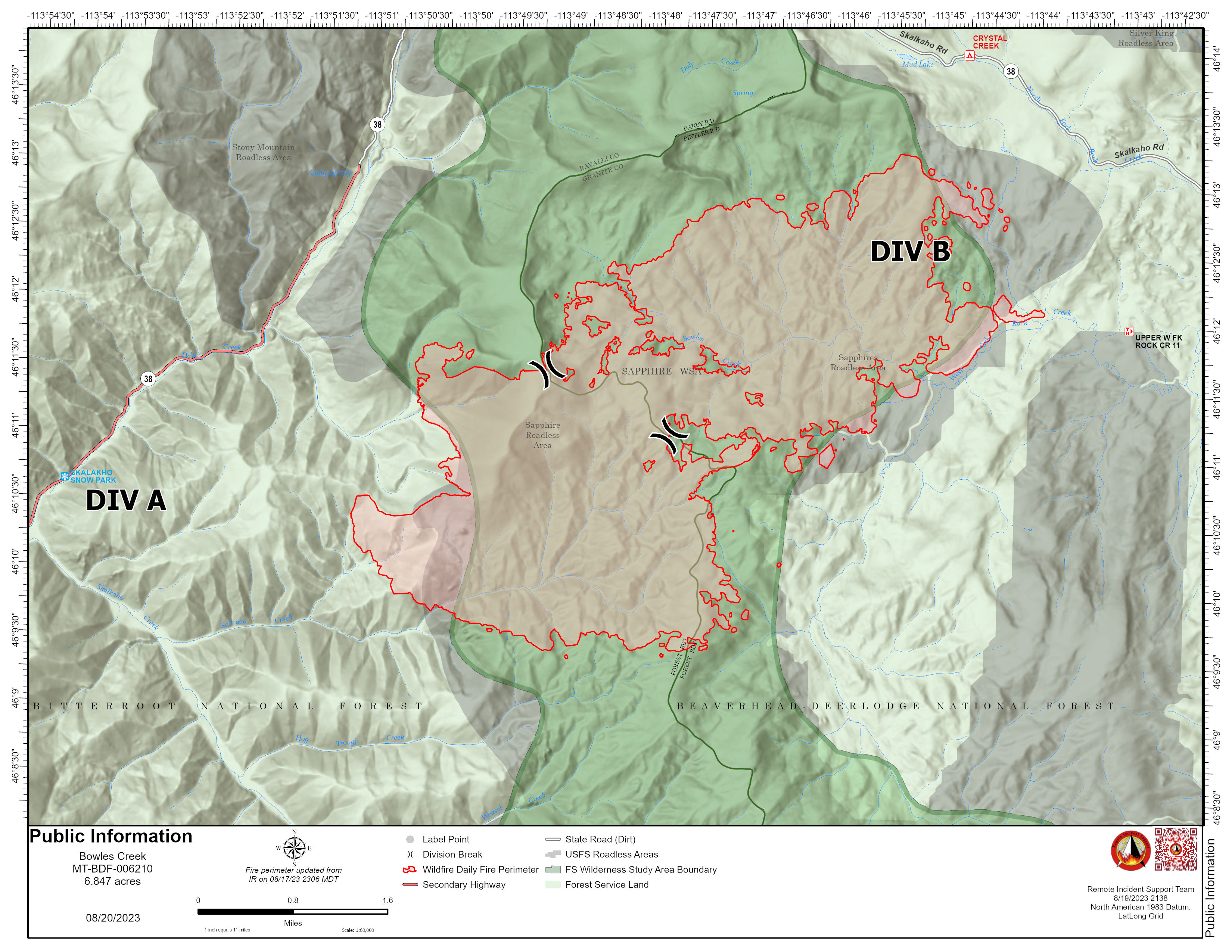
| pio_8x11_land_20230819_2138_BowlesCreek_MTBDF006210_0820day.pdf.jpg | 2023-08-19 22:57 | 1.2M | ||
| pio_8x11_land_20230819_2131_BowlesCreek_MTBDF006210_0820day.pdf | 2023-08-19 22:57 | 233K | ||
| brief_ansi_e_land_20230819_2050_BowlesCreek_MTBDF006210_0820day.pdf | 2023-08-19 22:56 | 7.3M | ||
| div_b_ops_ansi_e_land_20230819_2055_BowlesCreek_MTBDF006210_0820day.pdf | 2023-08-19 22:55 | 8.8M | ||
| div_a_ops_ansi_e_land_20230819_2055_BowlesCreek_MTBDF006210_0820day.pdf | 2023-08-19 22:54 | 8.8M | ||
| iap_8x11_land_20230819_1612_BowlesCreek_MTBDF006210_0820.pdf | 2023-08-19 17:31 | 507K | ||
| trans_8x11_land_20230819_1624_BowlesCreek_MTBDF006210_0820day.pdf | 2023-08-19 17:31 | 228K | ||