Index of /public/incident_specific_data/n_rockies/Historic_archived NIROPS/2014_fires/JohnsonBar/GIS/products/20140809
Name
Last modified
Size
Description
Parent Directory
-
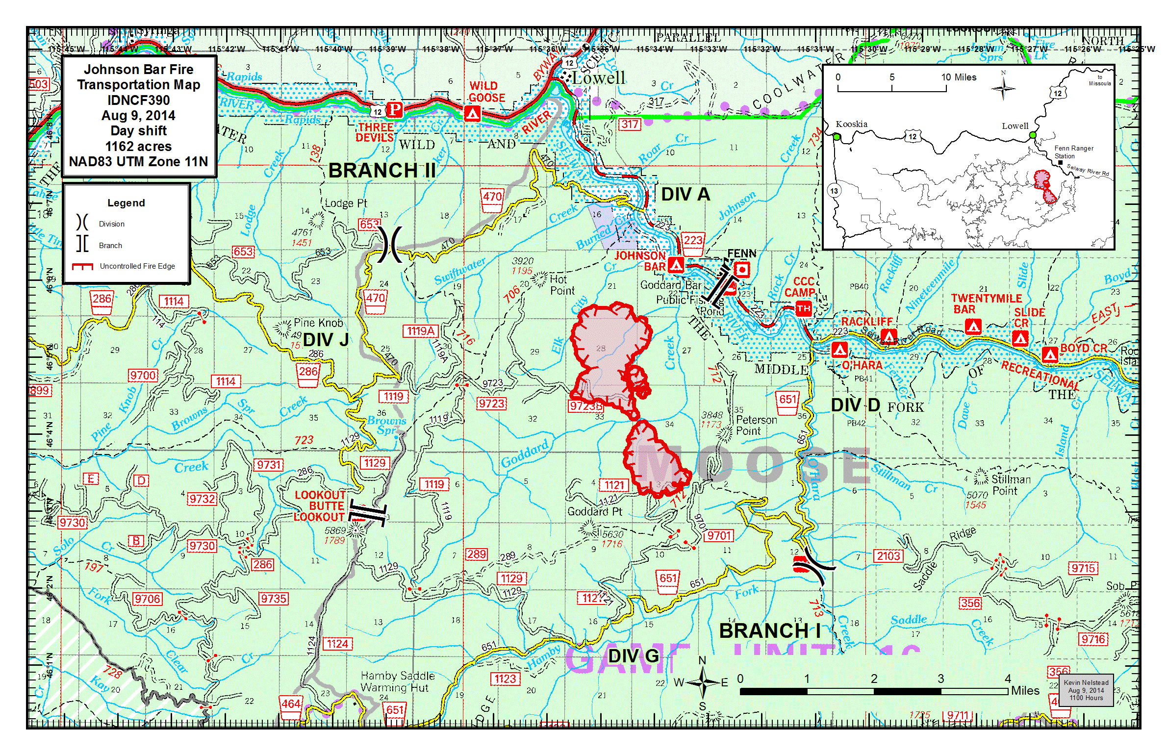
transp_11x17_land_2014_JohnsonBar_IDNCF390_FIMT100011.gif
2023-11-16 12:48
862K
transp_11x17_land_20140809_2015_JohnsonBar_0810day.pdf
2023-11-16 12:48
1.6M
transp_11x17_land_20140809_1645_JohnsonBar_0809day.pdf
2023-11-16 12:48
1.5M
PIO_8x11_port_20140809_1529_JohnsonBar_0809night.pdf
2023-11-16 12:48
1.0M
PIO_8x11_port_20140809_1122_JohnsonBar_0809night.pdf
2023-11-16 12:48
1.2M
ownership_south_33x44_land_2014_JohnsonBar_IDNCF390.pdf
2023-11-16 12:48
23M
ownership_north_22x34_land_20140809_1639_JohnsonBar.pdf
2023-11-16 12:48
7.6M
landuseagreement_8x11_land_20140809_1336_JohnsonBar_0809day.pdf
2023-11-16 12:48
1.3M
iap_multipage_8x11_land_20140809_2020_JohnsonBar_0810day.pdf
2023-11-16 12:48
2.2M
iap_8x11_land_20140808_2245_JohnsonBar_0809day.pdf
2023-11-16 12:48
1.0M
crew_33x44_land_20140809_2109_JohnsonBar.pdf
2023-11-16 12:48
30M
brief_8x11_port_20140809_1509_JohnsonBar_0809night.pdf
2023-11-16 12:47
1.0M
brief_8x11_port_20140809_1035_JohnsonBar_0809night.pdf
2023-11-16 12:47
1.1M
AirOps_11x17_land_20140809_2015_JohnsonBar_0810day.pdf
2023-11-16 12:47
1.5M