Index of /public/incident_specific_data/n_rockies/Historic_archived NIROPS/2017_fires/2017_CrucifixionCreek/GIS/Maps/20170910
Name
Last modified
Size
Description
Parent Directory
-
StrawberryStructures_TOPO_24x36_land_20170910_1245.pdf
2017-09-10 15:05
3.6M
StrawberryStructures_Aerial_24x36_land_20170910_1245.pdf
2017-09-10 15:05
4.7M
IAP_TOPO_17x22_land_20170910_12030_Strawberry.pdf
2017-09-10 15:05
3.5M
IAP_TOPO_17x22_land_20170910_12030_Scalp.pdf
2017-09-10 15:05
3.3M
IAP_TOPO_17x22_land_20170910_12030_Crucifixion.pdf
2017-09-10 15:05
3.3M
IAP_Aerial_17x22_land_20170910_1200_Strawberry.pdf
2017-09-10 15:04
2.8M
IAP_Aerial_17x22_land_20170910_1200_Scalp.pdf
2017-09-10 15:04
2.7M
IAP_Aerial_17x22_land_20170910_1200_Crucifixion.pdf
2017-09-10 15:06
2.5M
ComplexClosure_NorthHalf_11x17L_20170910_09300.pdf
2017-09-10 15:06
1.8M
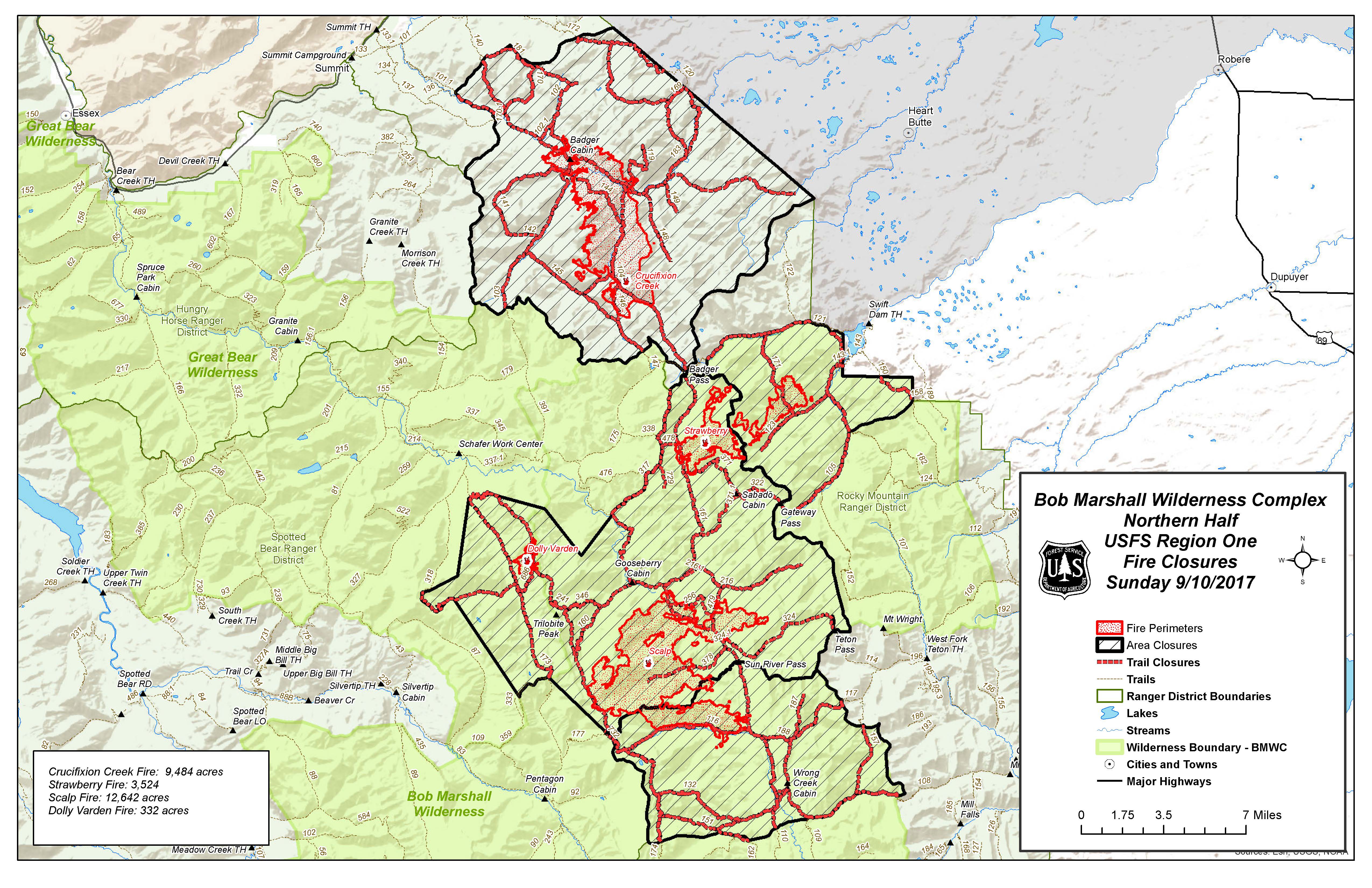
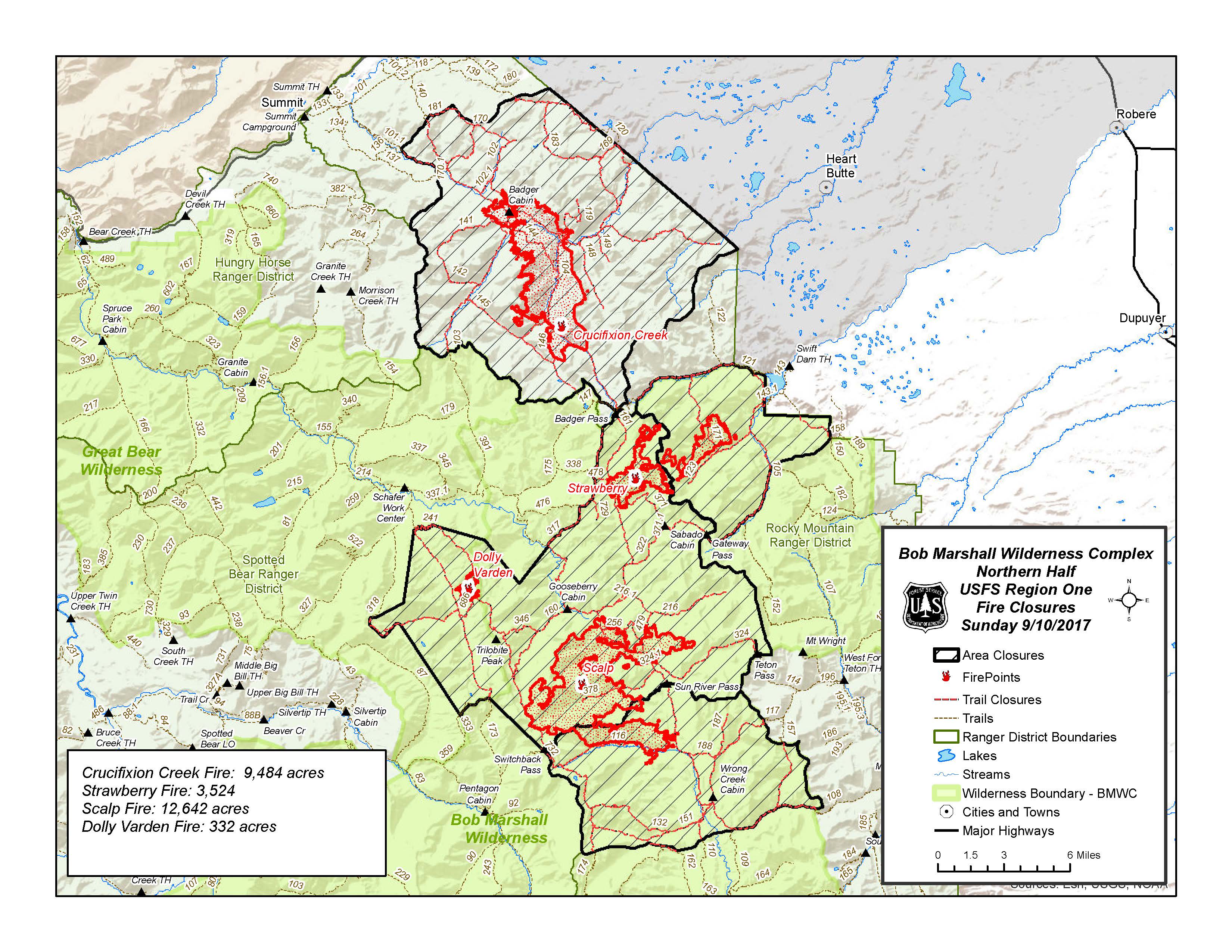
ComplexClosure_NorthHalf_11x17L_20170910_09300.jpg
2017-09-10 15:06
1.7M
ComplexClosure_NorthHalf_8x11L_20170910_0930.pdf
2017-09-10 15:06
1.1M
ComplexClosure_NorthHalf_8x11L_20170910_0930.jpg
2017-09-10 15:06
967K
Briefing_Topo_34x44port_20170910_1323_Reduced.pdf
2017-09-10 15:04
3.9M
Briefing_Aerial_34x44port_20170910_1331_Reduced.pdf
2017-09-10 15:04
4.9M