Index of /public/incident_specific_data/n_rockies/Historic_archived NIROPS/2017_fires/2017_Liberty/GIS/Products/20170819
Name
Last modified
Size
Description
Parent Directory
-
Repair_ArchE_land_20170818_1920_Liberty_MTFHA105.pdf
2017-08-18 23:37
2.9M
Progression_archD_land_20170819_800_MTFHA105.pdf
2017-08-19 09:04
1.1M
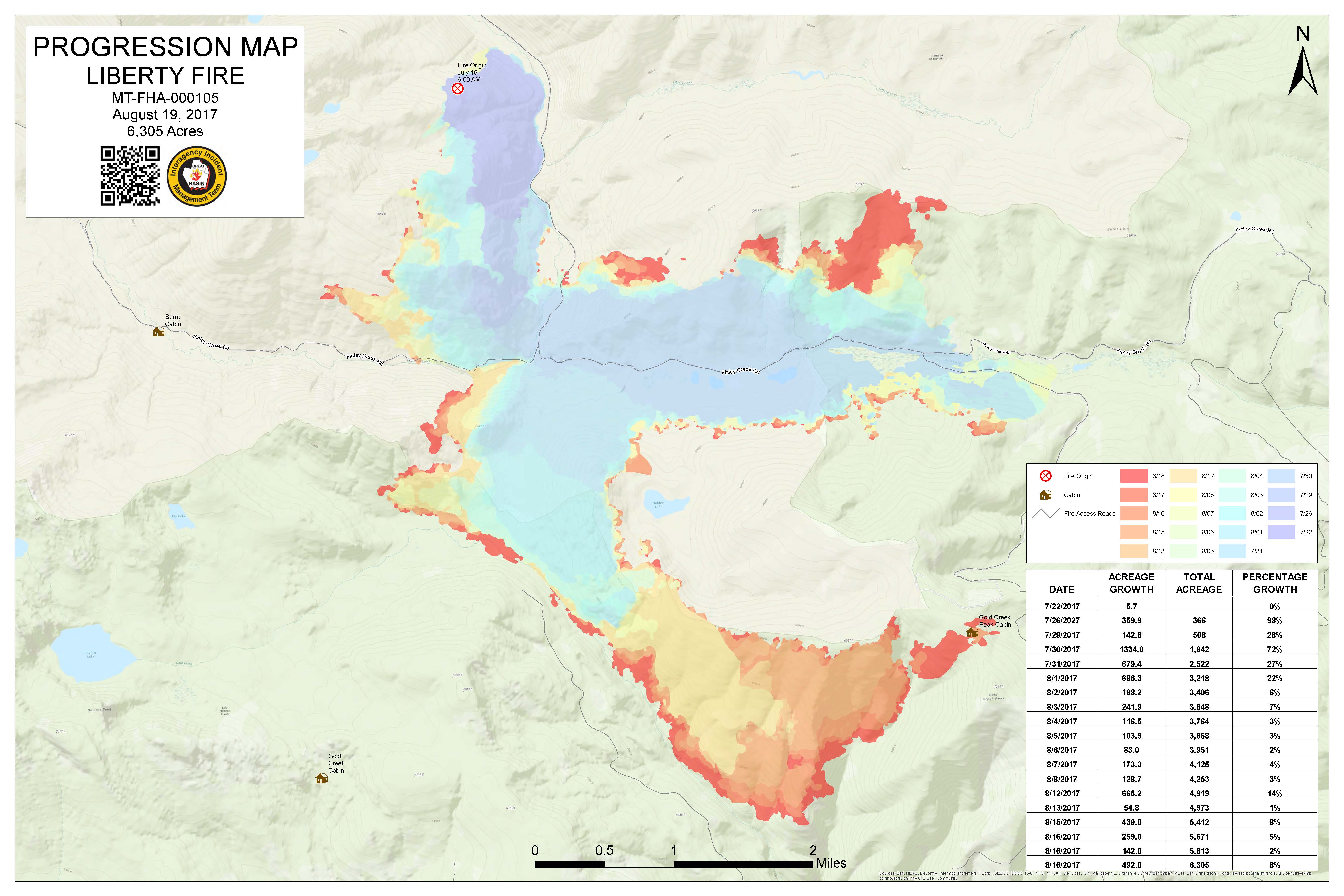
Progression_archD_land_20170819_800_MTFHA105.jpg
2017-08-19 09:04
895K
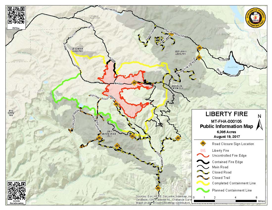
PIO_AreaFires_8x11_land_20170819_1548_Liberty_MTFHA105.pdf
2017-08-19 16:54
413K
PIO_8x11_land_20170819_1005_Liberty_MTFHA105.pdf
2017-08-19 11:04
318K
PIO_8x11_land_20170819_1005_Liberty_MTFHA105.jpg
2017-08-19 11:04
152K
OPS_ArchE_land_20170818_2205_Liberty_MTFHA105.pdf
2017-08-18 23:36
2.9M
OPS_ArchC_land_2017818_2210_Liberty_MTFHA105.pdf
2017-08-18 23:36
2.6M
IAP_ArchD_land_20170818_1730_Liberty_MTFHA105.pdf
2017-08-18 23:35
2.3M
IAP_85x11_land_20170818_1730_Liberty_MTFHA105.pdf
2017-08-18 23:34
1.3M
DIV_ArchT_land_20170818_2000_Liberty_MTFHA105.pdf
2017-08-18 23:33
3.0M
DIVC_ArchC_land_20170818_1900_Liberty_MTFHA105.pdf
2017-08-18 23:35
3.1M
DIVAB_ArchC_land_20170818_2000_Liberty_MTFHA105.pdf
2017-08-18 23:33
3.1M
AirOps_11x17_land_20170818_2215_Liberty_MTFHA105.pdf
2017-08-18 23:37
659K