Index of /public/incident_specific_data/n_rockies/Historic_archived NIROPS/2017_fires/2017_Liberty/GIS/Products/20170831
Name
Last modified
Size
Description
Parent Directory
-
Trans_85X11_land_20170830_1720_Liberty_MTFHA105.pdf
2017-08-30 23:00
205K
TFR_ArchE_land_20170830_2120_Liberty_MTFHA105.pdf
2017-08-30 23:04
2.5M
Repair_ArchE_land_20170830_2133_Liberty_MTFHA105.pdf
2017-08-30 23:03
4.6M
RepairDIVMTU_AnsiC_land_20170830_2125_Liberty_MTFHA105.pdf
2017-08-30 23:04
1.3M
RepairDIVC_AnsiC_land_20170830_2125_Liberty_MTFHA105.pdf
2017-08-30 23:03
1.3M
RepairDIVAB_AnsiC_land_20170830_2125_Liberty_MTFHA105.pdf
2017-08-30 23:03
1.2M
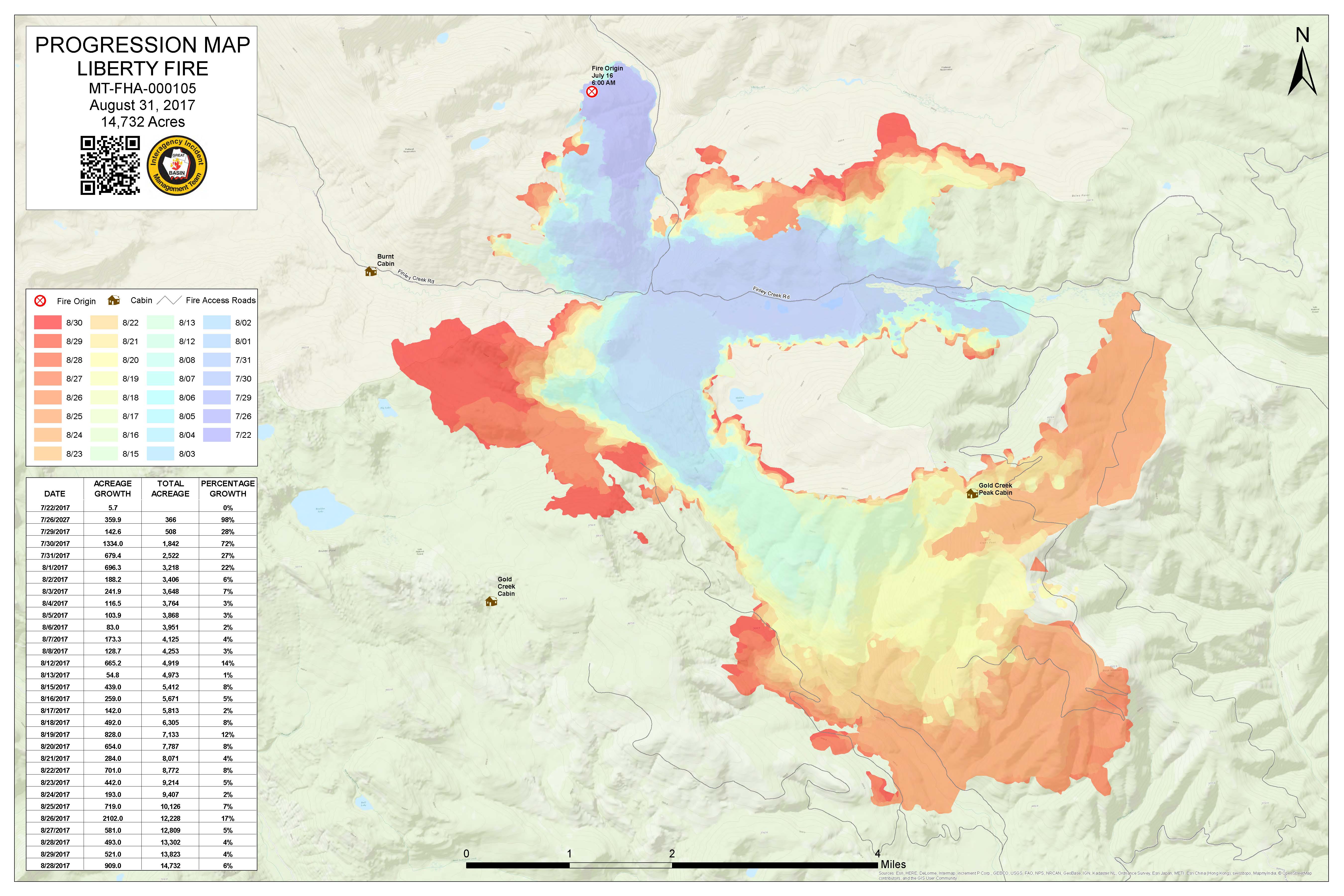
Progression_archD_land_20170831_0710_Liberty_MTFHA105.pdf
2017-08-31 08:33
1.2M
Progression_archD_land_20170831_0710_Liberty_MTFHA105.jpg
2017-08-31 08:34
1.0M
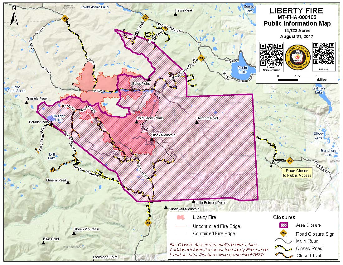
PIO_8x11_land_20170831_1300_Liberty_MTFHA105.pdf
2017-08-31 14:32
385K
PIO_8x11_land_20170831_1300_Liberty_MTFHA105.jpg
2017-08-31 14:32
236K
OPS_ArchE_land_20170830_2125_Liberty_MTFHA105.pdf
2017-08-30 23:02
3.0M
OPS_AnsiC_land_20170830_2125_Liberty_MTFHA105.pdf
2017-08-30 23:02
3.5M
IAP_85x11_land_20170830_1720_Liberty_MTFHA105.pdf
2017-08-30 23:01
516K
DIVU_AnsiC_land_20170830_2115_Liberty_MTFHA105.pdf
2017-08-30 23:41
1.3M
DIVT_AnsiC_land_20170830_2120_Liberty_MTFHA105.pdf
2017-08-30 23:01
1.3M
DIVM_AnsiC_land_20170830_2115_Liberty_MTFHA105.pdf
2017-08-30 23:01
1.3M
BAM_ArchE_land_20170830_2110_Liberty_MTFHA105.pdf
2017-08-30 23:01
1.9M
AirOps_11x17_land_20170830_2110_Liberty_MTFHA105.pdf
2017-08-30 23:00
367K