Index of /public/incident_specific_data/n_rockies/Historic_archived NIROPS/2017_fires/2017_ParkCreek/GIS/products/20170801
Name
Last modified
Size
Description
Parent Directory
-
OverviewMap24K_20170801_PIO.tfw
2017-08-01 22:17
108
Info_letter_20170801_0753_ParkCreekMTHLF000148_0801day.pdf
2017-08-01 22:04
1.2M
DivZ_letter_20170801_0743_ParkCreekMTHLF000148_0801day.pdf
2017-08-01 22:01
1.5M
Park_20170731_WithMAPs.pdf
2017-08-01 21:44
2.0M
ParkCreek_Operations_Map_Current.tif
2017-08-01 21:45
2.9M
OverviewMap24K_20170801.tif
2017-08-01 22:15
2.9M
TFR-OverviewMap20170801.tif
2017-08-01 21:58
3.2M
IAP_letter_20170731_1800_ParkCreekMTHLF000146_0801day.pdf
2017-08-01 22:03
5.0M
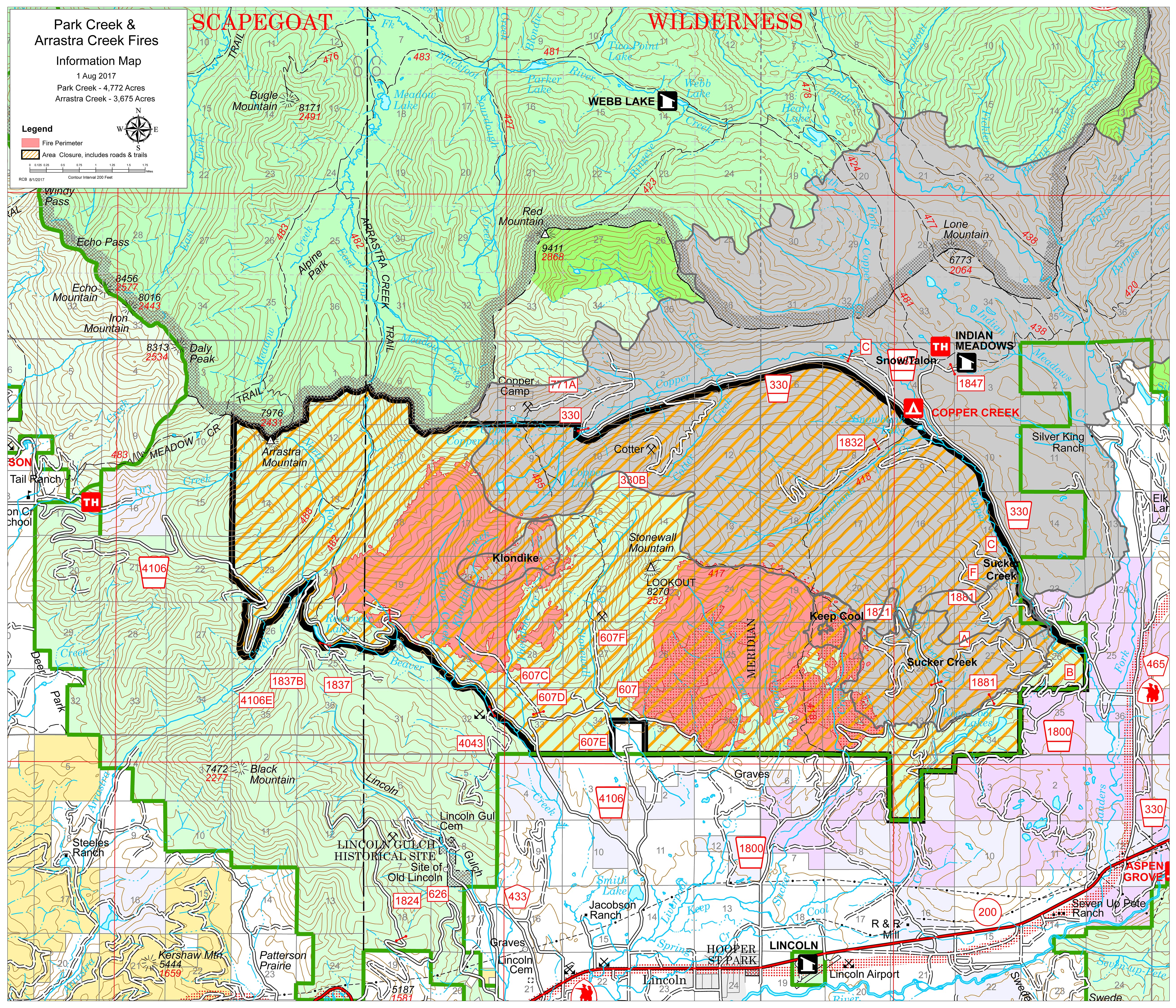
OverviewMap24K_20170801_PIO.jpg
2017-08-01 22:17
5.8M
Arrastra_20170731_WithMAPs.pdf
2017-08-01 22:01
6.1M
Progression_36x42_20170801_1047_ParkCreekMTHLF000148_0801day.pdf
2017-08-01 21:49
14M
OverviewMap24K_20170801_WithImage.pdf
2017-08-01 21:43
24M
OverviewMap24K_20170801_With_MAPs.pdf
2017-08-01 22:26
29M
OverviewMap24K_20170801_PIO.pdf
2017-08-01 22:25
30M
OverviewMap24K_20170801.pdf
2017-08-01 22:14
30M
OverviewMap24K_20170801V2.pdf
2017-08-01 21:45
30M
TFR-OverviewMap20170801.pdf
2017-08-01 22:15
59M