Index of /public/incident_specific_data/n_rockies/Historic_archived NIROPS/2017_fires/2017_Sunrise/Gis_Maps/MAP_PRODUCTS/20170809
Name
Last modified
Size
Description
Parent Directory
-
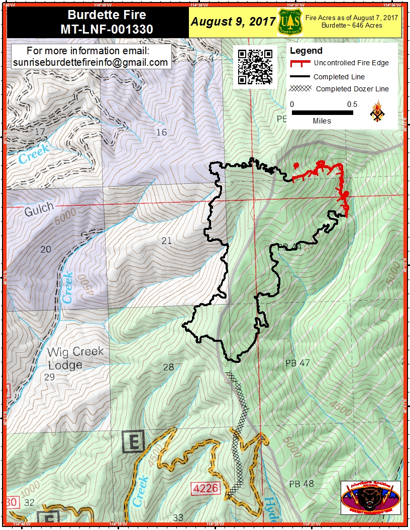
PIO_8.5x11_port_20170808_1833_Burdette_MTLNF001330_0809day.jpg
2017-08-09 07:19
1.0M
IAP_11x17_Index_land_20170808_1751_Sunrise_MTLNF1336_0809day.pdf
2017-08-09 07:07
1.6M
PIO_8.5x11_port_20170808_1833_Burdette_MTLNF001330_0809day.pdf
2017-08-09 07:00
2.1M
airops_11x17_port_20170808_1820_Sunrise_MTLNF1336_0809day.pdf
2017-08-09 07:09
3.3M
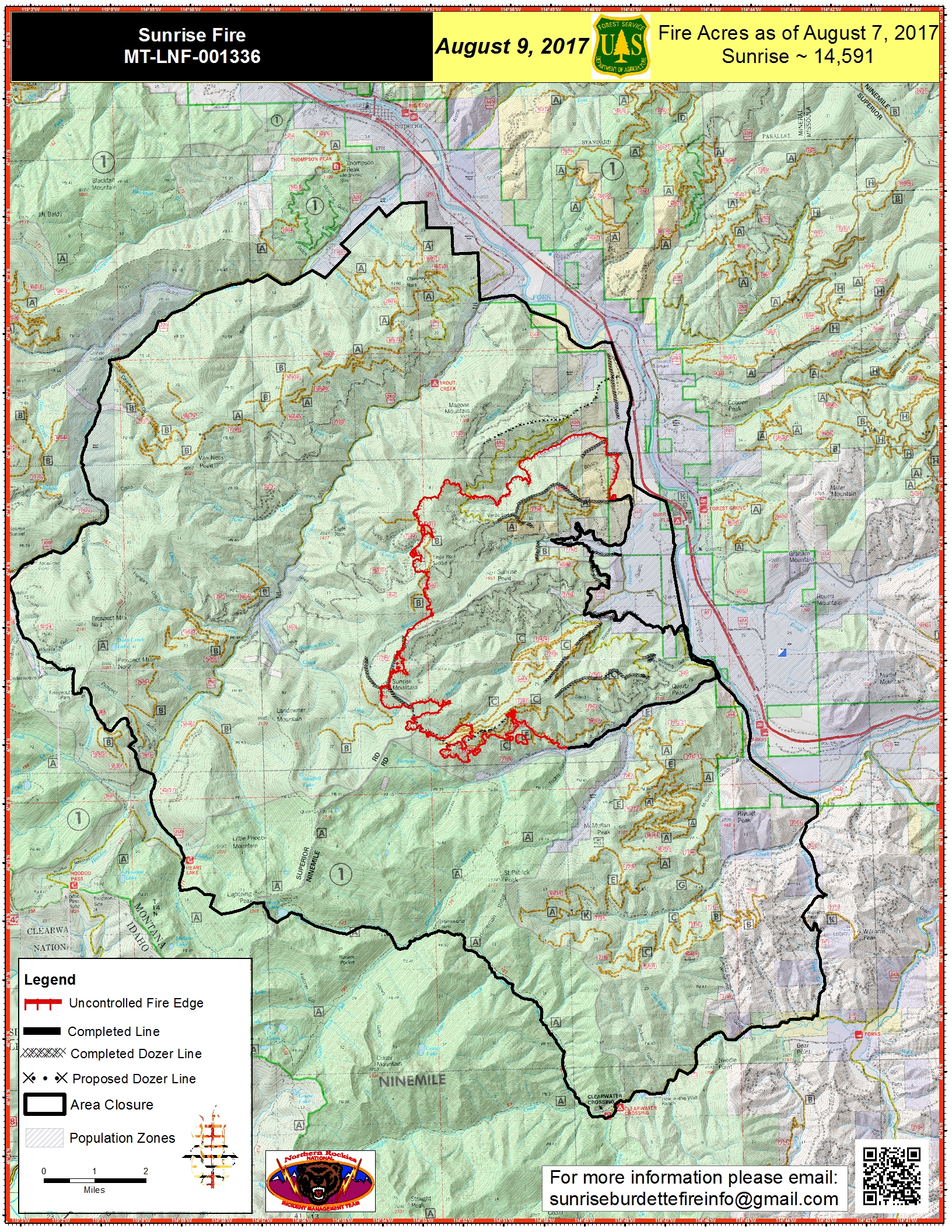
PIO_11x17_port_20170808_1658_Sunrise_MTLNF001336_0809day.jpg
2017-08-09 07:18
4.3M
PIO_11x17_port_20170808_1658_Sunrise_MTLNF001336_0809day.pdf
2017-08-09 07:00
6.4M
Briefing_EZoom_20170808_2100_Burdette_0809_0600_MTLNF001336.pdf
2017-08-09 07:09
6.5M
IR_Briefing_EZoom_20170809_0500_Burdette_0809_0600_MTLNF001336.pdf
2017-08-09 07:02
7.0M
IAP_11x17_MP_land_20170808_1802_Sunrise_MTLNF1336_0809day.pdf
2017-08-09 07:06
7.4M
IR_Briefing_E_20170809_0430_SunriseBurdette_0809_0600_MTLNF001336.pdf
2017-08-09 07:06
15M
IR_Briefing_EZoom_20170809_0430_DIV_K_Sunrise_0809_0600_MTLNF001336.pdf
2017-08-09 07:04
15M
IR_Briefing_EZoom_20170809_0430_Sunrise_0809_0600_MTLNF001336.pdf
2017-08-09 07:03
16M