| Name | Last modified | Size | Description | |
|---|---|---|---|---|
| Parent Directory | - | |||
| trans_11x17_port_2017_Moose_Peak_MTKNF225_West Fork_MTKNF222.pdf | 2017-09-15 23:20 | 369K | ||
| pilot_11X17_port_2017_WestFork_MTKNF2221.pdf | 2017-09-15 23:17 | 541K | ||
| trans_d_port_2017_Moose_Peak_MTKNF225_West Fork_MTKNF222.pdf | 2017-09-15 23:20 | 592K | ||
| brief_arch_e_port_20170916_0724_West Fork_MTKNF222_0916day.pdf | 2017-09-16 08:34 | 1.0M | ||
| Inciweb_8x11_land_WestFork_MTKNF000222_20170916.pdf | 2017-09-16 08:27 | 1.4M | ||
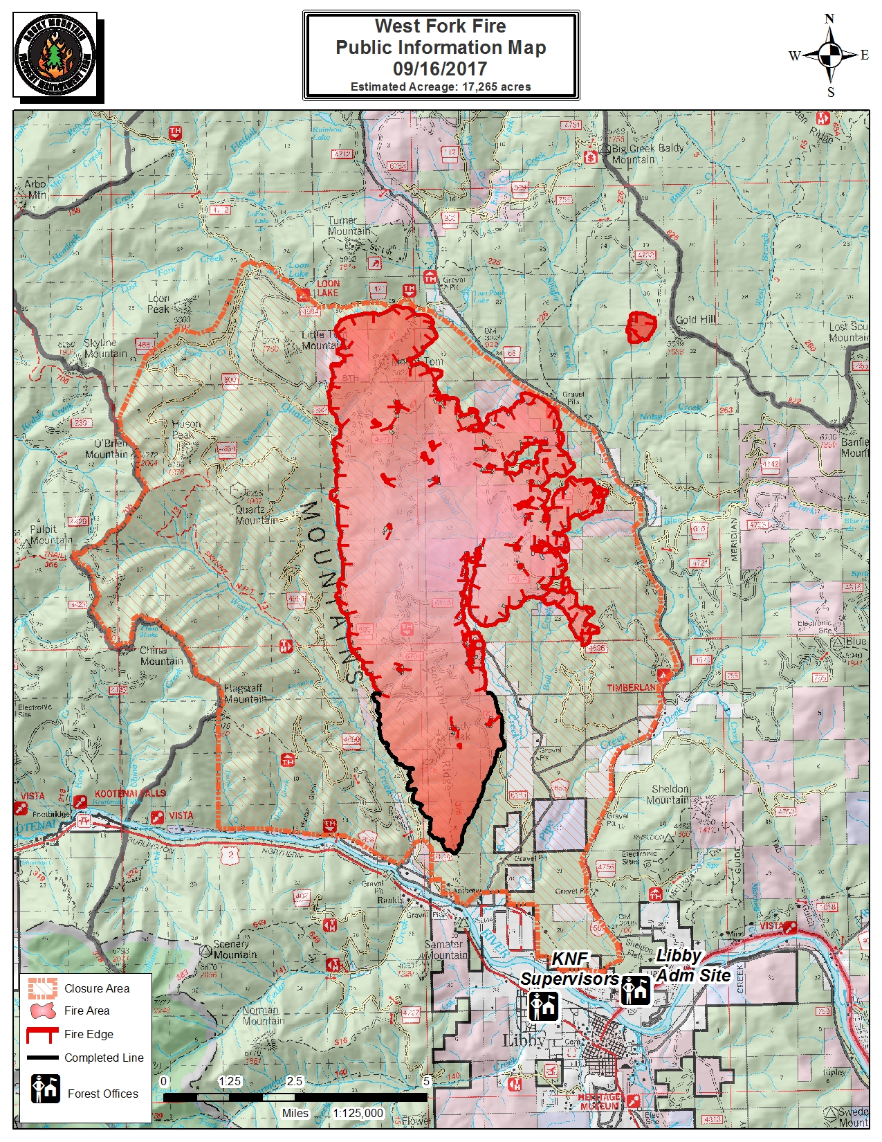
| Inciweb_8x11_land_WestFork_MTKNF000222_20170916.jpg | 2017-09-16 08:27 | 2.3M | ||
| iap_11X17_port_2017_WestFork_MTKNF222_20170915_0916day.pdf | 2017-09-15 23:16 | 3.0M | ||
| airops_arch_e_port_2017_WestFork_0916day.pdf | 2017-09-15 23:35 | 4.1M | ||
| PIO_Overview_ArchD_Port_WestForkMoosePeak_MTKNF222_20170916.pdf | 2017-09-16 08:48 | 5.1M | ||
| PIO_ArchD_Port_WestFork_MTKNF222_20170916.pdf | 2017-09-16 09:23 | 6.8M | ||
| ops_arch_d_land_2017_West Fork_KNF222.pdf | 2017-09-15 23:18 | 6.8M | ||
| planning_arch_e_port_20170915_2048_West_Fork_Moose_Peak_MTKNF222_0916day.pdf | 2017-09-15 23:26 | 33M | ||