Index of /public/incident_specific_data/n_rockies/Historic_archived NIROPS/2019_fires/2019_Horsefly/QRCodes
Name
Last modified
Size
Description
Parent Directory
-
20190822_HorseFly_IR_11.x17_NAIP.pdf
2019-08-22 21:01
4.2M
20190822_HorseFly_IR_11.x17_Topo.pdf
2019-08-22 21:01
4.2M
Horsefly_SatelliteImage_20190818_North_opt.pdf
2019-08-20 20:00
1.3M
Horsefly_SatelliteImage_20190818_Overhead_opt.pdf
2019-08-20 20:00
1.3M
Horsefly_SatelliteImage_20190818_South_opt.pdf
2019-08-20 20:00
1.0M
IAP_letter_port_20190822_2139_Horsefly_MTHLF000162.pdf
2019-08-22 22:48
885K
Ops_ArchE_land_20190822_2118_Horsefly_MTHLF000162opt.pdf
2019-08-22 22:50
9.0M
Ops_NAIP_ArchE_land_20190822_2156_Horsefly_MTHLF000162_opt.pdf
2019-08-22 23:00
8.3M
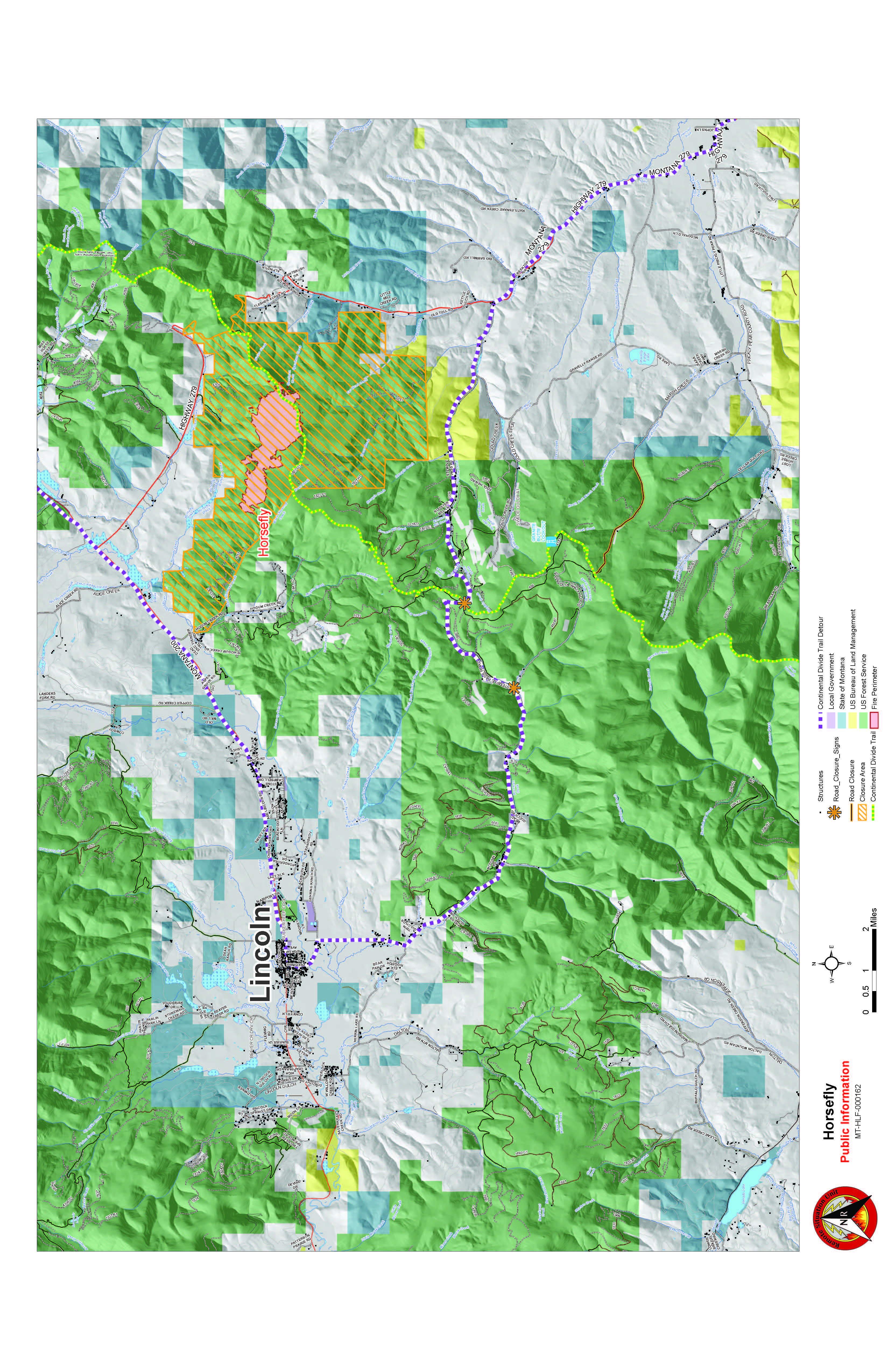
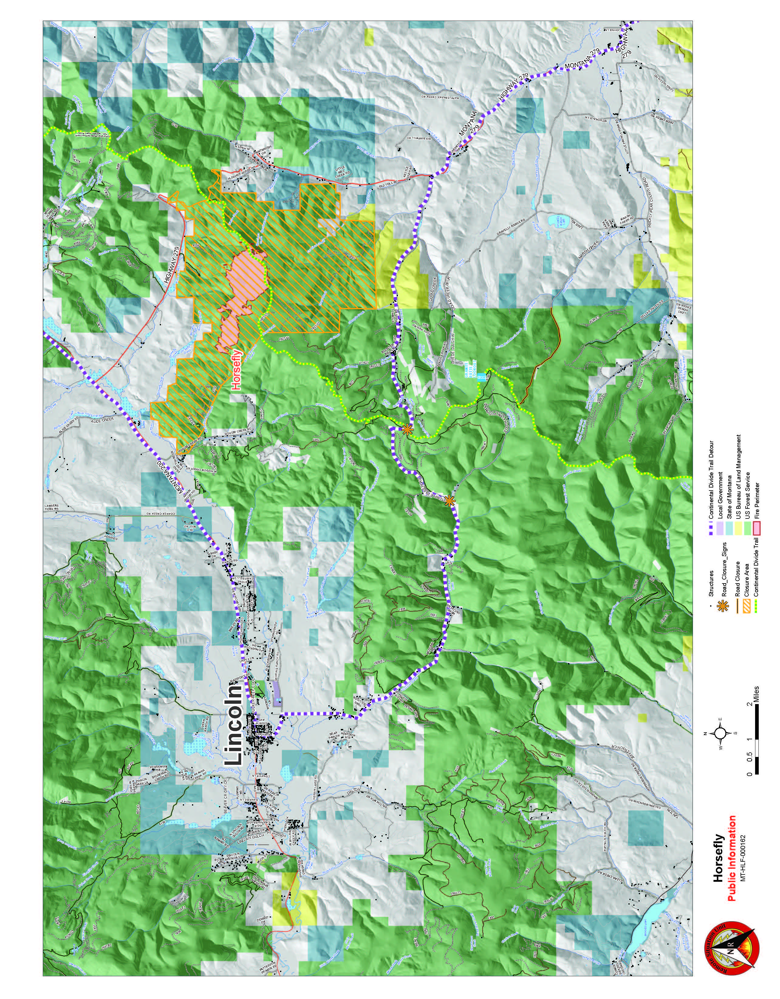
PIO_11x17_land_20190922_2122_Horsefly_MTHLF000162_opt.jpg
2019-08-22 22:48
2.5M
PIO_11x17_land_20190922_2122_Horsefly_MTHLF000162_opt.pdf
2019-08-22 22:48
3.8M
PIO_letter_land_20190922_2122_Horsefly_MTHLF000162_opt.jpg
2019-08-22 22:48
1.5M
PIO_letter_land_20190922_2122_Horsefly_MTHLF000162_opt.pdf
2019-08-22 22:49
2.7M
ProposedLine_ArchD_20190817.pdf
2019-08-16 22:20
17M
QR_FTP_QRFolder_Horsefly_20190814.png
2019-08-14 18:54
2.4K
Repair_ArchE_land_20190822_2118_Horsefly_MTHLF000162_opt.pdf
2019-08-22 22:58
12M