Index of /public/incident_specific_data/southern/Texas/2024_FIRES/2024_Smokehouse Creek/GIS/20240303
Name
Last modified
Size
Description
Parent Directory
-
trans_arch_e_land_20240302_1748_Panhandle Wildfires_TXTXS024902_0303day.pdf
2024-03-02 21:03
3.3M
ops_arch_e_land_20240302_2030_SmokehouseCreek_TXTXS240317_0303day.pdf
2024-03-02 21:03
2.0M
iap_11x17_land_20240302_1849_Smokehouse_Creek_TXTXS240317_0303day.pdf
2024-03-02 21:03
1.7M
brief_Arch_E_land_20240302_2028_PanhandleFires_TXTXS024902_0303day.pdf
2024-03-02 21:03
1.9M
PIO_arch_d_land_20240303_1050_Panhandle Wildfires_TXTXS024902_0303day.pdf
2024-03-03 10:52
5.1M
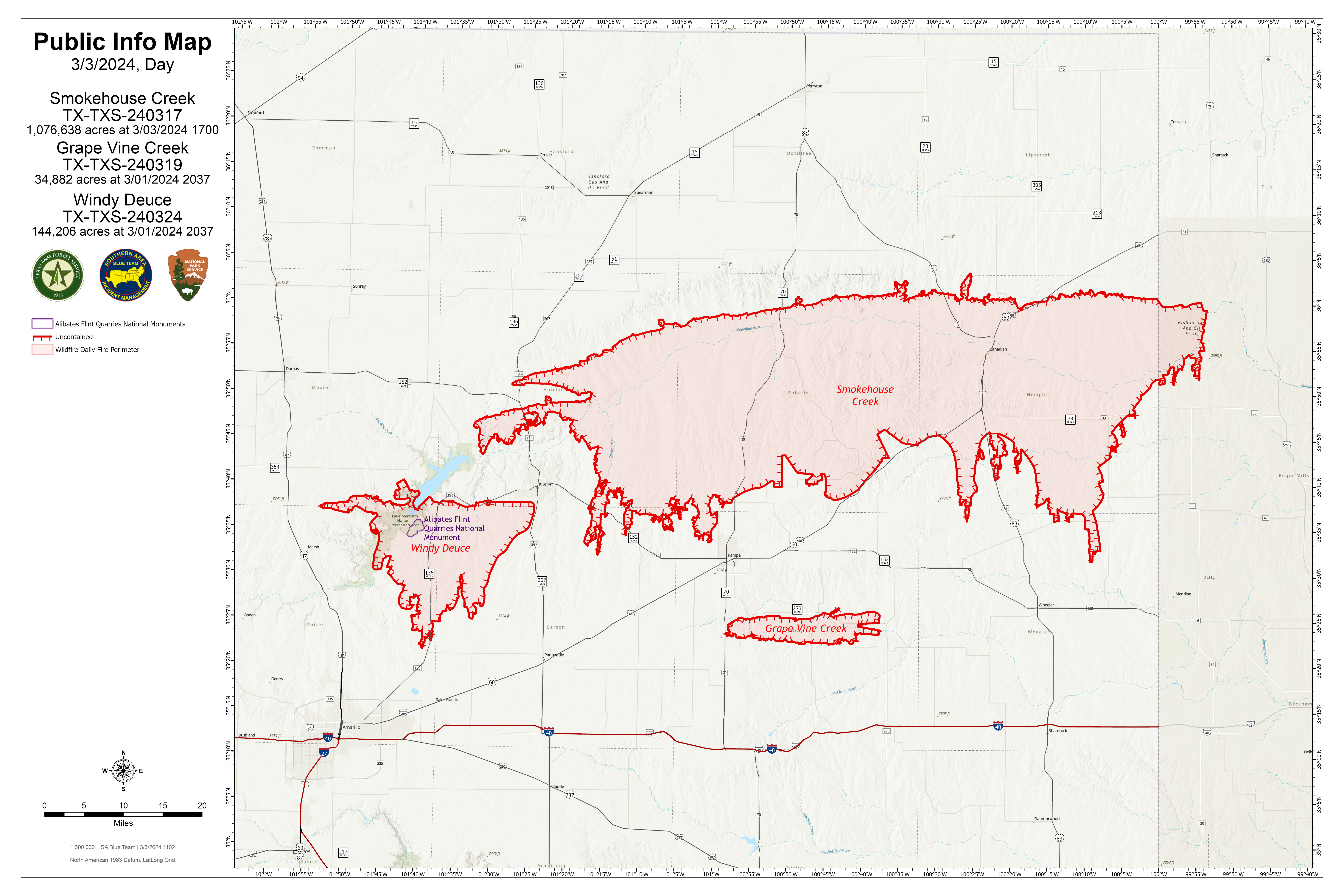
PIO_arch_d_land_20240303_1050_Panhandle Wildfires_TXTXS024902_0303day.jpg
2024-03-03 11:03
3.1M
OpsTiles_arch_c_land_20240302_2100_SmokehouseCreek_TXTXS240317_0303day_Div Z.pdf
2024-03-02 21:06
2.6M
OpsTiles_arch_c_land_20240302_2100_SmokehouseCreek_TXTXS240317_0303day_Div M.pdf
2024-03-02 21:06
2.6M
OpsTiles_arch_c_land_20240302_2100_SmokehouseCreek_TXTXS240317_0303day_Div G.pdf
2024-03-02 21:06
2.6M
OpsTiles_arch_c_land_20240302_2100_SmokehouseCreek_TXTXS240317_0303day_Div D.pdf
2024-03-02 21:06
2.6M
OpsTiles_arch_c_land_20240302_2100_SmokehouseCreek_TXTXS240317_0303day_Div A.pdf
2024-03-02 21:06
2.6M