| Name | Last modified | Size | Description | |
|---|---|---|---|---|
| Parent Directory | - | |||
| AirHazards_ansi_e_port_20150826_2130_Nickowitz_CA-SRF1470_0827day.pdf | 2015-08-27 08:00 | 7.0M | ||
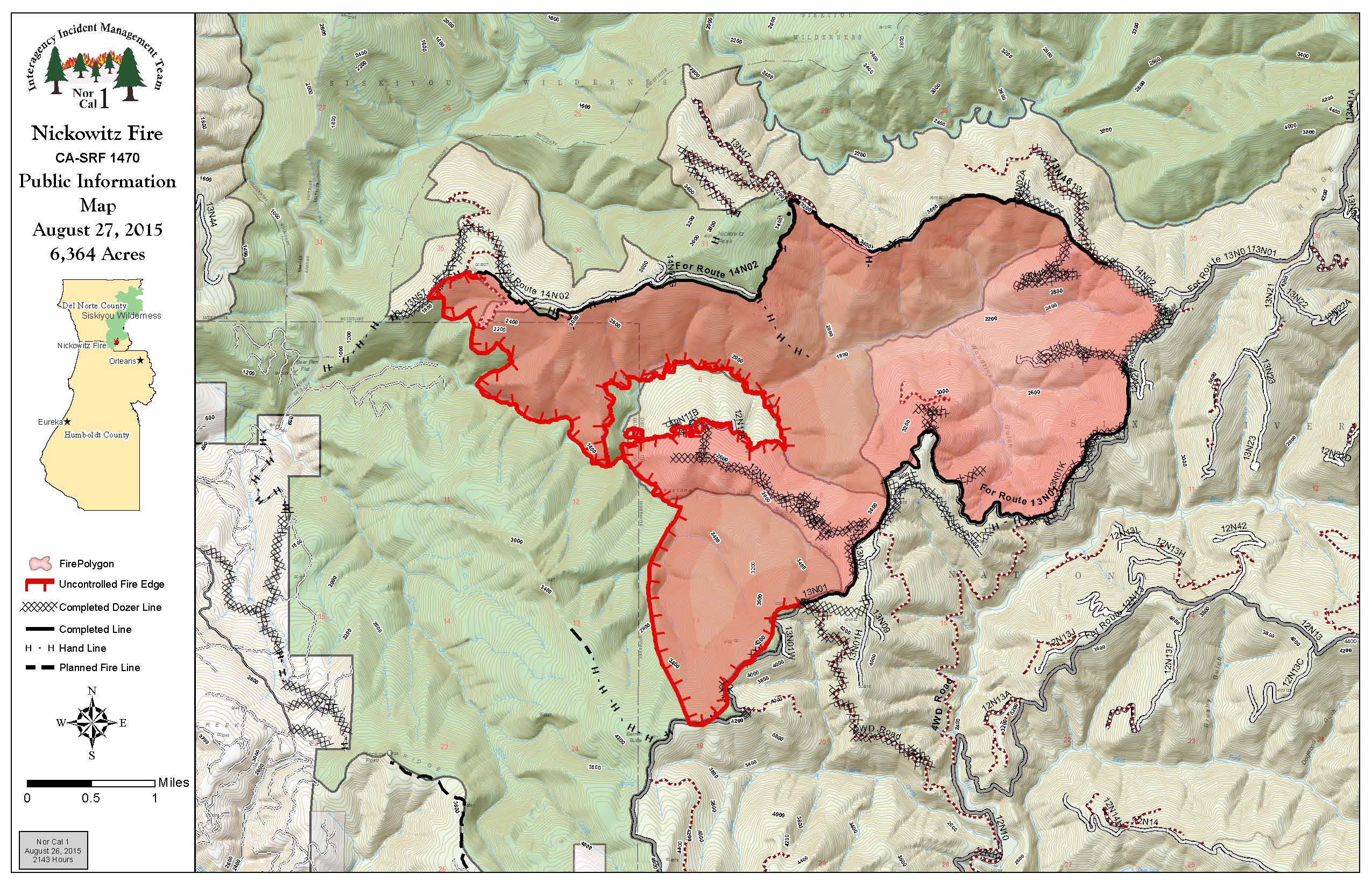
| Pio_11x17_land_20150826_2144_Nickowitz_CA-SRF1470_0827day.jpg | 2015-08-27 07:27 | 657K | ||
| Pio_11x17_land_20150826_2144_Nickowitz_CA-SRF1470_0827day.pdf | 2015-08-27 07:29 | 2.1M | ||
| airops_ansi_c_port_20150826_2130_Nickowitz_CA-SRF1470_0827day.pdf | 2015-08-27 07:22 | 2.4M | ||
| airops_fireperimeter_ansi_c_land_20150826_2145_Nickowitz_CA-SRF1470_0827day.pdf | 2015-08-27 07:20 | 1.3M | ||
| brief_Plans_ansi_e_land_20150826_2200_Nickowitz_CA-SRF1470_0827day.pdf | 2015-08-27 07:51 | 13M | ||
| iap_combined_11x17_land_20150826_2105_Nickowitz_CA-SRF1470_0827day.pdf | 2015-08-27 08:00 | 11M | ||
| repair_ansi_d_land_20150826_2115_Nickowitz_CA-SRF1470_0827day.pdf | 2015-08-27 08:00 | 5.2M | ||
| transportationEast_11x17_port_20150826_2132_Nickowitz_CA-SRF1470_0827day.pdf | 2015-08-27 08:00 | 1.6M | ||
| transportationWest_11x17_port_20150826_2138_Nickowitz_CA-SRF1470_0827day.pdf | 2015-08-27 08:01 | 2.1M | ||