Index of /public/incident_specific_data/n_rockies/Historic_archived NIROPS/2017_fires/2017_Hanover/GIS/Maps/20170816
Name
Last modified
Size
Description
Parent Directory
-
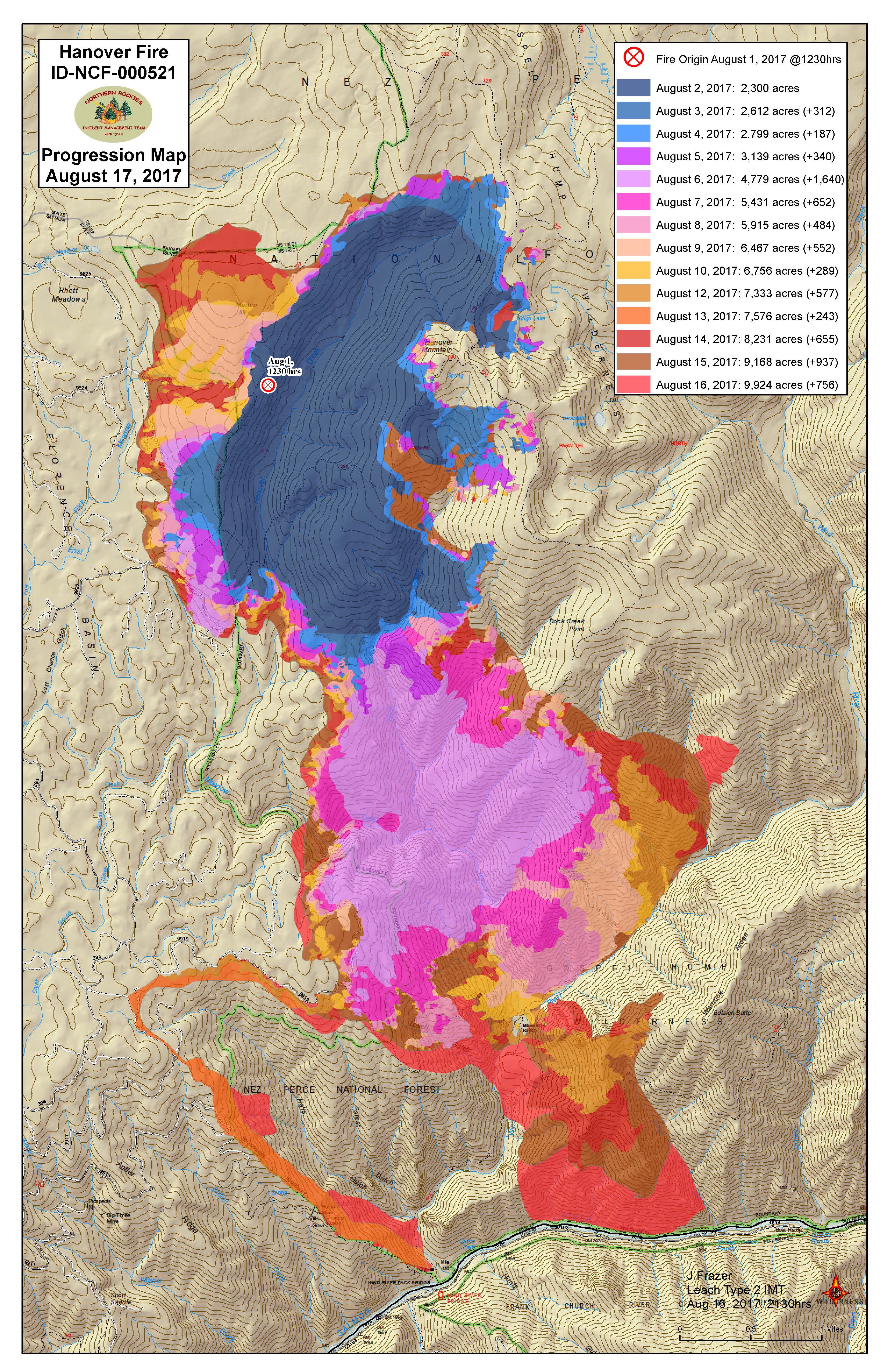
Progression_11x17port_2017_Hanover_IDNCF5211.pdf
2017-08-17 00:55
2.5M
Progression_11x17port_2017_Hanover_IDNCF5211.jpg
2017-08-17 00:53
2.4M
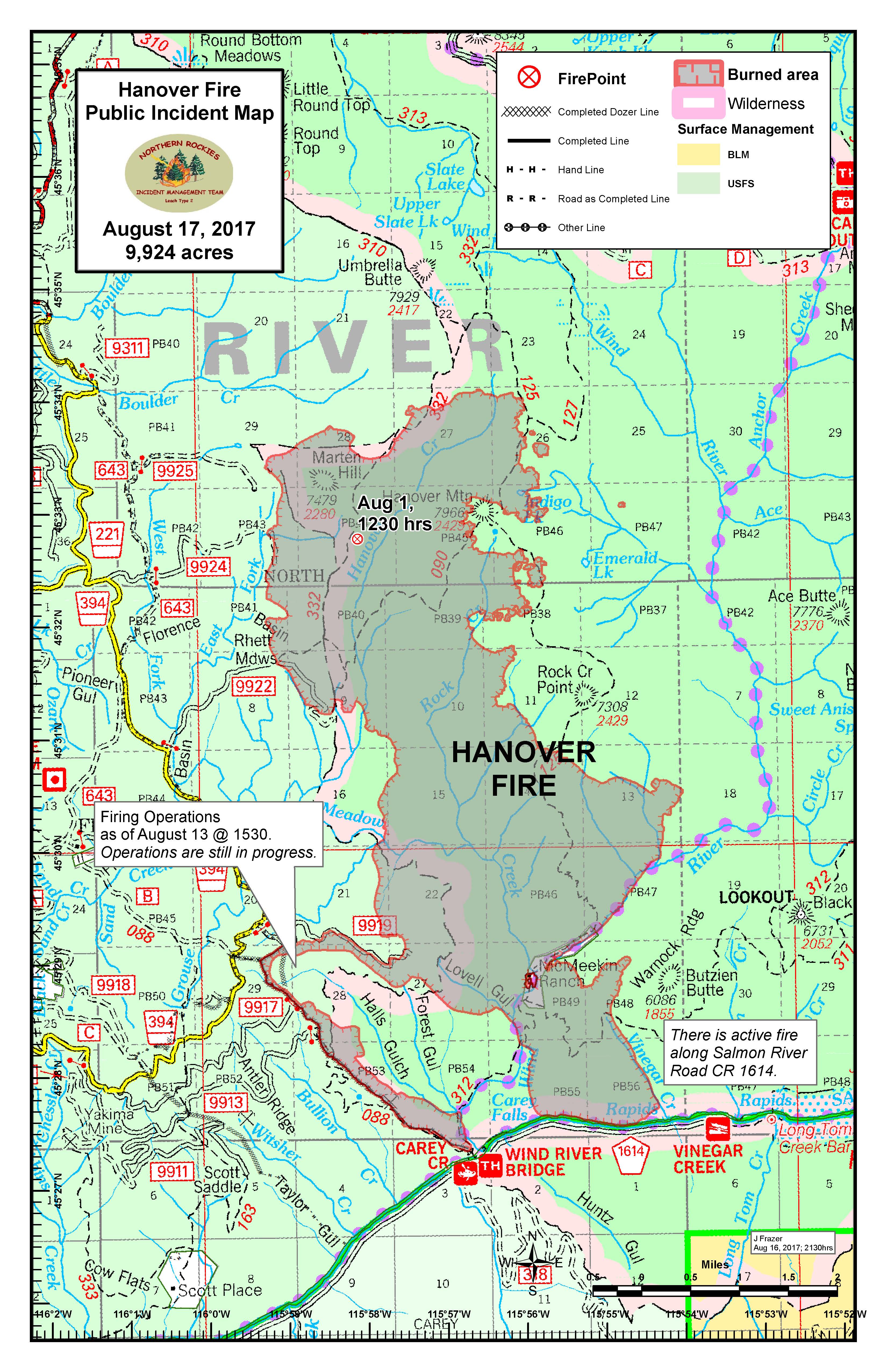
PIOtrapline_11x17port_20170816_2110_Hanover_IDNCF521.pdf
2017-08-17 00:53
657K
PIOtrapline_11x17port_20170816_2110_Hanover_IDNCF521.jpg
2017-08-17 00:52
1.8M
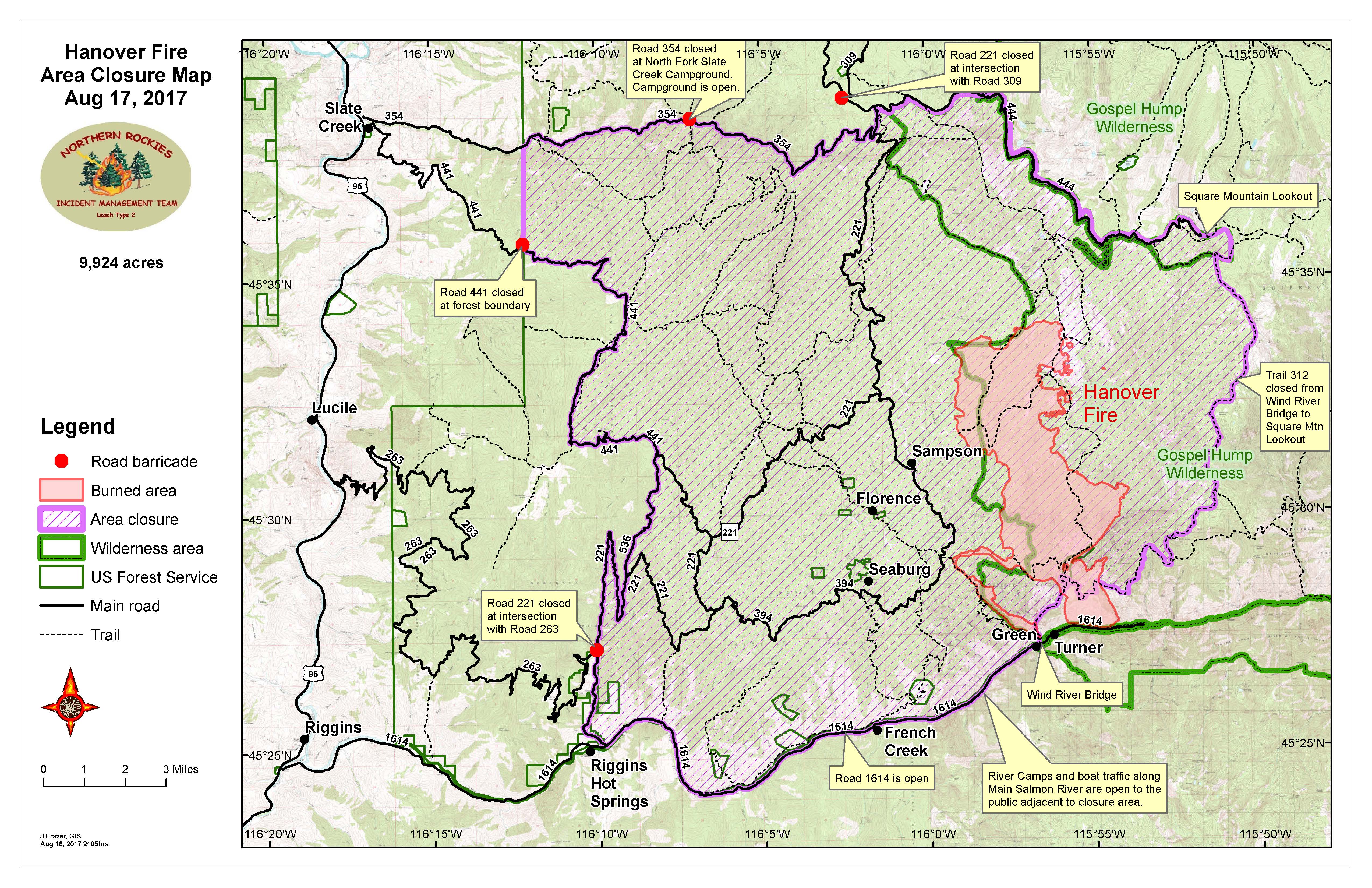
PIOclosures_11x17land_20170816_2105_Hanover_IDNCF5211.pdf
2017-08-17 00:52
2.3M
PIOclosures_11x17land_20170816_2105_Hanover_IDNCF5211.jpg
2017-08-17 00:51
2.3M
transport_85x11port_20170816_1800_Hanover_IDNCF5211.pdf
2017-08-17 00:44
313K
iapDivM_11x17port_20170816_1845_Hanover_IDNCF521.pdf
2017-08-17 00:43
5.0M
iapDivJ_11x17port_20170816_1845_Hanover_IDNCF521.pdf
2017-08-17 00:40
883K
iapDivG_11x17port_20170816_1845_Hanover_IDNCF521.pdf
2017-08-17 00:39
755K
iapDivD_11x17port_20170816_1845_Hanover_IDNCF521.pdf
2017-08-17 00:39
855K
iapDivA_11x17port_20170816_1845_Hanover_IDNCF521.pdf
2017-08-17 00:38
7.7M
iap_85x11port_20170816_1800_Hanover_IDNCF521.pdf
2017-08-17 00:32
1.0M
brief_34x44port_20170816_1830_Hanover_IDNCF521.pdf
2017-08-17 00:31
6.4M