| Name | Last modified | Size | Description | |
|---|---|---|---|---|
| Parent Directory | - | |||
| PIO_8.5x11_port_20170809_1211_Burdette_MTLNF001330_08010day.pdf | 2017-08-09 20:58 | 2.1M | ||
| PIO_11x17_port_20170809_1208_Sunrise_MTLNF001336_0810day.pdf | 2017-08-09 20:58 | 6.5M | ||
| AndysPIO_EZoom_2017_Sunrise_MTLNF001336.pdf | 2017-08-09 20:59 | 9.0M | ||
| airops_11x17_port_20170809_1832_Sunrise_MTLNF1336_0810day.pdf | 2017-08-09 21:01 | 3.3M | ||
| Briefing_EZoom_20170809_1830_Burdette_0810_0600_MTLNF001336.pdf | 2017-08-09 21:03 | 7.9M | ||
| Briefing_E_20170809_1830_SunriseBurdette_0810_0600_MTLNF001336.pdf | 2017-08-09 21:04 | 112K | ||
| IAP_11x17_MP_land_20170809_1859_Sunrise_MTLNF1336_0810day.pdf | 2017-08-09 21:04 | 4.9M | ||
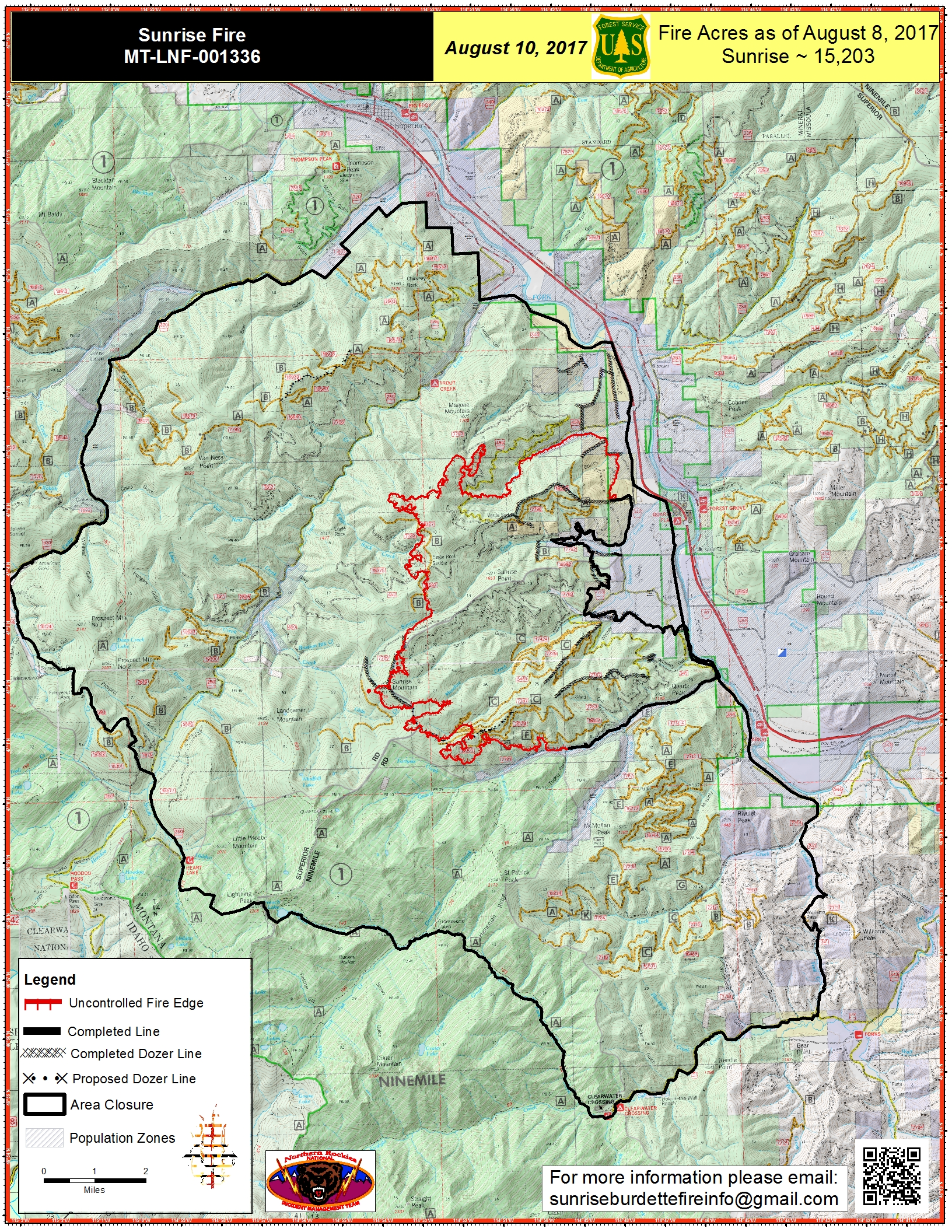
| PIO_11x17_port_20170809_1906_Sunrise_MTLNF001336_0810day.jpg | 2017-08-09 21:28 | 4.3M | ||
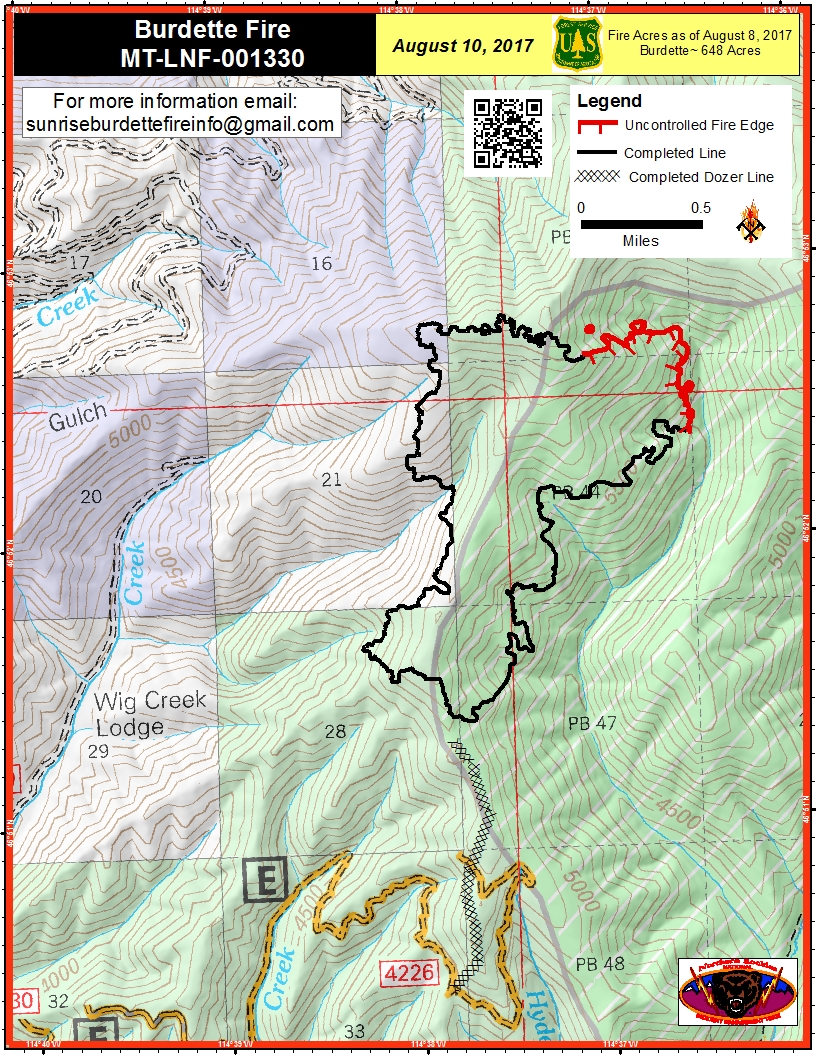
| PIO_8.5x11_port_20170809_1908_Burdette_MTLNF001330_0810day.jpg | 2017-08-09 21:28 | 1.0M | ||
| Briefing_EZoom_20170809_1930_Sunrise_0810_0600_MTLNF001336.pdf | 2017-08-09 21:29 | 6.7M | ||
| Briefing_EZoom_20170809_1930_DIV_K_Sunrise_0810_0600_MTLNF001336.pdf | 2017-08-09 21:30 | 6.6M | ||