Index of /public/incident_specific_data/n_rockies/Historic_archived NIROPS/2017_fires/2017_Sunrise/Gis_Maps/MAP_PRODUCTS/20170812
Name
Last modified
Size
Description
Parent Directory
-
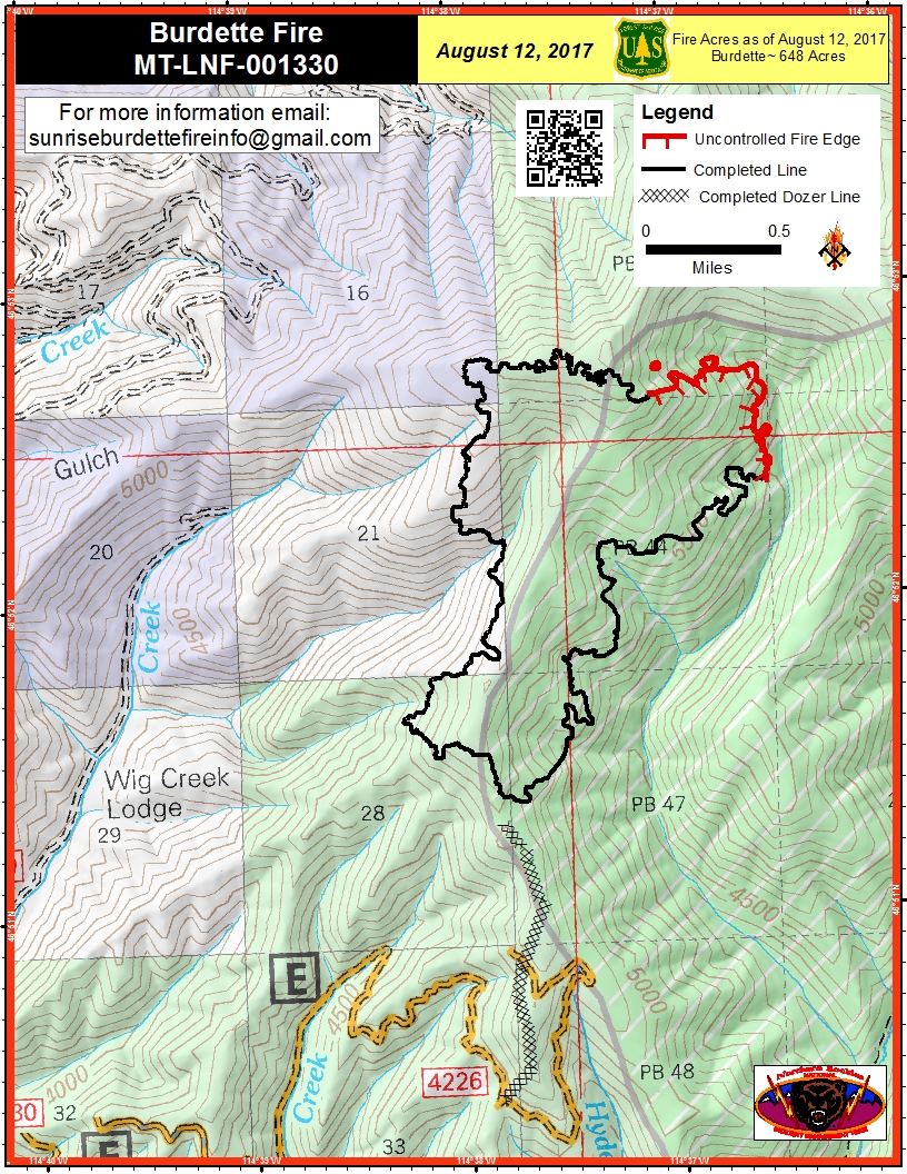
PIO_8.5x11_port_20170812_0545_Burdette_MTLNF001330_0812day.jpg
2017-08-12 06:52
1.0M
IAP_11x17_Index_land_201708012_0453_Sunrise_MTLNF1336_0812day.pdf
2017-08-12 06:30
1.7M
PIO_8.5x11_port_20170812_0546_Burdette_MTLNF001330_08012day.pdf
2017-08-12 06:51
2.1M
airops_11x17_port_20170812_0514_Sunrise_MTLNF1336_0812day.pdf
2017-08-12 06:31
3.3M
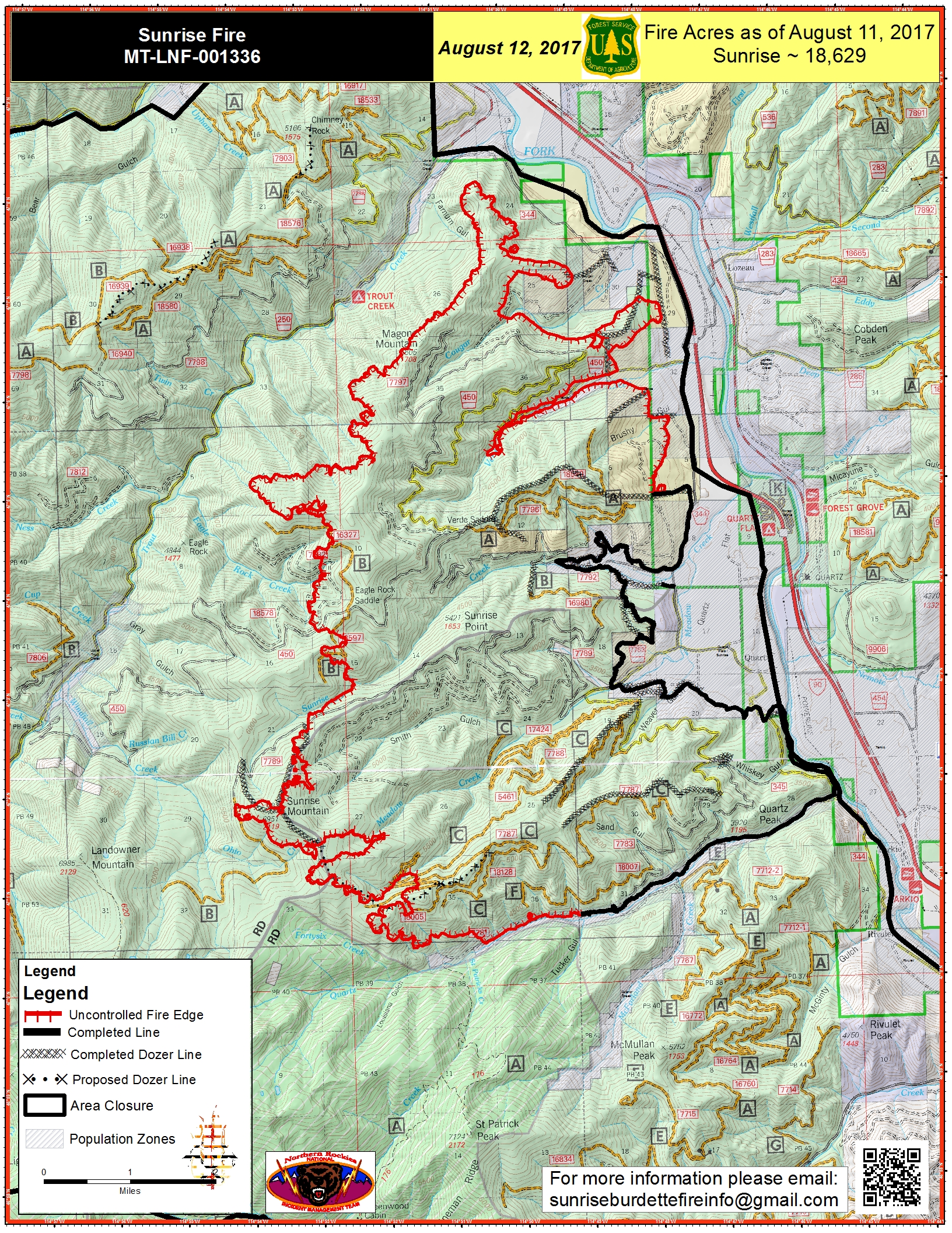
PIO_11x17_port_20170812_0544_Sunrise_MTLNF001336_0812day.jpg
2017-08-12 06:49
4.3M
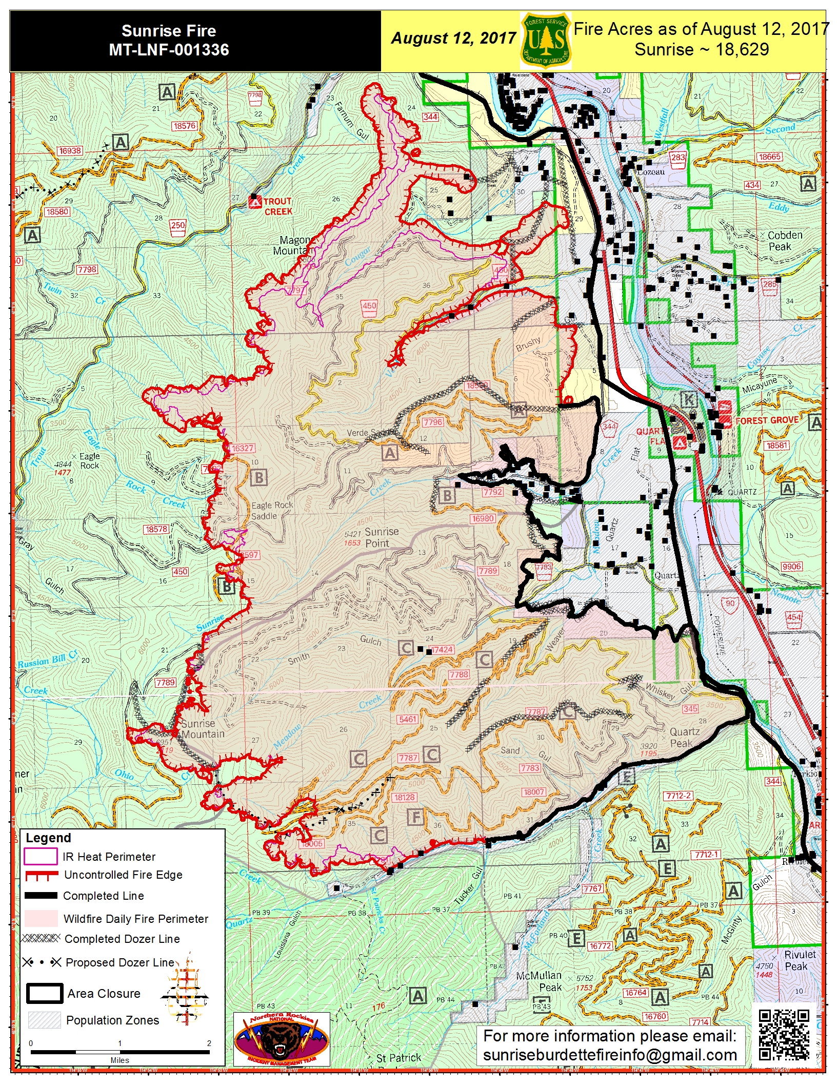
NEWPIO_20170812_0542_11x17_port_Sunrise_MTLNF001336.jpg
2017-08-12 06:54
4.4M
NEWPIO_20170812_0539_11x17_port_Sunrise_MTLNF001336_0812day.pdf
2017-08-12 06:54
5.8M
PIO_11x17_port_20170812_0536_Sunrise_MTLNF001336_0812day.pdf
2017-08-12 06:50
5.8M
IR_Briefing_EZoom_20170812_0415_Sunrise_0812_0600_MTLNF001336.pdf
2017-08-12 06:27
6.3M
IR_Briefing_E_20170812_0415_SunriseBurdette_0812_0600_MTLNF001336.pdf
2017-08-12 06:28
6.3M
IAP_11x17_MP_land_201708012_0500_Sunrise_MTLNF1336_0812day.pdf
2017-08-12 06:29
7.7M
Transportation_11x17_20170812_0430_Sunrise_0812_0600_MTLNF-001336.pdf
2017-08-12 06:27
7.9M
Briefing_EZoom_20170811_2030_Burdette_0812_0600_MTLNF001336.pdf
2017-08-12 06:30
8.9M