| Name | Last modified | Size | Description | |
|---|---|---|---|---|
| Parent Directory | - | |||
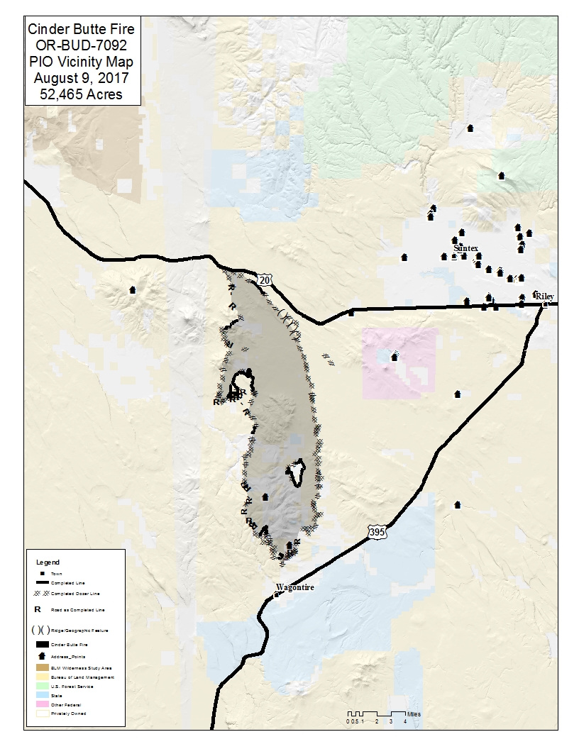
| PIO_vicinity_8x11_port_20170809_CinderButte_OR_BUD_7092.jpg | 2017-08-08 23:22 | 503K | ||
| PIO_vicinity_8x11_port_20170809_CinderButte_OR_BUD_7092.pdf | 2017-08-08 23:22 | 1.0M | ||
| IR_24x17_land_20170809_CinderButte_OR_BUD_7092.pdf | 2017-08-08 23:22 | 1.1M | ||
| iap_8x11_port_20170809_CinderButte_OR_BUD_7092.pdf | 2017-08-08 23:22 | 1.6M | ||
| briefing_48x36_port_20170809_CinderButte_OR_BUD_7092.pdf | 2017-08-08 23:22 | 1.6M | ||
| rehab_48x36_port_20170809_CinderButte_OR_BUD_7092.pdf | 2017-08-08 23:22 | 2.0M | ||
| trans_8x11_port_20170809_CinderButte_OR_BUD_7092.pdf | 2017-08-08 23:22 | 2.0M | ||
| ops_11x17_port_20170809_CinderButte_OR_BUD_7092.pdf | 2017-08-08 23:22 | 2.8M | ||